Sunday, 14 May 2023

14/05/23 - Return to the Queen Elizabeth, Elmley Castle

 A Community Owned, Good Beer Guide Stalwart


The answer to the questions "Best Sunday Lunch" in Worcestershire can be answered by the Queen Elizabeth, Elmley Castle.
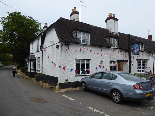
Queen Elizabeth, Elmley Castle
Returning to the Queen Elizabeth, after the walk

The reason for this..... Good value, lamb is an option and cauliflower cheese is standard - not a charged add on.

And it's now a regular in the Good Beer Guide.

A bit of history - my first walking visit to the village found the place closed up. A desperate appeal was on a hand written note on the front door "when will this pub re-open?". In 2014, the locals decided to do something about being a dry village. After all, at one point in pubs hey-deys, they were served by 3. 

36 residents clubbed together and purchased the lease, re-opening the doors in the December of that year.

It's now the heart of the village - offering not only booze but a tea room/cafe opening from 9am, a library, a takeaway and running many theme nights. Quiz nights look good, with a £10 entry fee covering fish and chips.

To work up an appetite for lunch, a puppy friendly route is found from one of my many guide books. This was written in 1993 and describes a fast disappeared world of pub hospitality. An interview with the long term landlord, Tony Howells, revealed the following rather quaint thoughts;
  • There was no need to advertise, as business was so good.
  • The only food available then were crisps, the guide book writer at pains to point out the unusual "ham and mustard" flavour on offer
  • Bar games are available - darts, shove halfpenny and quoits (anyone?)
  • Opening hours are 12-3pm and 7-11pm..... but flexible if the cricket team are at home
  • Dogs are welcome but not children
Build me a time machine!

Big Memories
1993 will do... no need to go back to when Elizabeth I visited

You simply cannot go wrong for the walk - head up the flanks of Bredon Hill and dependent on your energy levels, pick up any of the myriad paths to circuit the top. Today, we pick the shortest possible. One of our team is only six months old.
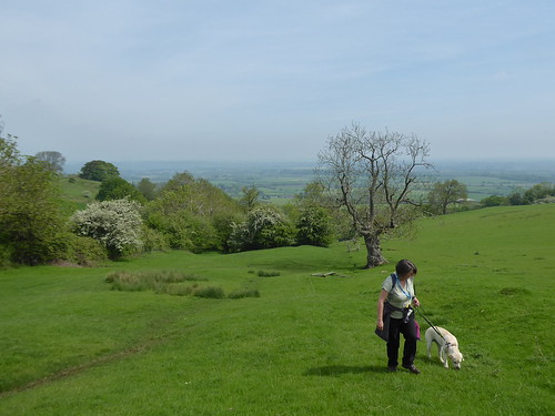
Climbing the flanks of Bredon Hill
Puffing and panting up Bredon Hills

Walk Details

Walk Inspiration - Pub Walks in Worcestershire, Walk 26
Distance - 3.5 Miles


Saturday, 13 May 2023

13/05/23 - Centenary Way - Stage 18 - Harbury

 A bold claim is made - Harbury, the village with the most pubs in the UK


Back on the Centenary Way. After many disasters (HS2, Overgrown fields, failed stiles) it's OK to have a mundane, uninspiring walk with no hazards.

This is completed across agricultural land, heading South from the village of Harbury, meeting the M40 and turning back. Where there are crops, there are good paths through them. When there is mud, its manageable.

Rape Fields on the Centenary Way
Good paths along the rape fields
Itchington Holt
Bluebells in Itchington Halt

Harbury village adds some much needed interest, with varied architecture, civil war history and a bold claim from the author of my guide book.

Harbury
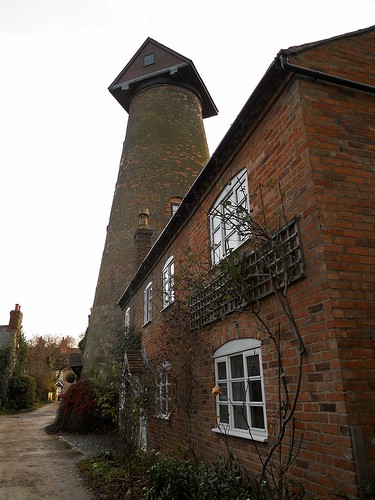
Harbury Mill - Currently Scaffold clad, but picture found on Flickr

Stephen Cross, Centenary Way guide book author and former mayor of Warwick, claims that Harbury has the highest number of public houses of any village in the UK. Stephen claims many watering holes were required to support the navvies from the nearby Oxford canal. Internet based research offers no collaboration of this fact so we can only use the evidence in front of us. 

The population is 2500 souls and until recently, there used to be 5 pubs. The Old New Inn and the Dog Inn have both gone. The former, for having a stupid name. The latter to create a nursery. Although judging by the behaviour of the after school mums who get tanked up on proscecco on a Friday afternoon, ruing the ambiance in the snug in MY local, closure was totally unnecessary. Let the kids run riot in the boozer. I'll take the crossword and my Butty Bach to Wacky Warehouse.

This leaves 3 pubs and there's little information to give Mappiman the information of which to visit. Few reviews on Pubsgalore. No Good Beer Guide Entries (Correction: And proof no one reads the blog to correct me - there is one!). Google reviews scream "avoid the Crown", but this may be a personal vendetta.

I was going to try the Gamecock but this looked uninviting, all in darkness but the door open to show its functioning.

This left the Shakespeare. A solid name for a Warwickshire pub and the sponsor of the local rugby club. Also the biggest in the village.

And the centre of all gossip.    

Shakespeare, Harbury
Largest pub in the village with most pubs.

Hard not to eavesdrop, especially when the groups of ladies voices drops to a pitch that you know the good stuff is coming. Only there 30 minutes and I learn who is the village cocaine addict is and the married teacher who is having an affair with one of the sixth formers.

Surprisingly, its not the same person.

Pub wise - you know you are in trouble when the menu is laminated and the size of a duvet. How many burger variations is too many? 

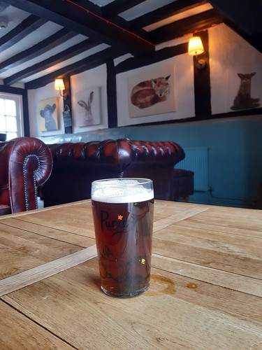
The Purity Ubu was more than serviceable and making up for the horrorshow of loaded chips, when all you wanted was a nice sandwich.

Purity Ubu in the Shakespeare, Harbury
Chesterfields and a handsome pint of LocALE

Walk Information

Distance - 8 Miles

Geocaches - 6

Previous Stages - Stage 1Stage 2Stage 3Stage 4Stage 5Stage 6Stage 7Stage 8Stage 9Stage 10Stage 11Stage 12Stage 13Stage 14Stage 15Stage 16, Stage 17


Sunday, 7 May 2023

07/05/23 - January Man - April at RSPB Marshside, Merseyside

Walking the chapters of Christopher Somerville's The January Man - Month by Month


Slight delay to April's chapter. I need to think of my global footprint.

April sees Christopher on the Southern banks of the Ribble Estuary, near Southport. His book is based on an English folk song and April's chorus leads;

 "Through the April rain the man goes down to watch the birds come to share the summer...."

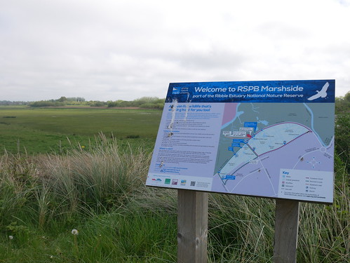
In search of feathered friends, Christopher heads off to RSPB Marshside. An area that I find myself passing, following an early May sojourn to the Lake District.

RSPB Marshbrook
RSPB Marshside

I've come prepared. Which Magazine best budget binoculars have been purchased. Possibly overkill for my first brush with nature.

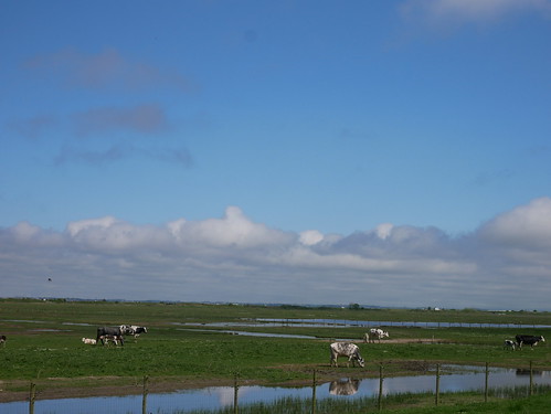
Freshwater flood lands
Flap Flap Flap.... that'll never get off the ground

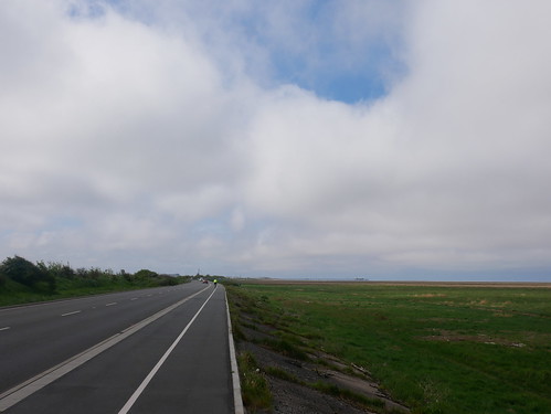
The bird sanctuary is a weird place to walk. It's half surrounded by a footpath shared with a golf course. The external perimeter is a fast road called Marine Drive. A mixture of freshwater wetlands and saltwater marshlands. Both loved by a variety of permanent and migrating bird-life.

Optical envy from professional twitchers, with bigger telescopes and camera lenses.

RSPB Marshbrook
Odd rambling along Marine Drive

Easily the most interesting part of the walk was along the Old Haul Road. A dead end track to the sea, used historically by the sand works and according to signage, by commercial fishermen in the present day.

Even without the binoculars, its possible to make out the funfair entertainment in both directions. The pier and big wheel at Southport. The tower and the big dipper at Blackpool.

The Old Haul Road
Old Haul Road - Path to the Sea

Walk Details

Previous Walks - JanuaryFebruary, March
Distance - 5 Miles
Geocaches - 2
Walk Inspiration - Marshside Visitors Map

Saturday, 6 May 2023

06/05/23 - Rannerdale Knotts, Whiteless Pike and Wandope

 Finding my limits on the eastern path from Wandope


Time to pick off a few more Wainwrights and a valuable lesson learned for my future self. Rather than actually pick a route at random - have a look at the complexity and height gain.

This is the closest I have got to giving up, lying down and waiting for someone to come to the rescue.

The walks is in one of the most beautiful parts of the Lake District, Buttermere. I was last here on the Inn Way to the Lake District and took the time for an afternoon nap on a little spit of headland jutting into Crummock Water. On awakening, I got a little emotional at the beauty and had a little cry. It was nothing to do with the lunch time four pints of Loweswater Gold at the Kirstile Inn.

The walk is meant to start at a little free parking area at the bottom of Rannerdale Knotts. I am early, but it is Saturday on a bank holiday weekend and in the one bit of planning I do, I spot more space elsewhere.

My walk begins at Newlands Hause, opposite Moss Force.

Parking area opposite Moss Force
Opposite Moss Force 

The guidebook does explain that this in intricate and occasionally off path. I recognise that I have to cross Mill Beck and this proves easy enough with walking poles to balance on slippery stones.  Its then up and up to Rannderdale Knotts - providing superb views across the lakes.

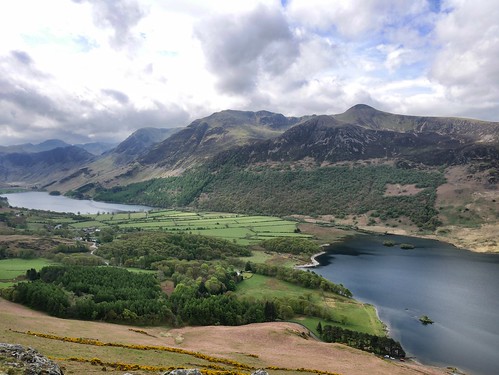
Lake Buttermere and Crummock from Rannerdale Knotts
Buttermere and Crummock from the end of Rannderdale Knotts

The descent is steep but short and the true start of the walk is found.  Yep, the car park is full.  I made the correct decision.

Doubling back on myself along Squat Beck, the bluebells are out if force. A roped walkway avoiding unnecessary trampling. Fleece off, predicted thunderstorms failing to materialise, this is as good as the day gets.

Heading into Dale How
Through the Bluebells

I can see Whiteless Pike and convince myself that I am not going up the huge lump looming over it.

This is, of course, Wandope. 51st out of 214 in terms of height. It's a relentless plod. Fell runners in both directions laugh at my lack of fitness.

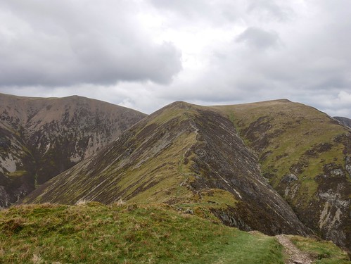
Wandope from Whiteless Pike
Whiteless Pike - dropping off to climb Wandope (peak to the right)

Then it all goes slightly wrong. The path east off Wandope (running past the hanging valley of Addacombe Hole) is a feint dashed line on the map. I get to the edge and look for it and there is nothing on the ground - just the steepest drop I have ever seen.

I am unsure what to do. It doesn't look safe, but I have no other way than forward, unless I go back the way I came.

Tentatively, I head "off piste", half hoping one of the other walkers will see me and talk me down.

After a very nervous start, a sole footprint is spotted in the peat and there is the faintest of paths dropping straight down along a thin ridge. Even with walking poles, I decide the only way to descend is on my backside, using the poles as some sort of breaking oar.  

Sliding down starts as a good idea, if a little unglamorous, until my trousers ride up.

I am now wearing my testicles as ear-rings.  

Getting to the bottom at Addacombe Beck, I see that I am supposed to do another climb - Ard Crags and Knott Rigg.

There's simply nothing left in the tank, but thankfully, I do have an escape route. The path running underneath Bleak Rigg will return me to where I crossed Mill Beck and a short climb back to the car.

Escape route under Bleak Rigg
Hugging the valley floor for as long as possible

I've never stopped so many times on a walk. My average speed, 1.23 MPH.    

Once back in civilisation, I investigate other people's experience of this route. I have read of a few who have walked up this killer path to Wandope.  

They all vow "never again".

I also google steepest incline safe to walk and find this;
An able-bodied person might go up an incline that is 45-50 degrees without the need of a harness, spotter, safety handles, or restraint. People who have excellent balance and great centers of gravity fall into this group of people who can climb such things unassisted.
The descent from Wandope is 40-49 degrees.

Walk Details

Distance - 8 Miles
Duration - 5 hours
Average Speed - 1.23 MPH
Height Gain - 3120ft
Walk Inspiration - Walking the Wainwrights, Graham Ulney, Walk 54 
 
Geocaches - 0