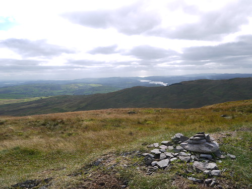
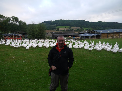
Sunday 29 September 2013

28/09/13 - Celebrity Doodle

Distance - 2.8 Miles
Geocaches - 5
Walk Inspiration - Frommer's 24 Great Walks in London


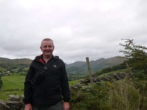
The morning saw the capital ring completed, so there is time for another walk before my 16:43 train home.

DLR direct from Woolwich to Shadwell.  I have walked here before but I don't remember everybody being covered in Tattoos.

Not just your normal run of the mill tattoos..... the fella coming down the steps in front of me has his entire head inked.  And he is not the only one.  Faces, necks, arms and hands are all covered.  I bet someone here has a matching "W" on each buttock.

I am distinctly unadorned.  Maybe something needs to be done.  How about the geocaching symbol somewhere discreet.  Or Mrs Mappiman for ever in a love heart.

This walk promises a lot of history and I straight into it in Cable Street.  The scene of a famous riot in 1936, as neo nazi black shirts battled with the Jews, Catholics and lefties.  That's a proper riot... not just kicking in the Windows of JD Sports.  The location is celebrated with a fine mural that would not look too out of place on the Falls road.
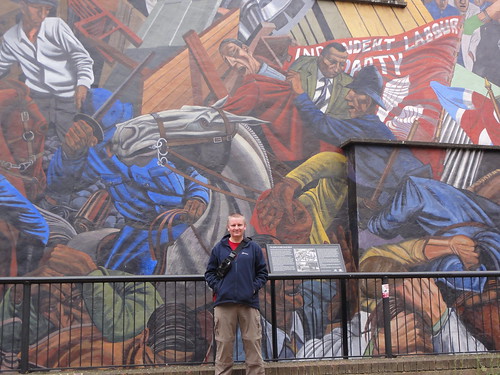
I predict a Riot
I predict a Riot
There is a cache at GZ.  I think that I understand the clue but after a good 15 minutes (getting hungry and rained on), I give in.

Very quickly, I am in the grounds of St George in the East church.  Built in 1723 by Hawksmoor and destroyed by some black shirts in flying machines in the 1940s.  It's now a recreational park but it does have a interesting grave stone.
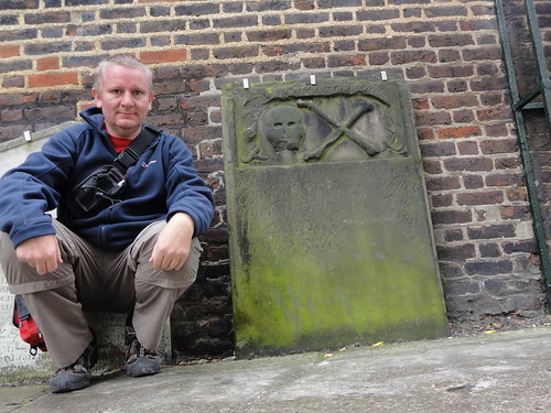
Pirate's Grave
Pirate's Grave
Having been previously mocked for going out of my way to look at a Clown's grave, I can now add the Pirate Alex Wyllie.  From 1741.

Next destination is Tobacco Dock.  This even has some Pirate Ships.  Walking down, I am back with the Tattooed ones.  And then all becomes clear.

Mystery Solved
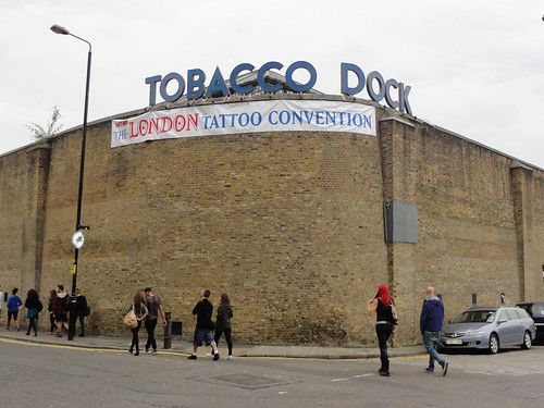
Check out the Ink on that
All of these rock and rollers makes getting the cache down by the canal a bit tricky.  But in London, no-one is really watching.

Continue down towards the river.  My guidebook has tales of people buried at cross roads with stakes through their heart and escaped tigers but its lunchtime and a man can only take so much history.

I know where I am off to - The town of Ramsgate - and just as I hit Wapping High Street, I see Father Noel Furlong from Father Ted, out walking his Labradoodle.

Graham Norton's Labradoodle's Arse
Now prefers to be known as Graham Norton
I shout after him that he needs that doodle clipped.  I should know, I have one the same colour.

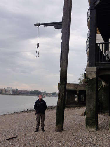
Pub time.  The Town of Ramsgate.  History oozing out of the walls.  You can nip down Wapping Old Stairs side and at low tide, see Executioner's dock.  Here, they hung the pirates for three tides and then tarred and gibbeted them.

Its low tide, so I can have a mess around on the shore to see if I can get the cache.  But I need to be careful, as my lunch order is coming anytime soon.  Fail on the cache but a great experience.  And if you are ever down there - have a peak around the corner for an unexpected view of the Tower of London.

Eat like a Victorian
Proper Olden Days - Steak and Kidney Suet Pudding and a gravy boat
Wapping High Street next.  What a place to kill an afternoon.  First off there is the Captain Kidd pub.  He was one of the more famous Pirates that met his death in the Gibbet.

And is if two great pubs are not enough - we have the Prospect of Whitby - the oldest on the Thames, dating from 1520.  Lets put that into perspective.  Henry the VIII had not started killing his wives yet.

Superb.  Another cache around the corner lead me to the steps and you can get onto the shore again.  Got to be worth it.

Death to Mappiman
A warning to Somalians with AKs
My scheduled walk ends now.  But I might as well grab the remaining caches around.  This is the joy of caching.  First off it reveals Shadwell Basin.  This looks a smashing place to live.  Then Wapping Woods - which in reality is a filled in basin made into a country park.

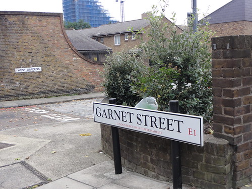
And finally, a bit of modern history.  A cache details the location where Alf Garnet's house was in "Till death do us part".  It was also the home of the script writer.  All knocked down now, but some evidence remains.

Till Death do us part
Alf and the Silly Moo's Gaff


Saturday 28 September 2013

The Capital Ring Summary

Distance - 78 Miles
Start Point - Woolwich Dockyard Station
Start Date - 04/04/2011
Finish Point - Woolwich Arsenal DLR
Finish Date - 28/09/2013
Geocaches Found - 43

The Capital Ring


The Best Section - Phase 6 - Richmond Park during the rutting season and arriving in town at nightfall

The Worst Section - Phase 14 - Two attempts, with the Greenway being closed on the first attempt.  Then to find out the nicely monikered path is actually the Northern Outfall Sewer.  And it didn't smell like a Greenway.


The Phases (Click on the Phase Hyper link for Walk details)

04/04/2011 - Woolwich - Phase 1
11/04/2011 - Falconwood - Phase 2
10/05/2011 - Grove Park - Phase 3
16/06/2011 - Crystal Palace - Phase 4
10/08/2011 - Streatham - Phase 5
26/09/2011 - Wimbledon Park - Phase 6
18/04/2012 - Richmond - Phase 7
30/04/2012 - Osterley Lock - Phase 8
04/07/2012 - Greenford - Phase 9
25/08/2012 - South Kenton - Hendon - Phase 10 and 11
03/04/2013 - Highgate - Phase 12
09/05/2013 - Stoke Newington - Phase 13
21/08/2013 - Hackney Wick - Phase 14
28/09/2013 - Beckton District - Phase 15

Summary
So, three summers in the making, I finally come to the end of the Capital Ring.  It's been emotional.  Made a change from walking the inner city streets, although less likely to help me gain "The Knowledge". 

The footpaths were that well signed posted that you only need the GPS for finding the caches.  With the amount of greenery in Central London, it shouldn't have been a surprise as to how wild this was walk was in places.  If it wasn't for the commute on public transport, I could have been anywhere.

There were many highlights - Richmond Park, Stoke Newington, Highgate and a few low lights - the canals of West London and the unforgettable experience that was the Greenway.

So what next for London. How about the Outer London Loop - 150 miles in the distant suburbs of London?

And look, to top it all, I got a certificate

Certified
Officially Certified

28/09/13 - Capital Ring Phase 15 - The Closed Circle

Start - Royal Albert DLR
Finish - Woolwich Arsenal DLR
Distance - 5.4 Miles
Geocaches - 6
Summary of all 15 Stages

Capital Ring Phase 15


This is it.  There must be a German word for the feeling of sadness that you get when you complete one of your goals in life.  This has taken me three summers and with 2013 Summer nearly at an end, I have to make a weekend trip to complete.

Train ticket prices are ridiculously cheap on the weekend - 10% of those costs of a weekday if you book in advance.  I can even have a relative lie in - getting a discount ticket on the 8am from Birmingham International.

The train steadily fills up.  I feel left out that I have neither a piecing or a tattoo.  And yes, my merrily adorned fellow travelers are all drinking cider for breakfast.

Arrive at Euston, tube to Bank and then the DLR to Royal Albert.  Not bad for a man without a Prince Albert.

Stage 14 wasn't the best and I'm not sure about this final stage.  What will it hold?

The End is Nigh
All Coming to an end
First stage is easy enough walking, across the two Beckton Parks.  Park 1 has a football, Park 2 has rugby.  Then I cut inside the University of East London grounds and have a nice walk alongside Royal Albert Dock.

Albert Dock
Royal Albert Dock - Airport Behind.

Plenty to look at.  Planes taking off from the opposite airport.  Rowers in the water.  Topless joggers.  Shame they were blokes.

At Gallions Reach, there is a cache that is a short distance off route.  I have plenty of time to kill before my cheap train back, so go for it.  An adventurous walk across waste ground, with signs of people living rough and then it works out that I am on the wrong level.  Cue a run across a dual carriageway, clamber up a bank and climb over a crash barrier.  Anything for a smiley.

Get back on my route proper, past a factory and hit the Thames, grabbing a cache under a bench.  The river will be my left hand friend all the way back to Woolwich.

Thames Side
Tower at the Thames
Thames
Tide is out.  This will be handy for later.
Two caches at the lock entrances to the Dock.  This is spooky walking.  Derelict, overgrown, signs of an industrial past and absolutely no people around.

The third cache along this stretch needs the Thames to be out, so that I can drop down to the foreshore.  Fortunately, I have timed it perfectly.

Down to the River Front for a cache
Down the ramp and back up the ladder
One more cache in Royal Victoria gardens and then I am at the end of my odyssey.  The only question to be answered is whether to take the foot tunnel or the free ferry.

Ferry or Tunnel
It's just pulling in, so would be rude not to.

Canary Wharf from the Ferry
Would have missed the view of Canary Wharf
After no people all the way on this leg, I hit the main street of Woolwich on a Saturday afternoon.  Quite a contrast.

But I bet that Columbus, Cook and Polo did not have such a welcome at the end of their adventures.

What awaits the triumphant traveller?
So good, them named the dish twice
Adventure over.  Time to plan the next one.

Sunday 22 September 2013

22/09/13 - What's a Hospice?

Distance - 4.5 Miles
Geocaches - 5
Walk from AA 1001 Walks

Last Night
Our final night in Grange-over-Sands and we venture out to see if our Landlord is unjustly pessimistic about his home town.  First off, we use the power of the Internet to work out where to eat. TripAdvisor is a wonderful thing, unless you own the Indian restaurant.  It gets 1 star and frequent comments on the waiters being asleep on the tables.  Chinese it is then.

But first the pub.  The Commodore is a huge rambling place and not as bad as we were led to believe.  It has the cask marque seal of approval, pool table and the footie on.  Couple of pints here before we use Google Maps to walk up and down main street trying to find the Chinese.  Problem solved by asking a man.  Old school navigation is sometimes the best.

Now I am not sure what effect they were going for in the restaurant but the concrete coloured decor gave the place a Stalinist feel.  Sonia also got increasingly freaked out by the robotic cats that were either waving or beckoning.  The food was excellent.

That just left the Keg and Kitchen.  Our landlord was most disparaging about the place, suggesting it should be forceably  closed down.  As Sonia was the only lady in here we thought that maybe it was a Cumbrian gay bar.  It certainly catered for all ages - from teens to pensioners.  We left to get back for the Albion's first victory on MOTD.  Just as a bit of bouncer controlled aggro started.

Today's Walk

After a hearty breakfast - I went full English - Sonia went Rice and Peas, with a Poached Egg on Top, there was much debate on whether to do a walk or not.  The distractors argued that the sooner we left, the sooner we could get everything sorted after a weekend away.  The prowalkers argued that is a beautiful day and we would probably not be here again.  No reflection on the all male bars or behind the iron curtain Chineses, we just need a town with more than two bars.

The blue skies and no need for a jacket condition sealed the deal.  An added bonus is that we can start from the B&B Door.

This means that the early walking is through the houses and all mercilessly uphill.  Sonia suggest there must be a bus service, but it is a Sunday, so unlikely.  Eventually, we hit the countryside at Spring Bank.

All that effort has rewarded us with stunning views of Morecambe Bay.

Bay Views
Bay Views
Cache number 1 is found just as the muggles start to appear.  There appears to be some sort of Octogenarian fun run on, as we have never seen such elderly joggers.  They are putting us to shame.

We are fast reaching the top of Hampsfell.  The terrain, with its limestone pavement is reminiscent of Malham Cove.

Heroic
Heroic - survivor of the great  Keg and Kitchen dust up
The first views of the the Hospice come into play.  We were told about this at breakfast - built in 1846 by the Vicar of Cartmel to provide shelter for the pilgrims making their way across the bay.

The Hospice
Shelter
On arrival, one of the joggers spends a good 15 minutes telling us the history and encouraging us to go inside to read the poems and to climb on the top and play with the unusual view finder.  As if we were going to come all this way and not.

Superb Feature
Use the Numbers on the View Finder to point the Fells.
On top
Superb location
The view finder can also be used to find an offset cache.  A superb idea, as you use the sights to line up the direction you need to count 50 paces towards.  There is an earth cache, where I have to ask for Sonia's opinion on what information is needed.

Then it's all downhill, first on fields (another cache) and then through Eggerslack Woods, for a bit of variety.  Plod our way down and are delivered at the opposite end of town, where a cafe is offering refreshments.  Good job we had Kedgeree for breakfast, the bacon sarnies are £4.50 each.

A quick walk through town, picking up a final micro in the Town Orchard.  A choice about whether to walk back along the road or the promenade was only going to come up with one winner.

The Promenade
A stroll along the Prom
And the answer to the blog title question?  About a gallon.

Saturday 21 September 2013

21/09/13 - Coast Path. No Coast.

Distance - 6.5 Miles
Geocaches - 13
Walk from - Country Walking Magazine


Last Night
Following directions from our landlord, we headed away from Grange-Over-Sands and went to the nearest best pub - the Pheasant Inn.  Unfortunately, it is in the next village along, Allithwaite.  It was a 35 minute walk, with plenty of ups and downs and no lighting for the way back.

This provided plenty of opportunity to discuss what we would have to eat and Sonia was desperate for a Goats Cheese Starter.  Imagine our joy when it was one of the special starters.  She ordered it along with a Taxi for 9.30.

This arrived bang on time and whisked back to our abode, which has taken on a more sinister hue in the darkness.  We entered and a year after visiting Venice, watched "Don't Look Now" on DVD.   I say watched it.  Sonia was asleep within 10 minutes and I was ordered to turn it off when I let loose my first little snort.

That's mountain walking for you.

Today's Walk

Cartmel


We have come to Cartmel.  A fine medieval village, with a priory, a Michelin starred restaurant and the home of Sticky Toffee Pudding.  What more do you want?

The weather is abysmal.  Opened the curtains to see the sea view.  It was a cloud view.  It wasn't raining as such, more like a low cloud had come down for us to walk through. 

Park up at the race course and head off Cistercian Way.  Slight detour to find cache of the day, but we have to wait for a muggle to pass.  You cannot just say "Morning" in this part of the world.  You end up in a 20 minute conversation.  Whilst I pass time waiting to grab my cache, Sonia learns how easy it is to take a dog on holiday to France.  When the next muggle comes, we have to pretend we want to take photos.

DSC02702
Told you the weather is grim
At last, we get the cache and head off on the walk proper.  Two more easy caches along Hill Mill Brook and through Walton Hall Farm. 

Short bit of road walking and then into the woods to pick up the Cumbrian Coast Path.  This is interesting.  We are at least two miles from the coast.  Even if we weren't walking through a cloud, I doubt whether we could have seen the sea. 

It was a very nice path though and not without its dangers.

DSC02704
Snakes Alive
We head uphill through the forest and meet another couple who are on the same path.  We need a bit of space between us, so Sonia leans against the marker post for a photo and to waste a bit of time.

DSC02706
Post not as sturdy as expected
Keep on the coast path.  Once through Burns Farm - now offering holiday homes to hardy souls - the ground takes a turn for the worse.  Its now a mud bath.  The walking would have been superb if only we could have seen more than 20 yards.  Sonia is getting tetchy, asking questions about teashops and civilisation.

At Speel Blank, I can see there is the option of taking 1.5 miles off the route by taking a short cut along the road.  I offer her this choice.

Mrs Mappiman - "I don't mind, whatever you want to do"
Mappiman - "Well the map looks interesting and there is a cache"

I open the gate to the sound of "Get back on this road now".

That's a cache I will never see again, but at least there are plenty more on the way back.

The navigation gets a bit tricky as we move between the farmyard and wild house steads.  At least we get the answer to the question "what do farmers do with old cars?"

DSC02712
Just drive them into a bush
Last couple of caches and thankfully, we can hear humans meaning we can get out of the miasma.  Although we are back at the car, it would have been churlish not to have investigated the pretty village.  There are certainly hordes of people doing the exact same.

DSC02714
She was disloyal last night and had Ginger Pudding

My sort of square - 3 sides are pubs
Three sides of a square dominated by eateries and drinkeries
Hawkshead Bitter
Four free papers and a pint.  Afternoon entertainment sorted.


Friday 20 September 2013

20/09/13 - Birthday Bagging Treat

Distance - 5.1 Miles
Wainwrights - 2 - Sour Howes and Sallows
Geocaches - 2
Walk Inspiration


Mrs Mappiman bought me a lovely weekend away for my 44th Birthday.  It came with an invitation for a two night stay in Grange over Sands - A place that Bill Bryson claims is one of the best places in the UK.  On check in at our B&B, we are warned not to go to either of the two pubs as they are full of weirdos.

Progress report tomorrow.

On the way up, we drop a student off at Knutsford City Limits so that she can make her way back to Manchester and then debate whether we are going to Lancashire or Cumbria.  Either way, its close enough to the lakes that I can get the two furthest south Wainwrights.  These may be the only two that I bag in 2013.

Stop off for the world's most expensive coffee (more than a pint - get a grip Costa) and the best homemade sandwiches in the world. 

As we come off the motorway, I ask if Sonia has brought a waterproof.  She says she doesn't need one as the weather forecast is for sunny spells and the met office are never wrong.

It starts raining.

Fortunately, there is a discount outdoor gear shop, so she manages to get goretexed up for £40.  Or 10 Costa Coffees.

Finally park up at midday at Troutbeck, getting one of the last parking spaces.

I think that if Sonia had seen the scale of the challenge ahead, she may have stayed in the car.  Fortunately, it is that steep that you have to look a long way up to see the summit.

So, over the bridge and quickly up hill at the Howe.  The views are starting to take shape, even if we are climbing two of the relative tiddlers.

P1030528
Back where I belong
Its all very stiff climbing and over a couple of ladder stiles.  Cache 1 of the day comes at a rocky outcrop, where views of Windermere are just appearing.  Swap a couple of TBS over.  Sonia has a rest on a rock.

Windmere is Behind is
Probably getting slippers next year
It really is relentless, with lots of false tops.  Sonia meets these challenges with a certain degree of bonhomie.  At the least the sun comes out and gently warms the new jacket off.

Finally, we make it to Sour Howes. 

Mappiman the Redeemer
Mappiman The Redeemer
The final cache of the day is up here, so I leave Sonia with the last of the sandwiches whilst I go off hunting.  After a while, it is found.

There is a cache here somewhere
Just where is number 3116?
Once grabbed, its apparent that we have gained the majority of the height for today.  With the sun out and extensive views all around, the walking could not be any more pleasant as we make out way to Sallows.

The summit is marked with the world's smallest cairn, which is something of an anti-climax.

Rubbish Cairn
Good Spot for my last Sarnie
A bit of wild walking down to Garburn Road.  This is a metalled track and makes for a fine descent.

The Road Home
Does this go to the pub?
No need to navigate, as long as we are going down, we are heading in the correct direction.  We are soon back at the car.

A quick investigation of Troutbeck is required.  We find what we need.

This place looks good
"A four Poster Bar, You Say?"
Well Earned
Might be the best pub we find this weekend
18 miles to get to chez Mappiman.  We drive through Windermere and then see a sign saying "great views and picnic area".  Decide to pull in to see if I can get a decent photo of the lake.  We are met with "Hawkeye Car Park Cameras" that have recorded our registration plate.  Minimum parking price is £1.80.

And the photo was rubbish.

Saturday 14 September 2013

14/09/13 - The Lazurus Trail.... Tougher

Distance - 8.3 Miles
Geocaches - 26 in Trail, 20 Found, 6 Not Found
First Cache
Ascent - 2172 Ft
Duration - 5 Hours 13 Minutes
Thanks the absentmindedness of a student, this weeks blog comes direct from an iPad mini.  Despite being asked several times if she had everything, she went back to Manc without her favourite gadget. 

I am so 2013 for the rest of the academic term.

I have been looking for an excuse to come walking around here again.  Its on the doorstep and classic Worcestershire walking, with great paths and some stunning views.  And a lot of ups and downs.

Last weekend, a geocache trail was laid.  This more or less followed the route of one of the first geotrails I attempted. placed by Delta68.  I remembered discussions with addicts about FTFs :-)

This sealed the deal.  Must have been the excitement of the walk that had me up with a particularly vivid nightmare at the crack of dawn.  Still, it is light and not raining and I can get to the parking before the geohords come. 

No one in the parking space at 7:15am.

Early Start
Dawn over the 100 House.
Initially, I was going to do this in reverse.  I really fancied coming at Walsgrove Hill from the opposite direction for the first time.  However, there is a bonus cache, so I better stick to the prescribed route and go in order to collect the clues.

And once again, cache 1 proves beyond me.  I swear is psychological.  I think I am going to struggle and I do.  I am not going to spend more than 10 mins at a GZ, so slope off, tail between my legs.

Next one is found in front of an audience of 1000s.

Xmas is Comin
Honk if you know where the cache is.
I know what is coming next.  Woodbury Hill.  Or the lungbuster, as I like to call it.  There is bad tree cover and to be fair, I am looking at the views, but I do have to double back to collect a couple up the track.  Imagine my joy to walk back down the hill and to find a decoy.  Real cache soon found.

Get to the top and there is a toughie that involves a climb.  Who makes these caches?  Dr Evil?  An equal number of finds to DNF, so I am pleased I make it.  No log book inside, but I do have spare paper to replace.  The cache provides the first views over to the west which make this stretch so special.

After four more caches (one where I am looking at the camo for the log, when this is covering a bag with the tupperware), I come out at Walsgrove Hill.  This is the cover for "100 walks in Worcestershire" book and you can see why.  I have it downhill.

Clock Tower
I can see for miles
The clocktower behind is where I have to aim.  First I have to find a cache at a location close to where Delta68 placed one.  I went there 3 times to no avail, but today, I have it instantly.

Past the school, admire the deer and arrive out at the A443.  For nostalgic reasons, I looked at where Delta68 had placed a cache.  At the time was unique to me and took two attempts to find with much joy on success.  Its all sad, now its gone.

Joy of Joy, another uphill stretch and then I drop down to Abberley Village.  First, I join the 4 out of 6 who fail to find number 13.... my first DNF since number 1.

Abberley Village is nice, although its a shame that the Manor Arms has now got all its windows greyed out.  This was a fine pub and the location for my 40th Birthday meal.  Now its just another dead pub and Abberley is a dry village.  Instead of my usual pub photo, I explore the grounds of the church.  Never noticed that is part collapsed.  Dodgy extensions according to this link.


Abberley Church
18th Century replacing 12th Century.  Hill behind is bagged.
Out the village, towards Haseland Farm.  Initially, I think I am heading into a vineyard but on closer inspection, it looks like I have found a Hopyard.

From the vine to the pint
Whatever it makes, I will have some tonight.
Another DNF before I pick up the Worcestershire Way Again.  More uphill but worse is to come.  Follow the road around Shavers End.  I know what is coming - a steep ascent to the top of Abberley Hill.  I take the opportunity to grab the Earthcache - which has been on the list since I did the Delta68 round.

Knackered
Photo Needed for the Earthcache.  Notice the path goes uphill.
So pleased when I reach the top.  I know that its nice and level, although the tree cover is not congruent to finding caches.  Get the first two at the top but am disappointed when I don't get the final two.

How long can one man go around and around two trees?  This leaves me without the final two co-ordinates for the bonus - so its a double whammy.

Console myself with the downhill path, out the woods and the end is in sight. 

Woodbury Hills
I did them hills.
Back at the parking layby, there are three new cars.  I look forward to their scores on the doors later.

Thanks to Wacky W Junior for a challenging cache round.  And not just the hills!


Saturday 7 September 2013

07/09/13 - Surviving Bob

Distance - 7 Miles
Geocaches - 4 Found, 1 DNF
Walk Inspiration


Friday night and Fast Pint Arm Bob is back in town.  He hears the calling of Stourport Carnival from Plymouth and makes his way up every year.  And then keeps me out to 1:30am as he needs me to operate the jukebox for him.

It the first Saturday of the Month, so this means the Millennium Way for the weekend walk.  It does take monumental effort to head out today, but thats dedication for you.  The alternative is watching people parading around the town on the back on lorries, so it must be done.

First obstacle is finding somewhere to park.  The instructions recommend the pub, but I am staying away from those dens of evilness for a while.  Geocaches often have recommendations for where to park but there is some strange advice been given here.  Eventually, settle of Crowle at the far north of the route.

Head out quickly onto good paths, through a football pitch and into an orchard.  First cache of the day quickly found.

Orchard
Rain is promised
Cache 2 is more elusive.  Have a hunt but when the dog starts crying, its time to give up.  Cache three is a whole lot easier. 

Skirt around the edges of Broughton Hackett.  Miss out on the cache in the churchyard by not paying attention.

Broughton Hackett
Be back on another day for the cache
The pub door is open, but I am not succumbing to its seductive siren.

Not Today
A rarity, I have walked past an open pub
Down the lane and surprise a lady who has got out of her car at the gym and is gyrating to Robin Thicke.  I think she thought she had the car park to herself.

Back at White Ladies Aston and through the churchyard.  It might be a sleepy hamlet but it has its share of intrigue. 

Village Intrique
Who is the phantom bird killer?

There is a cache that I missed from a previous trail.  Make spectacular hard work of it.  I start by being the wrong side of the hedge.  Leave the dog to go back on myself to get the right side.  Then part of it drops off.  Stuff my head into the hedge to reclaim it and pick up a thorn related geoinjury.  All that for a smiley.  Still, it was a nice cache.

Good walking as we head back towards Crowle.  Nice blue skies, fluffy clouds and views over to Malvern.

Mr Blue Sky
Mr Blue Skies
Through the cow fields at Bredicot and then into a field of triffid like sweetcorn where the path is overgrown.  Even with sat nav, route finding is tricky.

Eventually come out on the quiet lane which takes me back into Crowle.  A last cache at the church, which is overlooked by some strange inhabitants.

Llamas
Llamas guard GZ
Back in Stourport as the roads reopen.  I am greeted by the masses waving worm like creatures on the end of bendy sticks. 

No sign of Bob..... is he in the Wheatsheaf?