Showing posts with label London Countryway. Show all posts

Saturday, 7 December 2019

07/12/19 - London Countryway Summary

Length - 234 Miles walked
Geocaches Found - 167
Stages Completed In - 22
Start - Gravesend - 16/12/17
Finish - Gravesend - 07/12/19

What to do when you have walked the Capital Ring and the London Loop, but still feel the need to orbit the Capital?

The Countryway follows the same principal - a circular walk - and even further out.   Its not an official, signposted long distance way.  The route is described in an out of print book by Keith Chesterton.   It was written in the 1970s,  well before the M25 was constructed.  Remarkably, the footpaths are more or less in tact.

Des De Moor has kept the path alive through his blog.   Please look there for in depth route descriptions.   A number of bloggers have also documented their experiences, although I have the feeling that something terrible has happened to Dick Bowman.   From his now defunct site, I was able to lift the very useful GPX files but alas, the domain name is now for sale.   Should you need the GPX files, you will be able to download them from the Viewranger Maps at the start of each of my blogs.

I've completed the journey through monthly trips to the smoke - taking advantage of cheap advance Virgin Tickets from my Midlands home.  Seems fitting that I finish on the day they lose their franchise. 

Lets hope the next West Coast rail providers have similar offers.   I've got my eye on the London Peaks and the London Spiral next.

Highlights

The sheer variety of architecture, landscapes and terrain - Kentish hop fields, medieval manor houses, neolithic burial mounds, canals, river paths, woodlands and drops/climbs across valleys.

From a walking perspective, the North Downs Way on the Southern part of the Loop was an absolute joy.   Endless vistas along a lengthy ridge path as we moved from Kent and into Surrey. 

Plenty of interesting towns to visit - Sevenoaks, Windsor, High Wycombe and St Albans all offering plenty of beery charms.

Lowlights
The Northern Section from High Wycombe gets a tad repetitive - woodland and seemingly never ending ups and downs over the many valleys.    The less said about Stage 21's crossing of the A127 the better.   At least Des had warned us!

The Stages

Stage 1 - Gravesend to Sole Street
Stage 2 - Sole Street to Borough Green
Stage 3 - Borough Green to Sevenoaks 
Stage 4 - Sevenoaks to Oxted
Stage 5 - Oxted to Merstham
Stage 6 - Merstham to Box Hill
Stage 7 - Box Hill to Horsley
Stage 8 - Horseley to West Byfleet
Stage 9 - West Byfleet to Sunningdale
Stage 10 - Sunningdale to Windsor
Stage 11 - Windsor to Marlow
Stage 12 - Marlow to High Wycombe
Stage 13 - High Wycombe to Great Missenden
Stage 14 - Great Missenden to Berkhampsted
Stage 15 - Ashley Green to Kings Langley
Stage 16 - Kings Langley to St Albans
Stage 17 - St Albans to Brookmans Park
Stage 18 - Brookmans Park to Broxbourne
Stage 19 - Broxbourne to Theydon Bois
Stage 20 - Theydon Bois to Brentwood
Stage 21 - Brentwood to West Horndon
Stage 22 - West Horndon to Gravesend

The Flickr Album


London Countryway

07/12/19 - London Countryway Stage 22 - West Horndon to Gravesend

Distance - 14.5 Miles
Start - West Horndon
Finish - Gravesend
Geocaches - 0
Pubs - The Good Beer Guide Pubs of Gravesend
Previous Stages - Stage 1Stage 2Stage 3Stage 4Stage 5Stage 6Stage 7Stage 8Stage 9Stage 10Stage 11Stage 12Stage 13Stage 14Stage 15Stage 16Stage 17Stage 18Stage 19Stage 20, Stage 21

Another goal reaches it's end.    Monthly, for the last two years, I've been taking advantage of Virgin Trains cheap advance tickets to travel from my Midlands home and walk a section of the London Countryway.    Seems fitting that this, the 22nd such trip, is on the day that Virgin lose the West Coast Mainline franchise.   My 17:43pm from Euston amongst the last handful of services they will run.   I expected the drinks trolley to make it out of first class to share the gin with the regulars.   Should have taken a later train.

Following a painless commute, my walking day started at West Horndon at 10am.   The walk is going to end in spectacular style with a Thames Ferry Crossing.   No great endeavour deserves to finish in Tilbury.   Homework done, and I know even ferrymen have a lunch break - with a gap in the services from 2:10pm.    I have four hours to walk about 13 miles - so there won't be any hanging around.

Its not Geocaches or pubs that slow me down in the early stages - but endless muddy fields and un-signposted footpaths that criss cross water ditches.  Get it wrong and you are either dyke jumping, or doubling back on yourself.

The Deceptive Fields of Mud
Deceptive fields of mud.   Some of it exported back to the West Midlands
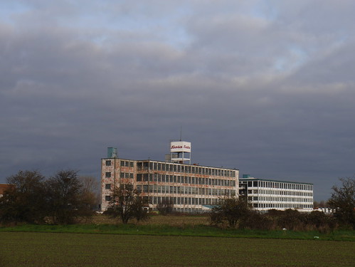
I can bring you little joy on the first 9 miles or so.  The tower blocks of Chadwell St Mary mark the beginning of the end - soon, it will be farmhouses that seem to be producing nothing but junk machinery and industrial scale mud.   Plus some pylons and abandoned factories.

Tilbury Ahead
Civilisation
Ruined Factory
Abandoned factories

No need to despair - there's a reason for what looks a lengthy detour to Coalhouse Fort.   A more direct route could have been taken into Tilbury but this stretch of 3 mile stretch of the Thames is an absolute joy.

Keith Chesterton describes a scraggly collection of houses and a pub that lead to the Fort.   They're all still there - undeserving of even a name on the OS Map.   With the seagull squawks, there's a real seaside feel to the approach to the Thames.   A little church, bombed from the estaury by the Dutch in 1667, shows why the gun batteries were needed.

Coalhouse Forty
Coalhouse Fort
A slight concern - especially as I am in the last few miles of a 205 mile walk - is the news that the sea wall has been breached by previous high tides and the footpath back to Tilbury is closed.

I've little choice but to investigate - my return tickets are from Gravesend - and there's no way I'm leaving a 2 year mission incomplete.    On inspection, you can't help but feel the council are over reacting.   Yes, the sea wall has a broken stretch of about 10 metres - which they have sealed off quite dramatically.   To get through, a drop down to the foreshore and back up is all that is required.

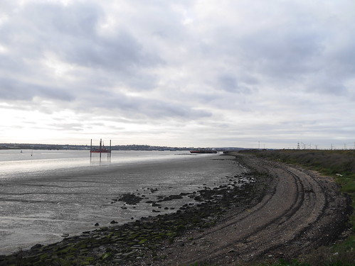
I find myself reminded of the closing stages of the London Loop - which had a similar walk along the Thames to Purfleet.   The skies are quite wonderful and there's a real feel of industrial decline, with endless ruined wharfes and constructions to which you can only guess the purpose.  Many photos, of the low winter sun over Gravesend.

Thames Path
Reaching the Thames
Thames Path
Mudlarker
Thames Path
Seaside-esque
Thames Path
More of the Same

Another, much older, fort at Tilbury and the cruise ship Magellan points to where the Tilbury Passenger crossing is.   It's 2pm and I've made it by 10 minutes.   It seems other people are in the mood to join in my celebrations.  You'd think I was making it up if I told you about the three well oiled cockneys on a water based pub crawl were dancing to Chas and Daves' "Gertcha".  What started off as amusing became quite annoying when the track skipped onto "My old mans a dustman" as we board the ferry.

Magellan Docked
Waiting for the marginally less impressive 2:10 passenger ferry

10 minutes on the ferry and I'm back in Kent.   Dropped off at the Three Daws pub, one of the three Good Beer Guide entries that will be in a separate blog.   Its busy, so I take my celebration pint into the beer garden - providing fine views back over my route.   I look over the water and consider the odyssey undertaken until my reflection is interrupted by unmistakable dulcet tones.

The three amigos have found their way outside and cranked up Chas and Dave's "Margate".

The Tilbury-Gravesend Ferry
My ferry - and see those Pylons?  I walked through them
The Celebration Pint
The end of London Countryway celebration.   Gertcha!


Saturday, 2 November 2019

02/11/19 - London Countryway Stage 21 - Brentwood to West Horndon

Distance - 6 Miles
Start - Brentwood
Finish - West Horndon
Geocaches - 3
Pubs - The Railway Hotel, West Horndon
Previous Stages - Stage 1Stage 2Stage 3Stage 4Stage 5Stage 6Stage 7Stage 8Stage 9Stage 10Stage 11Stage 12Stage 13Stage 14Stage 15Stage 16Stage 17Stage 18Stage 19, Stage 20


All things move toward their end and a nice easy leg on the penultimate stage of London Countryway.

A mere 6 miles and downhill all the way, as I move towards the flatlands of the River Thames estuary.

Not that today's walk was lacking in drama.   The majority of the walk is in Thorndon Country Park - officially closed to the public due to high winds.  I've set the alarm at 5:40am, travelled 130 miles and have targets to meet - so I conducted my own health and safety assessment.   Hard shell goretex top and bottoms and a German made trekking umbrella and I will be fine.

I'm not going to lie - the wind did test the umbrella.

Grim and soggy start at Brentwood Station and a short mile through the housing estates before picking up the woodland that provides some respite from the gales.    Very little to bring you in the way of photos, but if you're going to walk in woodland, doing it in Autumn provides the optimal experience.

Donkey Lane Plantation, Brentwood
Today's Walk - Mainly Woodland
Thorndon Park, Brentwood
Perfect in Autumn

Old Hall Pong
Old Hall Pond - the only Variety
I'd done my research and the comments on Des's blog had warned of the dangers and futility of trying to cross the A127 at the official footpath crossing.   Dick Bowman, who's GPX files I am following, managed to successfully cross without diversion.   I can only assume he did this at 3am on a Sunday morning.    I waited for 10 minutes, but there was no chance of getting through four lanes of speeding cars. 

At least I knew which way to go for the nearest safe crossing - and a grim one mile diversion it was to.   I know the answer to the question "Where does Essex man dispose of plastic water bottles that are certainly recycled for a use other than the storage of water".

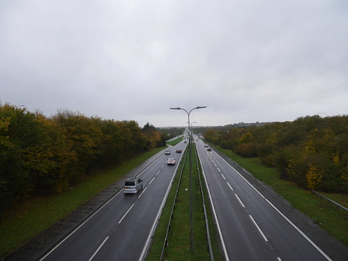
The Goddamn A127
Your challenge, if you choose to accept it, cross the A127
And onto Essex Man, I might as well meet him at his lowest ebb but in his natural habitat.   No danger of the Railway Hotel (further proof that the scariest pubs always have Railway in the title) not being open at 11:57am.

England had lost in a rugby final in a game that had started at 8:30am.   The flat capped, tattooed ones were fours hours into an early doors drinking day.   They were showing no signs of going back to reality any time soon.

Railway Hotel, West Horndon
West Hordon's Railway Hotel

Saturday, 12 October 2019

12/10/19 - London Countryway Stage 20 - Theydon Bois to Brentwood

Distance - 14 Miles
Start - Theydon Bois
Finish - Brentwood
Geocaches - 5
Pubs - The Brewery Tap, Brentwood
Previous Stages - Stage 1Stage 2Stage 3Stage 4Stage 5Stage 6Stage 7Stage 8Stage 9Stage 10Stage 11Stage 12Stage 13Stage 14Stage 15Stage 16Stage 17Stage 18, Stage 19

On every odyssey, there's a moment that becomes a test of faith, leaving you questioning what the hell you are up to.

This was the moment for the London Countryway - a day of foul weather, ploughed muddy fields, disappearing footpaths and only the most gastro of pubs for potential refreshment.

Still, it ends on a high point in the Weald Country Park and I can look back on the very pleasant previous 19 stages with a fondness, hoping Tilbury can save the day for the grand finale :-)

For a walker - light drizzle is the very worst of weathers.   Not so bad that you want to don top and bottom waterproofs - so you head off, only for the intensity to gradually increase without you really noticing.   By 5pm, I was soaked through to my pants, unsuccessfully trying to keep warm in an overly air-conditioned Virgin train carriage.

Theydon Bois Underground Station is left and a badly overgrown footpath leads to some terrible terrain to the M11.   Des De Moor explains how Blunts Farm had been using the land illegally for commercial waste and worryingly tells that I am finding it better condition now than it once was.

Blunts Farm, Theydon Bois
Just what you need in the Drizzle - overgrown damp foliage 
Under the M11
Pleased to arrive at the M11 Underpass

I'll keep the next few miles to a minimum - after a pleasant enough section on an old roman road, there are a lot of very muddy, recently ploughed fields.    I'm following Dick Bowman's GPX and the footpaths around Hill Hall and Colemans farm are no longer there.   Hedges exist on the exact point he previously walked through.   Photo wise - and this is true for the majority of the walk - all I have to bring you are churchs.   There are a considerable amount, surprising when you consider how lowly populated the areas are.

Stapleford Tawny Church
Stapleford Tawney - possibly the most pretty
Stapleford Rivers - about 6 miles in - offers the first potential refreshment stop but I've carrying too much mud to even consider soiling their gastro pub.    More interesting is the detritus of the former old white bear next door.   Now a private residence, its sounds like it had a chequered history as a motorcycle gang hang out before falling to economic unviability.   The pub sign is dumped in the back garden before the River Riding, along with the usual assortment of junk, kept by the landed gentry.

Woodman near Hare Street
Gastro Woodman - Not right for me today
WhiteBear1911
How the Next Door White Bear looked in 1911

Back of the White Bear
The former beer garden reminding me I could have been watching the new Breaking Bad Film on Netflix
After another couple of miles of mud and misery, I kind of regret not cleaning myself off and using the Woodman.   The only other available stop is Alec's in Navestock Side.  What used to be a classic country pub opposite the village cricket pitch is now Essex's finest fish restaurant.   Pray for the local's who have lost their community asset.

The day is saved by Weald Country Park.   Only a short section but the trees are magnificent in their decrepitude and who wouldn't want to meet an antlered Stag, apart from Richmond Park's Fenton.

Weald Country Park
What - No Mud in a Country Park
Weald Country Park
Lovely trees
Weald Country Park
Jesus Christ Fenton - Its a Stag

Weald Country Park is that lovely that they don't want you to leave, building a high fence around it and providing little signage to where the gate is to escape.   When you do, its all roads into Brentwood.

I chose the Brewery Tap for the only refreshment, declining the Good Beer Guide Entry on the other side of town.   This was just too close to the station to ignore.

Brewery Tap, Brentwood
Station down the road
No idea of why its called the brewery tap - its not associated with any brewery and mainly appealing to Carling drinkers.   There were three real ales on and when I tell you that Doom Bar was the best choice, you'll know Greene King featured for the other two.

But who can complain at a pub closest to a station that you can use an Oyster Card to get into the smoke that only charges £2.50 a pint.


Saturday, 21 September 2019

21/09/19- London Countryway - Stage 19 - Broxbourne to Theydon Bois

Distance - 12 Miles
Start - Broxbourne
Finish - Theydon Bois
Geocaches - 5
Pubs - The Crown - Waltham Abbey, Kings Oak - Epping Forest, The Bull - Theydon Bois
Previous Stages - Stage 1Stage 2Stage 3Stage 4Stage 5Stage 6Stage 7Stage 8Stage 9Stage 10Stage 11Stage 12Stage 13Stage 14Stage 15Stage 16Stage 17, Stage 18


The London Countryway is moving towards its end.   With three legs to go, I enter Essex, the final county.

There's no better description for today's leg than "A walk of two halves".

The first half is a four mile stretch southbound on the Lea Valley County Park.  I've walked the River Lea from Source to Mouth, so know exactly what to expect.  If you haven't, imagine a relentless canal, with an arrow straight path dissecting water filled gravel pits to the opposite side.   Throw in lunatic cyclists with their painfully annoying bells and you'll be rather pleased to reach Waltham Abbey.

Lea Valley Country Park
Lea Valley Country Park in a Picture
Waltham Abbey is a place of interest - lots of history and interesting buildings with a chance of a refreshment stop.  Arriving before the sun has passed the yard arm, I choose the first pub available, the Crown.   Would have been a risk to ignore an 11am opener.   No doubt the McMullens Country Bitter was the first pull of the day and the only thing in its favour was it was not the worst pint of the day.   After navigating the town, I learn that although from the same Brewery, the Welsh Harp looked a more interesting building - separating the church from the market square.   It dripped ancient history.  One for another day.

Into Essex
Marking the entry into the final county
The Crown
A Rare 11am Opener
Country Bitter at the Crown, Waltham Abbey
What you get for being first in
Waltham Abbey Church
Impressive Church in the Abbey Grounds

The M25 has been added since Keith Chesterton wrote the guide.  It's kind of fun reading him use terms like "if it will be built".   I wonder if the same will happen with HS2 in the future?

Once the motorway is bridged, its a short section of countryside, before reaching Epping Forest.

Countryside leading to Epping Forest
Out the other side of Waltham Abbey
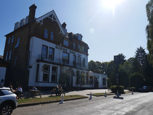
The forest is picked up at the Visitor Centre, where there is fine looking, rambling monster of a pub.  You can see by the skies in the pictures that it's summer's final hurrah and with plenty of time available, it would be rude not to stop.

The Royal Oak, Epping Forest Conservation Area
Kings Oak
Not wanting to risk a Greene King IPA, I think I've played it safe by going reassuringly expensive.  Yet somehow, they cannot even keep Stella Artois well.   Headless, soapy, with a scummy top.   At least they kindly filled my water bottle for the last few miles.

The second half of this walk proves a delight, the mighty trees offering plenty of shade and broad rides taking me all the way to Theydon Bois.   Only one photo required, so you can get the drift.

Into Epping Forest
Perfect Place to walk in an Indian Summer
Theydon Bois, the penultimate stop on the Eastbound Central Line, offers a couple of choices for refreshment.   The Bull, a Charles Wells Pub, proved the correct choice and the one closest to the Station.   Low ceilings inside, lovely garden outside and a good pint of Youngs Bitter saved the beer day out.

The Bull at Theydon Bois
Charming Theydon Bois
I'm back on the trail in October for another unvisited town.   Brentwood.  Who knows what I'll find.

Saturday, 17 August 2019

17/08/19 - London Countryway Stage 18 - Brookmans Park to Broxbourne

Distance - 12.6 Miles
Start - Brookmans Park
Finish - Broxbourne
Geocaches - 4
Pubs - Woodman and Olive, White Bear and The Bull at Broxbourne
Previous Stages - Stage 1Stage 2Stage 3Stage 4Stage 5Stage 6Stage 7Stage 8Stage 9Stage 10Stage 11Stage 12Stage 13Stage 14Stage 15Stage 16, Stage 17


The London Countryway is taking me to some mysterious places.   I'm not exactly sure where Brookman's Park is, but the first observed bus "labelled Luton" provides a small clue.   If the walk doesn't pan out, I can always take advantage of public transport and see the Baggies who are playing there today.

Wherever it is, it's prime commuter territory for the City Big Wigs.   The long avenue to the golf course (say no more) is resplendent with massive houses, no two architecturally the same, with the only common ground found by the high end German cars parked on the two entrance driveways.

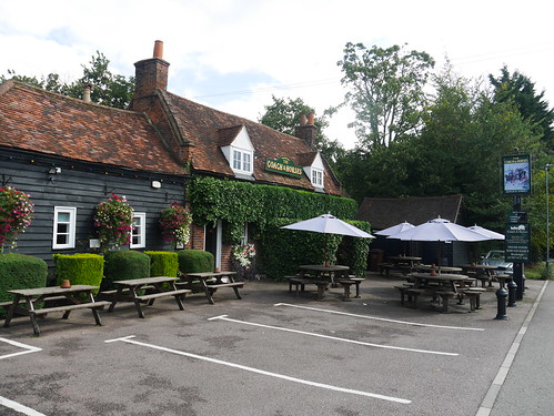
The walking is OK.   We're not hitting the heights of the Southern Section and you know when your blog is in trouble when the only things of interest to describe are a radio transmitter and a water tower.  There's some decent agricultural footpaths and the first village, Newgate Street or Ponsbourne (as the Church labels itself) is pretty enough.   Shame its only 11am, as the Coach and Horses looked much more promising than the pubs I did find open later.

Fields of Hertfordshire
Hertfordshire Agricultural Footpaths
Ponsbourne Church
Ponsbourne Church, Newgate Street
Coach and Horses
Coach and Horses remains undiscovered due to 11am arrival
Ponsbourne House
Ponsbourne Park House

Wormley Woods is a pleasure to walk.   Ancient Woodland, boardwalks for the boggy bits and in August, home to an awful lot of dragon flies.   I'm following Dick Bowman's GPX Files and all I am going to say is he got badly lost.   There's a West-East stretch along what looks like a path on the OS Map but is actually a badly overgrown ditch.    Future London Countrway'ers should stick to the present Authority on the route - Des De Moor.  I survived and felt this should be rewarded with a pint.

Wormley Wood Selfie
Woodland Selfie
Over the Boardwalks
Lovely walking over the boggy bits
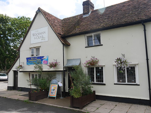
The OS Map shows a big blue cup of joy at Wormley West End.   My map is old and pubs are dying at an alarming rate, so this is no guarantee of refreshment.   But the building is there, even if its is now a Greek Restaurant.   I know this, as they have appended "& Olive" to the original name "The Woodman".

I hope the food is better than the beer.

Woodman and Olive
Christmas is just around the corner.  It's August.

Flat Italian in a Greek Pub
No ales on but you do get charged £5.10 for flat Italian Lager
Not to worry, I'll soon be in Broxbourne - where very early signage (I am at least 2 miles away) tells me it was the home of the Kayaking in the Olympics.  I simply have to navigate Baas Hill Common, cross the A10 and drop down to the village.   Really, I should be following the New River to the Station but a) I have this ear marked for a future walk and b) I need to see what Broxbourne has to offer the weary foot traveler.

New River
The New River Path - for another day.
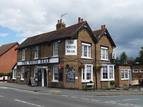
I am the only man in the White Bear who doesn't have a Ralph Lauren polo shirt on but I get away with it as they are all Arsenal fans and Arsenal are on the TV.   The only real ale on is Doom Bar but as the Cask Marque accreditation next the front door says "Expired", I join my Gooner friends in a Stella.

White Bear, Broxbourne
Dress Code, Ralph
Over the road is a McMullens tied house, the Bull.   I know really feel that I am in Hertfordshire.   A chainy pub but the County Bitter was pint of the day.

The Bull, Broxbourne
McMullens Bull

I'm rather looking forward to the next leg - where I will have my first visit to Waltham Abbey.   A place that I've wanted to visit since reading the first chapter of Iain Sinclair's London Orbital.

Sunday, 21 July 2019

21/07/19 - London Countryway - Stage 17 - St Albans to Brookmans Park

Distance - 8 Miles
Start - St Albans
Finish - Brookmans Park
Geocaches - 5
Pub - The Woodman, Waters End
Previous Stages - Stage 1Stage 2Stage 3Stage 4Stage 5Stage 6Stage 7Stage 8Stage 9Stage 10Stage 11Stage 12Stage 13Stage 14Stage 15, Stage 16


Plenty of route options on Stage 17 of the London Countryway. 

Keith Chesterton's original book had a loop over the top of St Albans and seemingly taking in Hatfield Airfield.    That's long gone and is now a business park.  I'm not going anywhere near a place of previous employ.

Des De Moor has two options - both finishing at Welham Green Station.

The now missing Dick Bowman website, where I had the foresight to download the GPX's, has us ending at Keith's original location - Brookmans Park. 

This is the one we take and it couldn't be easier to walk on a Sunday morning, although it won't get the pulse racing in terms of views, variety or places of interest.   I do it a slight disservice.   You have to play human frogger proficiently to get across the four lane race track that is the A414 North Orbital Road.

After a more than comfortable night in Lenny Henry's favourite Hotel Chain, we work our way through town.   Down the main street, past the museum and head east along Victoria Street.   More pubby landmarks to point out to Mrs M and its great to see the Horn, a top music venue, still apparently going strong.   Tribute bands, The Smyths and a Bit of A Blur, would certainly be attended, if we didn't live 130 miles away.

Our aim - and our path for the majority of this walk - is the Alban Way - A 6.5 mile disused railway line.   The shade offered means we are more than happy to put up with annoying cyclists dinging their tinny bells at us.

St Albans Museum
Another St Albans Landmark
Alban Way
Alban Way - with one those bell ringers approaching
Alban Way
But the shade is more than worth it

Dead straight, dead flat walking on tarmac is surrendered at Sleapshyde.  Probably early anglo saxon for "Sleepy Village".   The thatched pub, the Plough, looked a delight but hardly likely to open its doors at 10am on a Sunday morning.

The Plough, Sleapshyde
Another one slips the net
Our reward for a terrifying crossing the insanely busy A414 is a "green tunnel" to Colney Heath and ultimately North Mymms Park.

Green Tunnel
Safely across the A414 
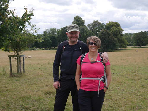
Team Photo in North Mymms Park
And into North Mymms Park for a team Photo
North Mymms Church
and North Mymms Church

Fortunately, we have a footbridge over the A1(M), which leads to the tiny hamley of Water End.

When Keith wrote the book, he mentioned the two pubs here - next door to one another.   Alas, the Old Maypole has bit the dust - even if it does proudly display its "Best in the West" signage in the wall.   Ever one to look into the history of dead pubs, www.beerintheevening.com reveals that it "never recovered from the manslaughter".

Interesting,

It's 11:40am and we wonder whether to wait the expected 20 minutes for the opening of the Woodmans Inn.   It's a nice day and they have lovely outdoor seating, so we take off rucksacks only to notice the door is open and Mrs M to exclaim "there's people in there, with pints".

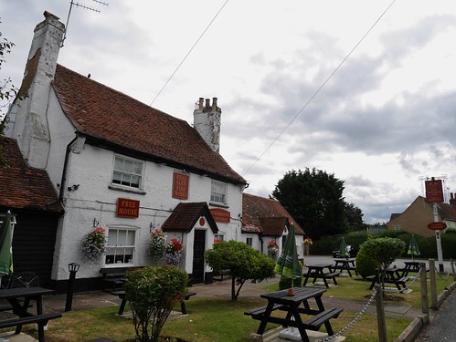
Woodmans Inn, Water End
Woodman Inn, Water End, with the Old Maypole a couple of buildings along.
A rare example of an 11:30am opener on a Sunday.   Super.

Its only half a mile along a delightful path called Wise's Lane to Brookmans Park.

Half hourly trains to the Smoke and a two day adventure on the London Countryway comes to a close.