Showing posts with label Brecons. Show all posts

Saturday, 6 April 2013

06/04/13 - Make your own jokes, please

Distance - 6.8 Miles
Geocaches - 1 (when we got back to Hay-on-Wye)
Walk Inspiration

Lord Hereford's Knob


Regular blog fans will know that I have been waiting since Christmas for the type of day that justifies a walk from my "Britain's Best View" book.  Today, was that day and Sonia is up for coming along.  Until she finds out it's 10 miles.  So I hit www.walkingworld.com to find a suitable alternative - and this one takes in the main place I want to go and comes in at less than 7.

We awake.  The dog gets excited.  I don't want to take her, as I know the walk will be sheep bound and its quite a long drive to spend on the lead.  Sonia talks me into taking her.  Then she goes on hides (dog, not Sonia).  I think she knew what we were in for.  Canine Premonition.

The drive is stunning, although Sat Nav wants to take us over a Toll Bridge.  Not sure if I have change, so we do the alternative and arrive at Hay for the obligatory toilet stop before picking up Gospel Pass to get to the walk start point.  We now know why it is so named.

Gospel Pass
Say you prayers Mappiman
It really is butt clenching time.  The snow is banked up 3ft on either side and we drive most of the 5 miles to Capel-Y-ffin, fishtailing with the parking sensors screaming.  Thank the lord we don't meet anything coming the other way.
 
It's a relief to park up and get out.  We head up the dead end road, with the monastic ruins to our left, spy a frozen dead sheep that's too gruesome for the blog and arrive in the valley.
 
 
Setting Off
All Smiles
This stretch is stunning walking.  We are gaining height but all very gently, following a stream to our left before we arrive at the escarpement.  Jaw dropping views in all directions
 
 
The Edge
Stunning
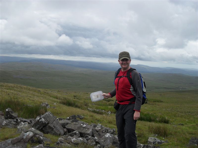
We turn right to reach the summit.  Sonia gets a reception so she can check in and tell the world that she is "proudly positioned on Lord Hereford's Knob".  Terry the reluctant dogger loads up his Fiat Punto with his oversized meercats to meet us. 
  
 
Cairn
Impressive Cairn on the Knob
Stretches out before us
This could catch on
We have gained all the height, and we have what should be a straightforward walk back along Darren Lwyd path on the high ground.
 
Unfortunately, this is under a lot of snow.  The path has disappeared.  We head off but about a mile in, its very tough going, with us disappearing up to my calves and Sonia's knees at an alarming rate.  Sometimes, the snow will just about take your weight.  Then you hear the crack and you are back sunk.
 
Very tiring and slow going, but we plough on - with no alternative escape route.
 
I know at the end, we will have a very steep drop.  But first, we take the exceptional views - which are even better at this end.
 
 
Valley Views
Sonia is too angry with me to appear on this photo
Valley Views
This makes it all worth it
The path down is incredibly steep.  You are meant to snake you way down gradually, but my fun loving walking colleague just plops on her backside and slides her way down.  This is the first time in the walk that she is actually in front of me.
 
 
Terra Firmer
Sonia's Bum Scoot Hill
At Capel-Y-Ffin we see two fellow walkers eating their lunch sat on the back of a hay wain.  Sonia remarks that she has never been so happy to get back to the car.
 
I'm not so keen.  I know that we have to tackle gospel pass again.
 
We survive, although at one point Sonia asks if "I am actually in control of this car".  We make it back to Hay-on-Wye.... a fine pub, a castle, plenty of book shops and one geocache on the other side of the river. 
 
Crossing the River to get the cache
Far less dramatic than Gospel Pass in the snow.

Sunday, 19 June 2011

19/6/11 - Not one place pronounceable in the West Brecons

Distance - 12 miles
From - Spring 2011 Trail Magazine
Confusion - Where to Park
Geocaches - 2

Picws Du


Reading through Spring Edition of Trail magazine and I realised that the Western side of the Brecons has been neglected.  This has more to do with the distance involved, rather than whether the mountains are any good or not.  Set the alarm for 6am and was out for 6:40am, with everything important apart from a mobile phone.  The journey at this time of day is a pleasure - Brecon in 75 mins and then another 40 down the most bizarre roads known to man - even going through a farmyard at one point.  There is no way this would be possible in Winter.

Sat Nav - are you sure its this way?

Arrive at Llanddeusant.  The magazine article provides the grid ref for the start of walk and a picture of a nice area for parking.  The two things are unrelated.  I drive around for a while looking for somewhere reasonable to park and end up popping into the the YHA (co-ords for walk start) and the nice man allows me to park there.  Why you would show a picture of a nice car park 1.5 miles away from the walk start is beyond me - unless they want to hoodwink inexperienced midlanders into making the journey.

Worried about the start of the walk for two reasons.  1)  I am going downhill, which means the last leg will be uphill and 2) The weather doesn't look the best.

My head will soon be in those clouds.

At the end of the road, turn right onto what has to be the most poorly signposted long distance path in the world.  The brecons way.  The way back takes in a decent stretch of this and not only is it not on the OS map, there isnt a single waymarker on the ground either.  The way is clear enough when you are there though.

Start the stiff climb up grassy banks to the starts of the unpronounceables - Bannau Sir Gaer to Waun-Lefrith.  You know what, I am sick of this.  Lets just call them hill one, hill two and look at the pictures.

We are on a ridge path that circumvents Llyn y Fan Fach (can't help myself, lake 1).  Impressive views, as once up, its a clear drop down and we just skirt the edges for some great photo opps.

What views.
no sarnies - just a cache at Hill 1

I love it once you have gained the height.  I have good views, but the light isn't great for the photos.  Still, you cannot have everything in life can you.  Work my way around the edge, meeting the first groups of walkers of the day, both pairs coming from the opposite direction.  What do they know that I don't?  Work my way around to Fan Foel, my favourite, as I can spell it and it has a shelted and a Trig Point.  I can eat my malt loaf in comfort.

Trigger

Then have a bit of ticklisting to go up and straight back down Fan Hir.  This isn't required for the walk, as we retrace our steps to drop down a staircase to Lake 2. 

This makes the walk - we see the lakes from the high ground and then drop down and see the high ground from the lakes.  A unique experience for me.

Simple walking now, although I do see 2 elderly gentlemen, who either still love mountain walking or have been on this route for a considerable time.  Walk with them a while, overtaking as they stop for sandwiches and then them catching me up as I finish off whatever else I can find in my sandwich box.

Mappiman at Lake 1
Then its a simple case of taking the access road down running parallel to the run off from the damned lake.  Not sure how it all works, but its pretty and I am sure there are fish leaping out of the pools at the bottom.

Lake 1 Spill Off
Past the car park (!) and then the mile uphill on the access road back to the hamlet that begins with two ls.  I have noticed on the map that there is an intriguing entry called the "Red Lion".  Could this be a pub to offer refreshment to a weary walker?

No, its the Youth Hostel.
Summary of things I have learned...

1) YHA people are lovely, even if they don't sell beer.
2) Trust your sat nav
3) Cause asking for direction is futile.
4) All walks should take you to a mountain ridge and then bring you back along the bottom.