The Southern, Herefordshire side of the Malvern Hill. If you want to visit soon, you've got to be quick. It looks like the A449 to the British Camp car park will be closing for 4 months. Of course, the ice cream kiosk have got a petition to stop the closure. How else will they sell two ice-creams for £10 to exhausted ramblers? A man on minimum wage has to work for two hours to provide a family of four with a 5 minute treat.
This country is broken.
Malvern has myriad paths, so the dodgy hand-drawn map in the Saturday Times was never going to be that useful. Christopher Sommerville wants you to go south on the Three Choirs Way (must be walked!) over Hangman's, Swineyard and Midsummer Hills. Then have a look at the Eastnor Obelisk before coming back on the Worcestershire Way to clamber over the top of British Camp.
Looking down over British Camp Reservoir
Striding out on Hangman's
Meeting the Gulley Quarry
Up close at the Eastnor Obelisk
Always trying to combine adventures - some things worked out, others didn't.
Facebook's Mysteries of Mercia wanted me to check out Clutters Cave.
Facebook Recommendation
Looking In
Looking Out
I should have checked the Facebook post's comments. Now frequently used as a Rambler's Toilet.
There's a Trigpoint to bag on Midsummer's hill, which oddly isn't marked on the OS Map. A bit of pre-walking research would have helped.
As it would with the OS Marked Walm's Well, the oldest well on the Malverns. I was so close, yet distracted by the much more modern covered reservoir. The well is directly opposite, should I find myself in this part of the world again.
Today's walk comes courtesy of Christopher Sommerville, walk correspondent in The Times. A couple of weeks ago, there was a route in remote Worcestershire.
The walk is all green lanes, agricultural countryside and the banks of Leigh Brook. Very remote, so not surprising that the only other humans encountered were also using Sommerville for bank holiday inspiration.
Alfrick Church
The key point of interest is Leigh Court. A manor house, a Tithe barn and a Church.
Both the barn and the church open for exploration. Who wouldn't want to poke their nose into one of the finest examples of medieval carpentry?
The Church is filled with C17th memorials and a Norman font.
From 1325 - one of the largest cruck-framed buildings in the land
Norman Font at Leigh
Of all the memorials, I was most struck by this happy chappie
Alfrick is home to 528 souls. For entertainment, they have a community shop and a village hall. The only pub, The Swan, closing down in 2000 and now a private residence. Information scarce, but I did find this 1950s photo of the locals and a bar manager, a Mr Barker, who was still running the pub as Worcestershire oldest landlord until his death in 1997.
Time Gentlemen Please
In the mood for pub archaeology, I consult the Historic Inns Book. The Bank House Inn is just a mile away from the Tithe Barn. It's still a going concern, but not as described in the 1960s. Its a quite horrible golfing hotel. I was unsure if the original building even still exists. If it does, it has been swamped by dormitories of hotel rooms and function suite or two.
Scampi in a basket always a winner
Travel Tavern Vibes
Of course, I ventured in. An unmanned reception desk and bewildering signage, where it looked best to follow the directions to the Sportman's Bar. Unmmaned. Saved me from myself and ordering an Estrella Galicia. The only vaguely interesting drink on.
Distance - 9 Miles
Geocaches - 6 Found
Walk Inspiration - The Times - June 6th 2020
That Times Newspaper from the start of June has paid for itself. The second Saturday running that I have completed one of their "20 Walks for Summer".
This is a delight.
It suggests starting at the Green Man in Fownhope. I'm hoping this is my last week of blogging Pub Walks without Pubs. With it not quite open, I decide to relocate the start to a picnic area high above the River Wye at Brockhampton.
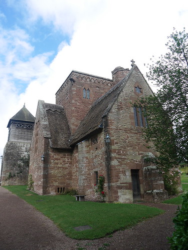
This also means that I can add a 2 mile loop to attempt some geocaches. I have a poor day, getting as many DNF as F and I cannot totally blame the cows. All was not lost, I had superb views and stumbled across the thatched church, falsely appreciating its antiquity. Only 118 years old in 2020.
Parking - High above the Wye... I'm bound to rue the walk back up at the end
Friends helping with the Geocaching
Brockhampton's Thatched Church
The Geocaches are laid along the Wye Valley Trail - which leads from the church up to Capler Camp Hillfort - providing views to the land where the pubs won't be open on the glorious 4th.
Looking over Wales
Agricultural land turns into Pagets/Lea Wood. The views don't get any less impressive, even when looking back over to England.
Looking over England
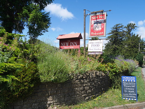
Fownhope is dominated by its main road and provides access to the River Wye. A bigger than expected church and two pubs - with the Green Man winning the prize for most impressive sign.
Would the New Inn have received the Mappiman Dollar?
or the no words required Green Man
A good couple of miles back along the meandering River Wye. Canoeists, fly fishermen and a very hairy pathway at Leabank, where fortunately there were ropes to assist with a path that is falling into the river. The canoeists had decided to commandeer a little beach, but a little further along is the remains of a ferry jetty.
Looked a perfect place for lunch.
As good as this Hawkshead Gold is, I am looking forward to next weeks cask.
My Lunch Spot for the day - the Swans know all the good places
The river is left behind at Brinkley Hill Farm. The climb back to the picnic area showed me how it got it's name.
Distance - 5 Miles
Geocaches - 1
Walk Inspiration - Times Summer Walks - 6th June 2020
Along with a weekly walk, the Saturday Times newspaper often has a collection of seasonal walks. June 6th had "Summer Walks" and out of the 20 listed, 6 looked of interest - either by location or walk quality. Pictures of routes saved to my Evernote organiser.
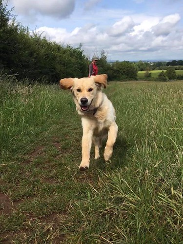
With the Championship resuming at 3pm, this little 5 miler from Hanbury Church looked just the ticket for a a football and pub starved rambler, his holiday starved wife and their up for anything Guide Dog in Training, Abi.
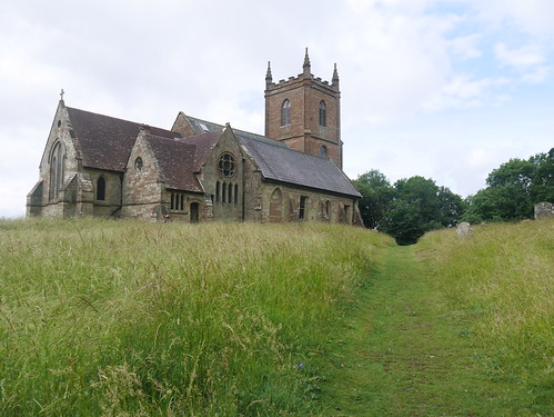
Parking is found on the high ground of Hanbury Church - a former iron age hillfort, with religious links going back over 1200 years. Audio from services are used in Radio 4's the Archers.
Hanbury Church on the high ground
We drop down through Pipers Hill woodland, picking up good paths on a field edge that has a stream. One of the party provides a warning of what is to come by darting through the undergrowth for a splash around.
I'm free - to do whatever I want
Field Edges
The fields lead to the Worcester-Birmingham Canal, where we have about a mile of towpath walking. It seems cruel to have her on her lead, but Mrs M - the main trainer - is unsure if she can be trusted to not jump in.
Abi is our third dog and 2nd Guide Dog puppy we have trained. Neither of the other two have leapt into a canal before. I'm that convinced she will be fine, I put my usual post walk pint money on it - knowing I am saving money in the pub barren lockdown and can afford to be reckless.
That's a fiver I will never see again
Of course, she let me down. A dive in like a furry Tom Dailey and a swim around the canal like some sort of big golden otter.
To dry off, we have some more lovely field walking - an arrow straight path cut through the crops - before crossing the grounds of Hanbury Hall, debating whether it has a cafe and if so, whether it is open.
Alas, Google could not provide an answer to that question.
Hanbury Hall - we are reasonably sure there is a cafe behind
Four times a year, the Times on a Saturday has a supplement of 20 seasonal walks. Four times a year, I plot them into my database as potential future walking options. Very occasionally, I actually walk one.
Leave sunny Worcestershire at 9am and head off to Nympsfield. It sound familiar, but it's not until I get here that I recognise the Rose and Crown pub and realise this is where I stayed when completing the Cotswold Way back in 2007. I had company then and this dog friendly pub put myself and the labradoodle up for the night. At first, we had the place to ourselves before the local hunt came in, dressed in full regalia.
I have never felt more English.
Mappiman's Bed for the night - 2007
Today, I am short of a walking partner. The dog isn't very well, so she gets a sickpass and I head off for the 50 minute journey without her usual whimpers of excitement.
Glorious blue skies have me in high hopes but Nympsfield is at the top of a very steep hill and appears to have its own microclimate.
I drop down through Dingle wood, slopping around in the mire that is equal parts horse poo and mud, with some very disappointing pictures in the fog.
Apparently, the light thing in the top left corner is called "the sun"
There are a number of reasons for choosing this walk. I rarely need an excuse to get on the Cotswold Way, but today there are some added historical factors.
The first of which is Owlpen Manor, one of England's finest Tudor manor houses - dating from 1200 but extensively rebuilt between 1464 and 1616. There is the manor house, a church and a number of reasonably priced holiday cottages. I could have stayed this week for £220 for 7 nights.
I'll save my entrance fee money and see if I can get any photos by using the public footpaths around. Standing on a bridge and peering over the hedge gets me a result.
Over the Hedge
Public Footpath into grounds
Technically, I probably shouldn't have been here
Having got my fix of Tudor history, I head up to Uley. I think I have been to this pub before as well.
England captured in a Photo
This walk needs a 21st Century fix and there is a geocache across from the Church. Despite a finger tip search of a bus shelter (its was a Cotswold Bus Shelter, much nicer than regular) I gave up. There was noone around, as you could hear them all singing in the church.
More disappointment to follow in the shape of the stiff climb up to Uley Bury. Think I am still in post xmas out of condition mode, as it is a bit of a lung buster. At least the 70 year old walkers behind me don't actually manage to overtake me.
Uley Bury is our next historical item on the walk. Its an Iron Age Hill Fort, with a very flat hill top and some excellent ramparts which make it like a tiered cake. The only decision to be had is which rampart to walk on. On a normal day, I would have been rewarded with excellent views of the Severn Vale. Today, you can make do with me next to a tree.
Stunning Views... Usually
There is a geocache in an old biscuit tin which is in remarkable condition, being as the top doesn't fit properly. At least I have one find today. Walk my way around to the carpark and there is another multi. I have a sit on the bench and work out the co-ords, but the final cache is back the way I have come. The pub is open, so I knock it on the head.
I know where it is, even if I can't be bothered to get it
I'm on the Cotswold way now, walking on an excellent path free of mud (hurrah!) as we walk towards our final historical artifact - the wonderfully named Hetty Pegler's Tump.
I have walked here twice and although its marked on the map, I haven't actually found the burial site. I am afraid that I have no Tump shots to show you this time.
Instead of Tump hunting, I concentrate on my second and best geocache of the day and walking down only to walk steeply back up. Nothing pleases me more than these sort of rambling work outs.
All the way down to go all the way back up - love it.
It's not long before I am back on the road and crossing my last field to get back to Nympsfield, taking in a small cache near a stile.
12:15 and the pub is open. I get my drink - of course it had to be the Cotwold Way - and adopt my usual post walk position.
Happy Mappi
But what am I doing? I have no filthy hound covered in her usual mix of mud and fox poofume. I can actually go inside with all the other humans. The pint is finished off next to a roaring fire, on an old leather sofa - that comes complete with added advice from the management.
Perfect end to a perfect Walk. Apart from the fog. And horse poo.
Distance - 5.0 Miles
Geocaches - 3
Walk from - Times Xmas Walks 2010
Pubs Visited - Two
The Times on Saturday has to be the finest paper available. It takes me an hour to read it on a good day and four times a year it has a walking supplement that I cut out and keep. Searching my database of walks for somewhere to go up the Stiperstones, it revealed this perfectly sized amble that tempted Sonia away from asking strangers questions.
I last came here six years ago. Where does the time go? I remember that you could park almost at the summit which made it even more tempting for Sonia who commented as we gained altitude on the drive "that she liked the fact we have nearly driven to the top".
Quick park up and gain the remainder of the height to reach Cranberry Rock. It's a stunning day - after a week of grim weather, the winds have moved in to leave perfect blues skies. It is, however, very cold. I can hear Sonia's teeth chattering as I find the first cache of the day.
Windswept and cold
Unfortunately, all the caches on this walk are on the ridge. Even though she engages in conversation with a couple of ladies about the dog, I can tell that she is less than pleased that I have crawled into a gap in the rocks to retrieve Cache Number 2.
Decide to park the caching
The ridge walk is superb. There are stunning views in all directions. Only pause from now on to break the ice so that the dog can get a drink from the puddles and to setup the timer on the camera.
Only 10 seconds to get across the rocks
We meet an army of goretex glad pensioners at the Devil's Chair and then avoid the cache at Shepherd's rock to make a great westerly descent down to the village of Stiperstone. Sonia muses about what sort of cake shop they have. I am forearmed with the knowledge that there is a pub, as I can see it on the OS Map.
The Stiperstone Inn is the focal point of the village. We know this as there is a wedding party in the back room and the non invited locals are settling down to watch the football. With real ale and two fires at either end, it makes a fine place to spend a Saturday Lunch.
Yes, they have semi skimmed milk. The pint is mine.
We avoid eating anything more than the complemenary biscuit, as we know that what goes down must go back up. Sure enough, we have a very steep climb once we leave the village.
In all my years walking, something extraordinary happens next. Now the Japanese have often commented that my hound looks like a sheep, but it seems that she is good enough looking to get a Ram interested in putting on his Barry White CD. First he came to me for permission and then the wooing commenced.
Love is in the air. Big Cojones.
Molly fluttered her eyelashes, but we dragged up the hill to avoid whatever mutant offspring would be the production of this union.
Leave Randy the Ram behind
The walk levels out. We can either lose height and drop down to the Field Centre or take a short cut back to Manstone Rock. No contest really, there is a cache left at the rock and Sonia wants lunch.
We get back to the car and the Sat Nav takes us on a precarious drive over Long Mynd, with Sonia going quiet as she spies the drops on the left of the car. No pubs between Church Stretton and Cravan Arms.
We consider fish and chips. The queue in the first chipper is out the door, but I know of another one around the corner. We are concerned by the lack of punters and all is revealed when I enter and ask for fish and chips twice...."no fish, only sausage" is the response. My suggestion to changing his shop name to Sausage and Chips falls on deaf ears, so we head over to the Craven Arms. For steak and ale pie twice.
So this is two Saturday's running that I have had company. Place you bets on a hatrick blogfans.... next week I am off to the first battlefied off the English Civil War.
At the end of August, I took the Times Newspaper with me to Greece. As I sat and read it in our prison apartment, there was a walk detailed at Ironbridge in the pull out weekend section, with a link to the details at the end of the article. Despite having a toilet that wouldn't accept paper, we did have wireless Internet - so I spent a week booklinking various free walk series and dreaming of cool autumn days to walk in Blighty.
Its taken me 2 months to get time to do it. Where do the weekends go?
This is the birthplace of industry and you could make a real day of it by getting passes to the museums. However, I don't have time and do have a labradoodle that probably wouldn't have been welcome. I just concentrate on a stunning walk, that was more woodland than river.
As its an working class town, there are working class vices. Just as I am about to cross the famous bridge, I spy a pub next door to an award winning pork pie shop. And more of that later.
Pies Left
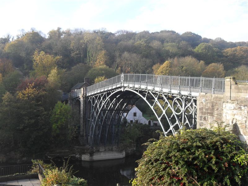
There was always going to be a shot of the bridge.
Cross the bridge and find cache number 1. I have downloaded all caches within 0.25 miles of the walk and a world record of 46 were found. I have only attempted the ones on route and it provided a nice distraction.
Head East along the south side of the river. Have to nip off track for cache 2 and re-emerge from the bushes in front of startled Germans. Continue all along the this cycle way, passing the tile museum and ending up at a foot bridge on the way to the Tar Tunnel. I don't know what it is either.
Find a canal here and I can see a tramway up the woodlands that mean that I am in for my first climb of the day.
Uphill next to the tramway
This sets the scene for all the return journey - getting high in woodland and having the occasional stunning views through the trees. Stop to arrange the camera from a footpath that is right next to the dining room of a hotel.
Power to the People
Come around the back of the Bliss Hill Victorian town and get a few caches. One involves a precarious dangle down hill from a tree on a steep hill and as I am signing the log, the labradoodle comes barrelling down past me. No harm done but she does get frustrated with my caching.
Through Lloyds Coppice on the Rigeway path.
It's in the trees
Finaly work my way through Dale Coppice and a dodgy council estate before taking the downhill path back to the carpark. I oass colebrookdale church and the YHA before dropping down a path called simply paradise. I wouldn't go that far, but it was better walking country than Greece.
This is why I want to stay at a YHA
If I changed one thing about the walk, I would go in reverse order so that you pass all the pubs and pie shops on the way back to car. I drive back through and fortunately, I can pull into a bay to load up at Mrs Miggins. I cannot choose between the pie and pasty.
You all know what I ended up doing.... a two handed savoury chow down.
Get back home and check the Times. This weeks walk is in the Wyre Forest. I have it scheduled for the end of December.