Showing posts with label mountains. Show all posts

Monday, 17 February 2025

17/02/25 - Dow Crag

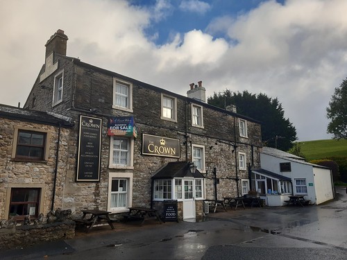
Walna Scar Road - only for the fearless

Every year, I like to walk at least one Wainwright. I currently sit at 87 completed. There are 214. I need to get a wriggle on.

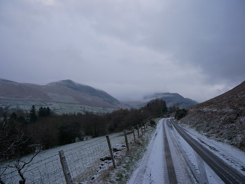
Today's walk begins at the end of Walna Scar Road. My god. Whoever designed it clearly wasn’t thinking of a Seat Ateca. Should I ever attempt it again, I’ll be sure to take a longer run-up—and possibly say a small prayer.

As we set off, snow flurries dance in the air. A picturesque sight, but also a reminder that even the slightest dusting would have left us stranded at the top, contemplating a new life in the fells. "Take up walking to lower your stress levels," they say. Right.

For cars, Walna Scar road runs out at a rather large car park. Now Ringo Controlled and they must have put a mast in somewhere. Didn't stop at least three cars winging it. Yellow penalty notes on drivers side windows are going to ruin your afternoon. At least I know the app works.

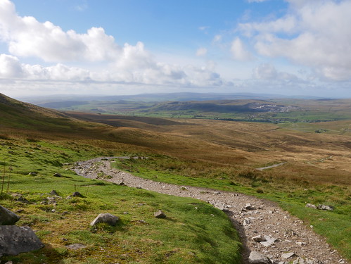
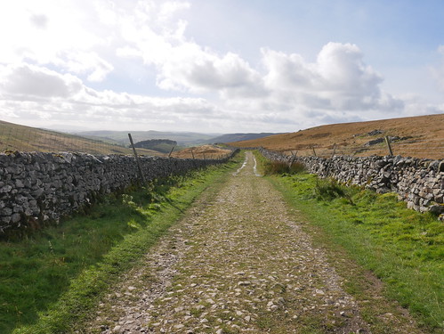
From this point on, its a historical pack horse track that leads from Coniston to the Duddon Valley.  A gentle introduction to the days walking.

Walna Scar Road
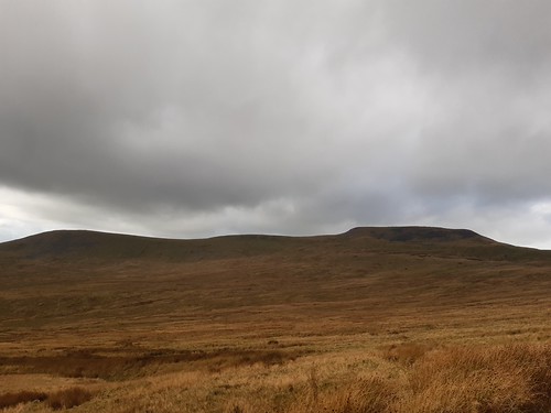
Ruby on Walna Scar Road - Dow Crag behind

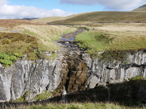
We head North West to Goat Tarn. Photos taken - the Hause behind our access point to the tops.

Goat Tarn
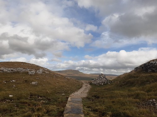
Mrs M unconvinced there is a path
480608112_10165362131208228_6762583359841461055_n
But look, she is on it and above me

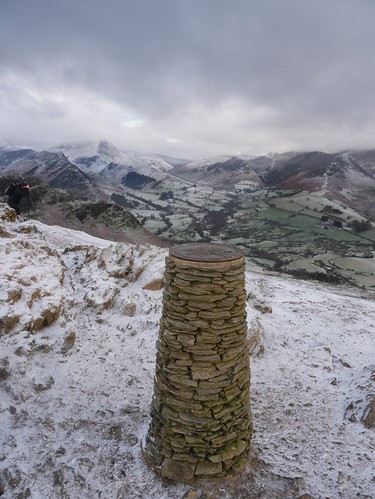
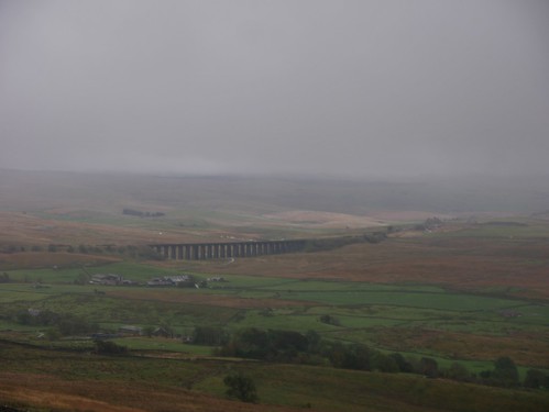
Few photos from this point on. It all gets a little survivalist. On a summer's day, this would have been a near perfect introductory walk to the fells. Slightly challenging, but once the height is gained, a great ridge walk with some super views over the Coniston Massif. 

In February - and contrary to the forecasts - the wind was fierce. Dry your eyes fierce. Now you know why everyone coming in the opposite direction is so rosy cheeked fierce. On completion Mrs M asks if her face is a red as mine. Wind blasted.

480269892_10165362129858228_2375520586771618073_n
The last walk photo..... I'm going for a walk and I may be some time

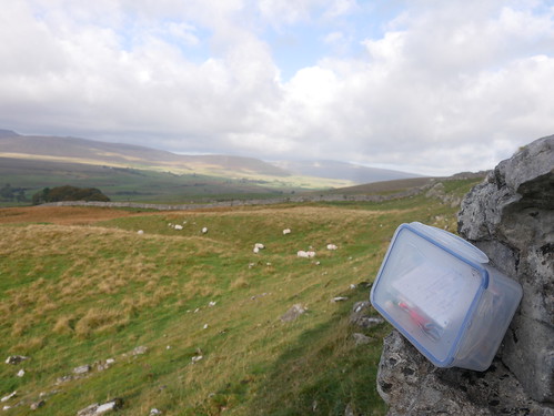
Even Geocaches needed to be ignored. Not that I could feel my fingers to open tupperware boxes.

But every step down is a step out of the wind. And prizes await once we toboggan back to town, hoping to Christ we don't meet anyone coming in the opposite direction.

Black Bull, Coniston
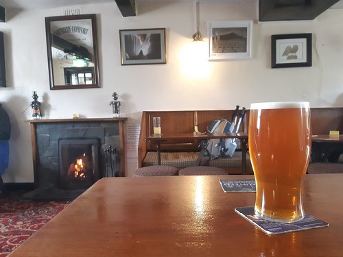
The Black Bull, Coniston

I've got many favourite pubs, but the Black Bull has to be in my top 10. Bluebird Bitter is available in bottle conditioned format for export, but it doesn't taste the same as on cask, in its place of birth. Bluebird XB, its slightly stronger brother, is rarely seen elsewhere.

This, and a roaring fire, a fitting reward to a fine day.

Black Bull, Coniston
The Line Up in the Black Bull. If you are on the bus, go for Old Man

Walk Details

Distance - 6.5 Miles

Dow Crag Height - 2552 Feet

Geocaches - Too Windy to Look

Walk Inspiration - Pocket Mountains - 40 Walk in the Southern Lake District

Monday, 8 July 2024

08/07/24 - Yr Eifl

We can see the pub from here


We selected the best weather day to challenge the mountains. Yr Eifl is a range of three peaks at one end of the Nefyn Bay. Garn For, Garn Ganol (the highest at 1850ft) and the hill fort of Tre'r Ceiri. Town of the Giants.

The walk is not without its minor challenges. Deceptively easy on a low incline track too start, its hands on rocks scrambling to the top of Garn Ganol. 

Pictures can tell the story.

Starting Standing Stones at the Car Park
Car Park Standing Stones and 2/3rds of Today's Work
Easy beginnings
Easy Mountain Access
View from the shelter at Garn For
Shelter view at Garn For
Scrambling to the top of Garn Ganol
Hands on Rock on Garn Ganol
Top of Garn Ganol
Views all along Lynn Peninsula.  And Lunch. 1 Banana.
Tre’r Ceiri
Final peak - Tre’r Ceiri Hillfort

My planned route would have taken us to the pub at Llithfaen. But not with these opening hours;

Tafarn Y Fic a Monday No Go

Instead, we console ourselves with what we could have won.Through binoculars, we can see the stemmed glasses of San Miguel* at the legendary Ty Coch Inn. No one who ever visits will ever forget it. 

We made the walk on the evening - where we can see what we conquered earlier in the day.

A later in the week revisit**, a must, where it will be blogged.

View of a Pub Bench
A View from a Pub Bench

* exaggeration, we can see the building
** if the rain stops 

Walk Details

Distance - 4.5 Miles

Geocaches - 2 and an Adventure Lab Cache

Walk Inspiration - BBC Countryfile

Saturday, 2 December 2023

02/12/23 - Cat Bells from Little Town

The first snows of Winter for my 84th Wainwright


Things could have been worse. By the end of the day, the good people of Ambleside, Coniston and Grasmere are opening villages halls to house stranded motorists.


We're only 15 miles away in Keswick and after a fun packed, three generational weekend of good food, wine and well rehearsed Karaoke routines are only slightly jealous that we couldn't have extended the time away by being snowed in.

The dusting did present minor issues. 

"Where to park?" is always a concern in the Lakes. The guide book says Hawes End, which Google Maps shows as "Permanently Closed". So we hatched a plan. Mrs M to drop me off at Little Town and I'd complete a linear walk back to Keswick. The single track lane became increasingly hairy - so we both decided I would be dropped off underneath Barrow, increasing the walk-in distance but leaving us with a better chance of transportation back to Worcestershire.

P1040660
She abandoned me

 Just the one Wainwright to conquer.  Cat Bells.  My 84th.

Cat Bells is a fell in the English Lake District in the county of Cumbria. It has a height of 451 metres (1,480 ft) and is one of the most popular fells in the area. It is situated on the western shore of Derwentwater within three miles (five kilometres) of the busy tourist town of Keswick. Its distinctive shape catches the attention of many visitors to the Lakes who feel compelled to climb to the summit after seeing it from the viewpoint of Friars' Crag on the opposite side of Derwentwater. The Lake District writer and walker Alfred Wainwright acknowledges the popularity of Cat Bells among fellwalkers of all abilities by saying:


"It is one of the great favourites, a family fell where grandmothers and infants can climb the heights together, a place beloved. Its popularity is well deserved: its shapely topknott attracts the eye offering a steep but obviously simple scramble."


Getting access from Little Town proved inspired. A slow and steady climb up Yewthaite Combe, an easy route.  

P1040661
Crossing Newlands Beck to get to Little Town

P1040662
Looking West from Yewthwaite Comb
P1040676
First glimpse of Derwent Water.  No boats running in December

P1040678
Looking South, back at Cat Bells on the descent
P1040673
The Cat Bells Toposcope

The descent was much harder.... I have all the gear but little idea, with walking poles and two different types of spikes left at home. As undignified as it was, a fair amount was down on my backside. Slippage, and I would have taken any number of other walkers out - who are all coming from the Keswick direction.

Hawes End reached, where a handy man in a van with Google Pay sells coffee, warming hands for the Cumbrian Way to deliver me back into town through Lingholm.

Where the pubs await.

Saved for another blog but with a sneak beer board preview;

Beer Board Sneak Preview
Don't worry - I didn't

Walk Details

Distance - 7 Miles

Geocaches - 2

Walk Inspiration - Jarrold 56 North and West Lakeland, Walk 6 


Saturday, 6 May 2023

06/05/23 - Rannerdale Knotts, Whiteless Pike and Wandope

 Finding my limits on the eastern path from Wandope


Time to pick off a few more Wainwrights and a valuable lesson learned for my future self. Rather than actually pick a route at random - have a look at the complexity and height gain.

This is the closest I have got to giving up, lying down and waiting for someone to come to the rescue.

The walks is in one of the most beautiful parts of the Lake District, Buttermere. I was last here on the Inn Way to the Lake District and took the time for an afternoon nap on a little spit of headland jutting into Crummock Water. On awakening, I got a little emotional at the beauty and had a little cry. It was nothing to do with the lunch time four pints of Loweswater Gold at the Kirstile Inn.

The walk is meant to start at a little free parking area at the bottom of Rannerdale Knotts. I am early, but it is Saturday on a bank holiday weekend and in the one bit of planning I do, I spot more space elsewhere.

My walk begins at Newlands Hause, opposite Moss Force.

Parking area opposite Moss Force
Opposite Moss Force 

The guidebook does explain that this in intricate and occasionally off path. I recognise that I have to cross Mill Beck and this proves easy enough with walking poles to balance on slippery stones.  Its then up and up to Rannderdale Knotts - providing superb views across the lakes.

Lake Buttermere and Crummock from Rannerdale Knotts
Buttermere and Crummock from the end of Rannderdale Knotts

The descent is steep but short and the true start of the walk is found.  Yep, the car park is full.  I made the correct decision.

Doubling back on myself along Squat Beck, the bluebells are out if force. A roped walkway avoiding unnecessary trampling. Fleece off, predicted thunderstorms failing to materialise, this is as good as the day gets.

Heading into Dale How
Through the Bluebells

I can see Whiteless Pike and convince myself that I am not going up the huge lump looming over it.

This is, of course, Wandope. 51st out of 214 in terms of height. It's a relentless plod. Fell runners in both directions laugh at my lack of fitness.

Wandope from Whiteless Pike
Whiteless Pike - dropping off to climb Wandope (peak to the right)

Then it all goes slightly wrong. The path east off Wandope (running past the hanging valley of Addacombe Hole) is a feint dashed line on the map. I get to the edge and look for it and there is nothing on the ground - just the steepest drop I have ever seen.

I am unsure what to do. It doesn't look safe, but I have no other way than forward, unless I go back the way I came.

Tentatively, I head "off piste", half hoping one of the other walkers will see me and talk me down.

After a very nervous start, a sole footprint is spotted in the peat and there is the faintest of paths dropping straight down along a thin ridge. Even with walking poles, I decide the only way to descend is on my backside, using the poles as some sort of breaking oar.  

Sliding down starts as a good idea, if a little unglamorous, until my trousers ride up.

I am now wearing my testicles as ear-rings.  

Getting to the bottom at Addacombe Beck, I see that I am supposed to do another climb - Ard Crags and Knott Rigg.

There's simply nothing left in the tank, but thankfully, I do have an escape route. The path running underneath Bleak Rigg will return me to where I crossed Mill Beck and a short climb back to the car.

Escape route under Bleak Rigg
Hugging the valley floor for as long as possible

I've never stopped so many times on a walk. My average speed, 1.23 MPH.    

Once back in civilisation, I investigate other people's experience of this route. I have read of a few who have walked up this killer path to Wandope.  

They all vow "never again".

I also google steepest incline safe to walk and find this;
An able-bodied person might go up an incline that is 45-50 degrees without the need of a harness, spotter, safety handles, or restraint. People who have excellent balance and great centers of gravity fall into this group of people who can climb such things unassisted.
The descent from Wandope is 40-49 degrees.

Walk Details

Distance - 8 Miles
Duration - 5 hours
Average Speed - 1.23 MPH
Height Gain - 3120ft
Walk Inspiration - Walking the Wainwrights, Graham Ulney, Walk 54 
 
Geocaches - 0


Sunday, 16 October 2022

16/10/22 - Pen-Y-Ghent

Distance - 7 Miles

Walk Inspiration - Country Walking Magazine, July 22, Walk 20

Geocaches - 5

Other Yorkshire 3 Peaks - Whernside, Ingleborough


Third day of the long weekend and the third mountain. For my money, Pen-Y-Ghent is the most handsome of the Yorkshire 3 peaks. As its a Sunday, this is also the shortest walk of the trio.  Everything is meticulously planned for maximum pleasure.

Back to Horton-in-Ribblesdale, short road walking to the Church and out into the countryside, via Horton Scar.

Horton-in-Ribblesdale
Horton-in-Ribblesdale Church, with Pen-Y-Ghent looming on it's shoulder
Geocaching on Horton Scar

There's no problem with route finding. A flagged path leads ever upwards, although its not always clear how you actually get to the top. Transpires that the path runs around the back of "the snout" and there's some hands on rock scrambling required. Nothing a 53 year fueled by a full English cannot manage.

Pen-Y-Ghent
Easy route finding
Pen-Y-Ghent
But how do you get up the shapely snout?

An absolute minimal amount of time on the top - once the trig point is touched, a photo is taken of a group of youth (their camera not mine, I am not a weirdo, will look on the gram for it later, OK maybe I am) and I am marching back down the Pennine Way. Super views and easy navigation.

Route Down
Walking down the Pennine Way

A geological feature to break up the walk. Who wouldn't want to know what happens to Hull Pot Beck? I'm unsure whether I have seen a stream disappear into nothing on a map before.

HullPot
Nature's Magic Trick?

Turns out it disappears into a great big hole in the ground.  Where the water goes next, anyone's guess!  

Hull Pot
Hull Pot Beck - Side On
Hull Pot
Hull Pot - End On

And then its just a mile and half of walking between stone walls. Every step savoured as every step brings me closer to Microsoft Teams misery.  

Its been a fine weekend of good Yorkshire walking and good Yorkshire drinking.

Route Home
The Yellow Brick Road to on-line collaboration software

Saturday, 15 October 2022

15/10/22 - Ingleborough from the Crown, Horton-in-Ribblesdale

Walk Inspiration - Country Walking Magazine, July 22, Walk 19

Geocaches - 4

Distance - 11 Miles

Yorkshire 3 Peaks - Whernside


Torrential rain is not what you want to hear lashing against your B&B window, when you know you have a 5 hour walk ahead. The forecast had it going on all day and its rather a nice surprise to find it blown over by the time I have had my breakfast rated on Facebook.  

Harts Head Hotel, Gigglewick, Breakfast
People Liked the bean separation.  But disliked the raw black pudding.  And "toast"

A short drive from Gigglewick to Horton-in-Ribbesdale, which has everything needed.  Paid parking, which can be for the 48hours.  A pub.

Country Walking Magazine suggests that Ingleborough is the superstar of the Yorkshire Three peaks.  They go as far as to say that if the mountains were Destiny's Child, Ingleborough would be Beyonce.

I'm not so sure - its a long entry walk from Horton - and you do pass some stunning geological features on route but for my money, Pen-y-Ghent is the most handsome.

Ingleborough
Ingleborough, from the approach

The walking is (relatively) easy. The gradients are kind, as I walk through the limestone pavement of Sulber and continually climb on well flagged paths, keeping my boots nice and dry. Its only the final approach that can be described as "lung busting".

No hanging around at the top - its exposed, the winds are viscous and the rain starts up.  Two summit geocaches have to be shunned - it's simply too dangerous to go looking under rocks on the edge of a mountain.  

Ingleborough Summit
From the top of Ingleborough

Drop down the southern side of the mountain to Little Ingleborough and work my way to geological items of interest.

Gaping Gill - a 100 metre deep pothole - is not going to show much at ground level. Have a google. Or come back in May, when the potholing club will lower you down on a chair.

A little further on is Trow Gill, which provides a suprise for the unaware. The path winds down through a narrow path between 200ft cliffs. Very reminiscent of Lud's Church in the Peak District, and just as slippy underfoot.

Trow Gill
Trow Gill, as it opens out

Easy walking back through limestone pavements to pick up the walk-in route at Sulber. The return to Horton shows what needs to be conquered tomorrow - Pen-Y-Ghent.

Pen-Y-Ghent
Tomorrow's Adventure

5.5 hours and 11 miles after setting off, I am ready for refreshment. Like the announcement of a new pope, I took the smoke rising from the Crown's chimney as a positive sign. 

The Crown, Horton in Ribblesdale
The Crown, Horton in Ribblesdale - For Sale Sign had me worried

All punters were ramblers, so there was a decent buzz of post walk chatter in the main room.

The Black Sheep was pouring rather well.

The Crown, Horton in Ribblesdale
Post Walk Refreshment


Friday, 14 October 2022

14/10/22 - Whernside and Ribblead's Station Inn

Distance - 8 Miles

Geocaches - 2

Walk Inspiration - Country Walking Magazine, September 2018, Walk 19


The Yorkshire 3 Peaks is a classic hill walking right of passage. In 12 hours, maniacs need to complete Whernside, Ingleborough and Pen-Y-Ghent - a distance of 24 miles and over 5000ft of ascent.

I am attempting the same but over 72 hours.  My challenge will also incorporate two pub crawls, two full English breakfasts, suet pudding with chips and a balti chicken and mushroom. Cruelly, I am denied a certificate for this endeavour.

The first one to tackle is the highest. A great big lump of a hill that has one saving grace.  The Ribblehead Viaduct is an impressive feat of engineering and I get to walk under it, whilst I still have the ability to see my hand in front of my face.

Ribblehead Viaduct
Marching past Ribblehead Viaduct

It's a gentle but relentless climb up past Bleamoor sidings. I hear the train-a-coming and the disappointment of it being a diesel powered, Northern shunter rather than a steam locomotive dissipates when I get a wave from the train driver.

Bleamoor Sidings
Bleamoor Sidings

An aqueduct, and a waterfall that is more impressive in real life than in photo and I am into the clouds, with nothing more to visually represent.

Force Gill
Gill Force - better in real life

Whernside top is flat and lengthy - with the height gained, its a case of plodding for a mile and a half through the driving rain, fully hard-shelled up. Half way down the drop to Bruntscar, and I am through the mist to almost see the views from the top.

Coming off Whernside, through the mist
Coming down Whernside's southern flank

Back to Ribblehead, where there is a comforting pub - the Station - to toast one down, two to go.

Halloween decorations placed lower than head height at the bar means that every second drink of my Settle Brewery Ribblehead bitter is accompanied by an in take of fake cobweb.

Settle Brewery, Ribblehead Bitter
Eponymous Bitter - Cobwebs out of shot

If proof is needed that the world is a better place after a pint, I leave the pub to blues skies and a view of what's been walked.

Whernside, when the clouds lift
Whernside, from a pub garden


Saturday, 29 January 2022

29/01/22 - Scafell Pike and Lingmell. Recovery at the Wasdale Head Inn.

Distance - 6.5 Miles

Geocaches - 2


A friend with a significant birthday and his desire was to be the highest man in England.

2010 was the last time I walked it - from Seathwaite - can I still do it my fifties? We pick the quickest route, from the Wasdale Head Inn. Hopefully, this will come in handy later in the day.

The drive there was as spectacular as the length. Avoiding Hardknott Pass, we ended up on the Cumbrian Coast through Muncaster.  5 hours. We could have made it to Edinburgh.

At 10:30am, we start walking.  I use this term in the loosest possible sense of the word.  The only time we are not climbing up, we are heading down. A few other hardy souls are out in Storm Mallik (wind, rather than rain), including a family of four. During one of our many breathers, my mate with the significant birthday is given inspiration from a 10 year old girl.  She assures him is "doing really well and to keep going".  

A mantra for life, if I ever heard one.

Our route?  Lingmell Gill and up Brown Tongue, past Hollow Stones and across the boulder field to Scafell Pike summit. Where it is too cold to stop for all of our sandwiches. Have you tried to chew a frozen ham bap?  For variety, we drop down and up to Lingmell, providing my first new Wainwright since the start of the first lockdown in 2020. The descent from Lingmell is easy to navigate but so, so steep. My thighs - which have ordered walking poles from the internet this morning - are not sure whether its easier going up or down.

Here are the photos;

View from a Car Window
View from a car window, as we reach Wast Water

Wasdale Head Inn
Only fools would purposely leave this pub behind

Somewhere near the top of Scarfell
Somewhere near the top of Scafell Pike

Looking over Wast water
Descending from Lingfell

Geocaching Mappiman
Mappiman Geocaching on Lingfell

Lingmell Descent, with the pub
We can see the pub from here!  A hellish descent from Lingmell

4pm when we arrive back at the pub... all of us walking like John Wayne after a particularly lengthy cattle drive.

The Wasdale Head Inn is a classic mountaineering pub and perfect for a single night, which you spend amongst people with the same interests as yourself. They may be better at the mountaineering but I can give them a run for their money at the bar.

Wasdale Head Inn
Former Farmhouse
Wasdale Head Inn
Cumbrian Humour

Wasdale Head Inn
The Parlour

Three hand pulls are on.  Initially, I hadn't realised that the Great Corby Brewhouse was Cumbrian, rather than Northamptonshire based.  All three were in superb condition and I think the landlord knows to avoid people replenishing lost body fluids with anything stronger than 4.5%.  

Wasdale Head Inn
Wasdale a rebranding Corby Ale?  A 3.8% session bitter

The food was the type of pub grub in epic proportions that was needed after "walking" for 6 miles at an average speed of 1 mile per hour.  Fish and Chips labelled the "Wasdale Whale".