Saturday 30 June 2018

30/06/18 - Latrigg, Skiddaw Little Man and Carl Side

Distance - 10 Miles
Geocaches - 0
Route Inspiration - Self developed to knock off two more Wainwrights


Today's trip was an experiment that could change the way I tackle future Wainwright ticking.

5 weeks ago, I looked to see if it would be possible to use public transport to get into the Lake District for a day trip.  This avoids cashing in Mrs M brownie points and the complication of finding reasonably priced accommodation for a single night on the weekend, when the Lake Districts honey pots seem to want 2 day minimum bookings.

Trains looked reasonable enough.  We can get from Sandwell and Dudley to Penrith in 2hrs 10 minutes, for less than the cost of fuel, through Virgin Advance tickets.

But would the buses prove reliable enough to get to the mountains?  And home again after.

The more pressing concern was the heatwave that has materialised since the booking.   Whisked northwards on Pendolino, we get a first hand view of the moor fires over Winter Hill and Saddlemoor.  We also have time to consider how much 5 litres of water will weigh, as we try to keep ourselves reasonably hydrated.

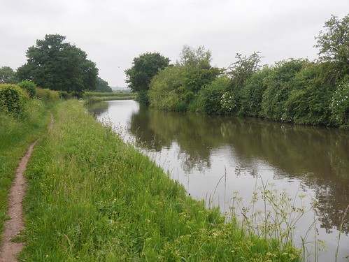
Arrival at Penrith is bang on time and in a move that shocks us, so is the 10:20am bus to Keswick.  A 16 mile hurtle along dual carriageways and through tiny villages noted for future walking inspiration.  Every village bus stop is at a pub.

The walking starts in earnest at 11:10am, once my walking partner finds suntan cream for purchase.  No surprise that the first shop has sold out.

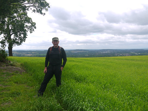
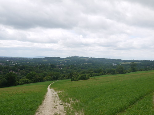
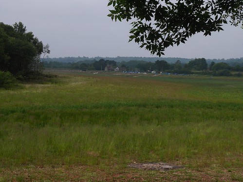
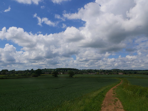
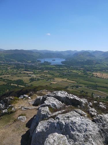
We just need to find a way up today's first Wainwright, Latrigg.  We can see people on top of this tiny, yet very steep, hill but the paths on the ground do not in any way represent what is documented on the OS Maps.   We make it, appreciating the shade provided by its wooded slopes, before the views open up.

Latrigg views over Kewsick
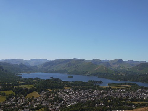
Keswick and Derwent Water from Latrigg
Views
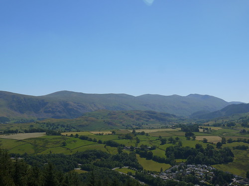
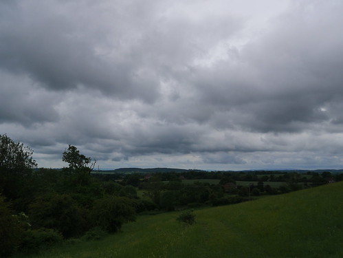
Mountains for another day

Navigational issues are far easier now, we can see where we need to go, with clear paths up to Skiddaw Little Man.  We just need to summit the 2838 feet.  I think I need to join a gym before coming back this way.

Out Path up Skiddaw Little Man
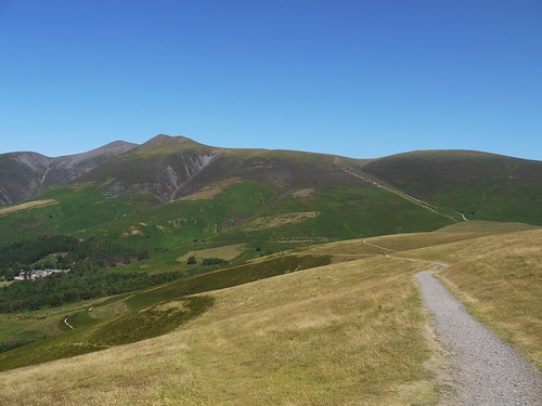
The winding path to Skiddaw
More Mountains
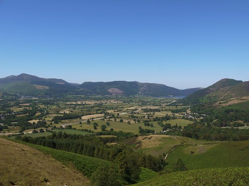
Always the chance to catch breath with a photo stop

Little Mans False Summit
Looking over to Scafell, Bowfell etc from the false summit, more height required
Although we don't top out Skiddaw (4th highest), we more or less get the required height. With a bus to catch, we have to turn back towards Keswick, taking the Allerdale Ramble down to Carl Side.

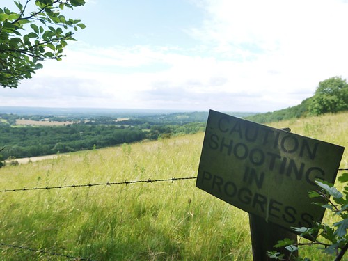
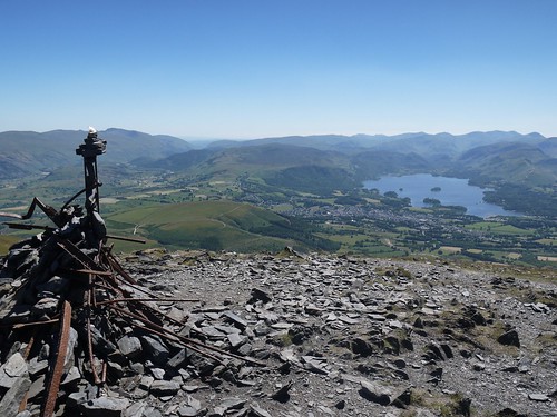
And I make the exact same mistake as I made the last time I did this to get to Ullock Pike.  The faint path is significantly better than the main footpath marked on the OS Map.  The descent is that vertiginous that you cannot really tell but once you've slithered down the shale to Carl Side and look back you can see the difference.  Not least because everyone else is on the other path.

Ullock Pike
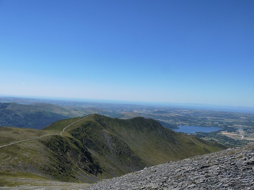
Ullock Pike from the Shale - Scotland Ahead.
The drop from Carl Side to the valley floor is something else.  I cannot remember a descent so steep and relentless.  There are two saving graces 1) we didn't choose to walk the opposite way and go up it and 2) we have the radio to listen to the game of the World Cup - France 4 3 Argentina.  There's also a beer festival on at our local.  We question our sanity.

No conversation - just concentration of finding our footing on jelly legs and the strange feeling that you have when 4.5 litres of water has been consumed and nothing has been expelled.

White Stones
White Stones Breather
The remainder of the walk was a blur - fields and roads through Millbeck and Applethwaite and back to the madness of Keswick streets on a Saturday.   Dogs are kicked, tourists are tutted at and push chairs overtaken with total disregard to oncoming traffic.

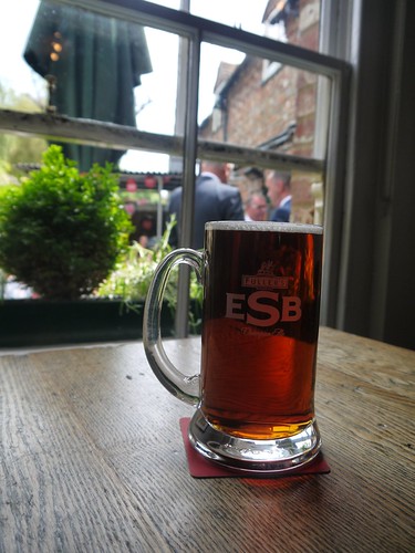
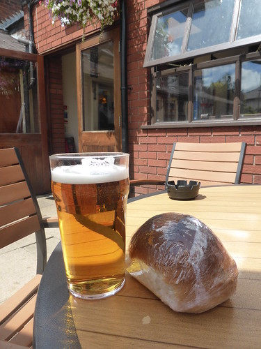
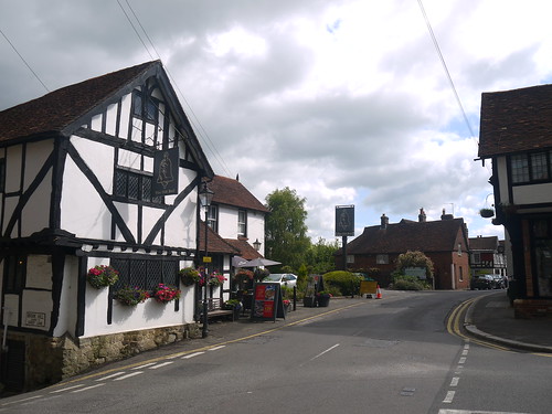
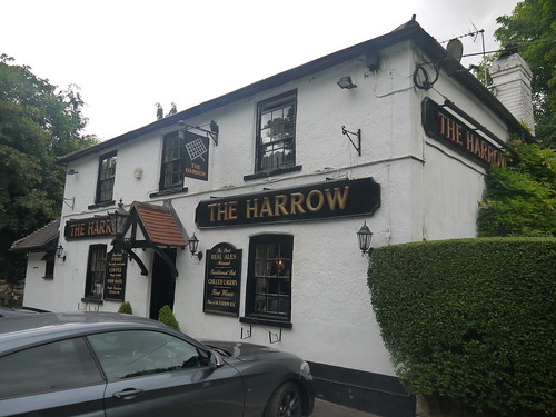
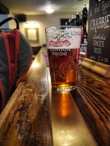
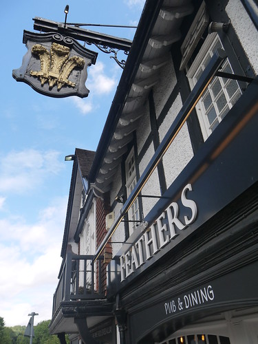
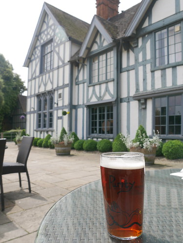
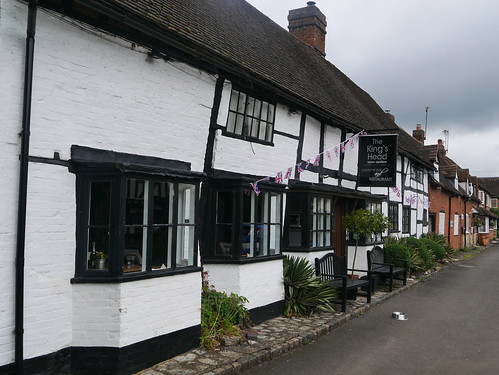
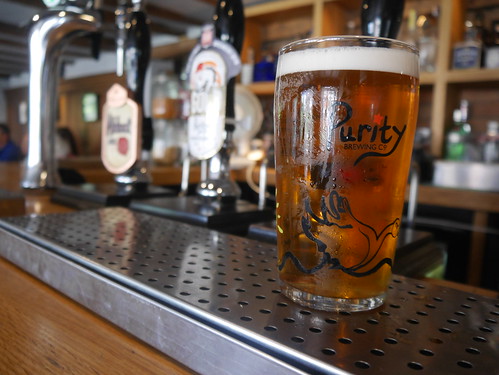
It 4:30pm when we fall through the Royal Oaks door, with 50 minutes to grab more fluid and a 10 minute walk to the bus station.

Much needed at the Royal Oak
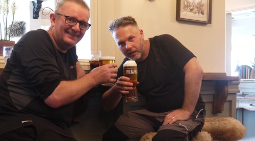
Royal Oak Celebration - A wainwright for me
We arrive at the bus stop 10 minutes early for the X5 Gold.  Its there waiting for us.  I confirm with the driver that this is the Penrith bus and comment that he's early.  He says he's not - 17:11 for boarding, 17:20 for departure and goes on to complain he cant do right for doing wrong.

No moans from us - we are delighted at the efficiency....  All trains and buses bang on time - no parking hassles.  No 50 MPH speed limits through the M6 Roadworks.

This could be the future.

But never during a heatwave.

Or a World Cup.


Saturday 23 June 2018

23/06/18 - The Chess Valley Walk

Distance - 10 Miles
Walk Inspiration
Geocaches - 8
Post Walk Refreshments - The Queens Head, Chesham, Fullers ESB


Without a doubt, linear routes connected by railway stations are presenting my favourite type of day walk.

This is a classic and a review of my Oyster account card should show that the 16 minute journey from Chesham to Rickmansworth cost only £1.60.

The walk back was free.

The Chess Valley walk follows the chalk bed Stream from almost the minute you leave Rickmansworth.  It's crystal clear, shallow and loved by both dogs and eaters of water cress.  All the historical details can be found by clicking the "Walk Inspiration" hyperlink above.

Here's the photos.


First Sign at Rickmansworth
First Signage at Scotsbridge

M25 Crossing
Crossing the M25
Dog Friendly
Dog Friendly Pools at Sarratt Bottom
Fields alongside the river
Occasional Fields with the stream out of view
Latimer
The Pretty Cottages at Latimer
Nether Ditch
Timeless views at Nether Ditch
Could it be improved?  Well, there's no natural refreshment stops along the 10 miles.  The only civilisation is at Latimer, which is a collection of pretty cottages huddled around the memorial green and a church on the hill... publess, shopless and cafeless

If you're desperate, you can divert for less than half a mile for the Red Lion for Chenies.  Alternatively, keep following the Chess Valley signs and once in Chesham, you will be delivered to the Queens Head.  It's literally built over the stream.

Queens Head, Chesham
The Queens Head
And what a find - a lovely traditional pub that does a nice line in Thai food.   For the South East - this is now as traditional as pie and mash used to be.   I can only vouch for the quality of a tuna mayo sandwich and an extraordinary pint of Fullers ESB.

If I lived in Chesham, this would be my local.

Fullers ESB
10 Mile Reward

Wednesday 20 June 2018

20/06/18 - Bathams Pub Walk - The Unicorn, Stourbrige

Distance - 4 Miles
Geocaches - 3
Walk Inspiration - The Crystal Canal Walk
Other Walks from Bathams Pubs


The Unicorn sits a little further along the Bridgnorth road from the previously explored Royal Exchange.  My challenge was to find a suitable, yet different walk.

Last time, I went rural, with some surprising countryside around Norton.  Today, the Internet provided a fine urban walk that follows the Stourbridge Canal - nicknamed the Crystal Canal due to the the glassworks that line the tow path.

There's a choice to get there suggested start - you could catch the bus to Red House Glass Cone or walk along up Wollaston High Street and play count the dead pubs.   Along the repurposed boozers, I found Indian Restaurants, private houses, estate agents and even a garden centre. 

Use them or lose them people.

So Red House Glass Cone can mark the official start of the walk - one of only 4 left in the UK and the most complete example.  If you have time, there is a free museum to learn more.

Red House Glass Cone
Its here that the Canals are picked up.  Its starts industrial, but soon turns rather leafy as we take the Stourbridge Spur.

Wollaston Canal
Start of the Canal Walking
Stourbridge Canal
Gets leafy after the Wollaston Junction

The bonded warehouse marks the end of the canal walking - previously used to store high value goods like tea and tobacco.

Bond House
Bonded Warehouse
Half a mile of road walking to get back to the Unicorn.  No danger of this pub not being used.... Tuesday lunch time and there's not a spare table to found inside.

The Unicorn
Bathams Pub #7 out of 10 for Mappiman
The reason?  It might have something to do getting change back from a fiver for this lunch.

And I swear, the bitter just gets better and better.

Lunch
Meal Deal - Bathams Style

Saturday 16 June 2018

16/06/18 - London Countryway Stage 5 - Oxted to Merstham

Distance - 10 Miles
Start - Oxted
Finish - Merstham
Geocaches - 16
Pubs - 2
Previous Stages - Stage 1Stage 2Stage 3, Stage 4


Stage 4 of the London Countryway ended unceremoniously in the Oxted Wetherspoons.   A place tainted by the tipsy, reeling and drop down pissed at 2pm on a Saturday afternoon.

It left an undeserved sour taste in the mouth for Oxted.  At 9:30am, a mere two stops from London Bridge, I was more taken by its black and white independent shops and a lovely looking Everyman Cinema.   I could potentially live here, if I was ever minted enough.

And the nicer pubs are out to the West on the Godstone Road.

West Oxted
West Oxted's Pair of Pubs
The main purpose of the London Countryway today is to introduce me to the North Downs Way, which is picked up after a lung busting pull up Tandridge Hill.   Once the height is gained, its all plain sailing on a lovely ridge walk that leaves me begging for more.   The NDW gets added to an ever growing list of future walks.

Climbing to North Downs Way
Climbing Tandridge Hill

The walking is easy, the paths are perfect and the Geocaches are imaginative.  I have an endless roll of photos looking down to the South Downs and when there's a gap in the trees, a few of an unexpected vista of the City.

From North Downs to South Downs
Looking South
Unexpected City Vistas
Picking out the landmarks looking North

Stunning.

8 miles in, with the Water having expired at 5, I'm provided with welcome refreshment at the Harrow, Chaldon.  Reach the folly tower of Whitehill, take a 160m detour to enjoy a freshly changed London Pride that was worthy of its name.

Whitehill Tower
Of no historical importance, a mere folly built in 1862
The Harrow, Chaldon
Chaldon's Harrow
The Harrow, Chaldon
Perfect Pint

A simple drop down into the ending point at Merstham, taking advantage of a trig point for a selfie.

Mappiman on South Downs Way
North Downs Way Selfie
Dropping down to Mershtham
Dropping down into Mestham

Mersthams a small village that had two pubs but only the Feathers remains.  A Food & Football place to wait for the 30 minutes train back to the Smoke.

The Feathers
Pub and Dining at the Feathers
I'll avoid the temptation of saying this is the best leg of the Countryway..... I've read the guidebook and from here to Boxhill comes highly praised indeed.

Let's just say the best so far...


Sunday 10 June 2018

10/06/18 - Heart of England Way - Stage 15 - Berkswell

Distance - 7.3 Miles
Geocaches - 1
Previous Stages - Stage 1Stage 2Stage 3Stage 4Stage 5Stage 6Stage 7Stage 8Stage 9Stage 10Stage 11Stage 12Stage 13, Stage 14


I've photographed Berkswell's church many times but never at 5:45am.

Berkswell Church
Berskwell
The reason for this ungodly, golden hour?  Child #2 needs an airport run.

This is a another chance to revisit many of the paths shared with the Millennium Way.  And they are worth revisiting.

Heart of England Way
Heart of England Way Lovliness
Heart of England Way
And My favourite part of the Millennium Way


Two minor issues with today's walk. 

1) Re-walking the same paths means that I have found the Geocaches.   A single smiley is added to the total today, with a previous find used to drop off a Travel Bug.

2) I'm obviously too early for the pubs.  The unspoiled and Good Beer Guide recommended Bull's Head at Barston is forsaken for an exploration of the Church Yard, noticing it's restored Medieval cross.

Barston's Medieval Cross
Religious Vandalism, Cromwell Style
Great paths of a similar style lead me back to Berkswell, with the peace only interrupted by the roar of the 7:26am Ryan Air to Warsaw.

Up, up and away, Junior Mappiman.

Up Up and Away
Of Course I waved to him


Saturday 9 June 2018

09/06/18 - Barnt Green

Distance - 7 Miles
Geocaches - 2
Walk Inspiration - Walk 09, Spring 2018 Country Walking Magazine


This walk really demonstrates the strength of Country Walking Magazine.  Easy accessible, varied terrain and refreshments available.   A perfect little ramble.

The starting point is Barnt Green Station.  Arrive by train or park for £1.20 on a Saturday.  No sooner have you got your bearings than you are out in the country park and could be miles from anywhere.

Lickey Hills Country Park
Over the road from the Station
A gentle climb uphill on good tracks through woodland.  The only two caches of the day are easily found.

From the Visitors Centre, its over the road to pick up the North Worcestershire Path and the fields of Cofton Hackett.

Field Views at Cofton Hackett
Fields of Cofton Hackett
We are looking for the huge expanse of blue that is Upper Bittell Reservoir.  How can we lose something so big?  Eventually a gap in the trees shows that it has been drained and Internet research shows essential maintenance works were required.   Along with the Herculean effort of rescuing the fish.

Drained Upper Bittell Reservoir
The Boats are in the far distance - the water of Upper Bittell are long gone
The Worcester/Birmingham Canal provides the final change of terrain - easy walking back into Barnt Green for post walk entertainment.

Worcester and Birmingham Canal
Canal - Unexciting, but easy walking with no navigational errors
Only one choice for the post walk pint - Ron Atkinson's local - the Barnt Green Inn.  It's a gastropub with a surprising amount of history - dating from 1651 and reputedly hosting Queen Victoria for a night.

It's now all £12.95 sandwiches, outdoor softrock music pumped from external speakers onto expensive patio furniture and a surprisingly good Purity Ubu, suggesting the Cask Marque award is well deserved.

Barnt Green Inn
Purity Ubu in front of a Grade II listed Gastropub

Saturday 2 June 2018

02/06/18 - Dropping off a very specific Travel Bug in Warwickshire

Distance - 11 Miles
Geocaches - 42
First Cache
Pub - Kings Head, Aston Cantlow


At the Start of May, I picked up a Travel Bug that had a very specific mission to stay in Warwickshire.  It was part of a complex puzzle that when combined with a number of other TBs, would give the co-ordinates to a mystery puzzle cache.  I'm staggered that 30 people have managed to log the final prize but not surprised that one of them is my caching and twitter buddy, Superted.  I know he likes a challenge.

So, once back from America, I felt that I needed to drop this off straight away so others could find.  A search on Geocaching.com for a suitable trail found a new loop in a place that I've not visited before but sounds like a 1930's dandy.  Aston Cantlow.

And would you believe that the TB and caches are owned by the same CO, HKMHill?

Usual MO for these trails - fact finding in the village to get a multi.  Thank god he publishes a checksum, as I'm always screwing these up.

Aston Cantlow Village Hall
One of the pretty buildings in Aston Cantlow

The only questions to answer are a)  will I meet the other cachers who have signed the logs before me today and b) will I find a box big enough to take this quite chunky TB.

The Warwickshire Bug
The TB
Geocache Size:  Huge
Question B well and truly answered

Typical Warwickshire countryside on route - nothing too grand but the occasional nice view.

Warwickshire Views
View from a cache
Second Loop Views
View on the way to a cache

The walk could easily be split into two loops.  It's just as I am thinking of whether to tackle the second loop that I do bump into the other cachers - just as I am signing a log.  Nothing quite like handing a cache to the next cacher to sign.

Despite dwindling water supplies, I decide to make the most of the day and start the 2nd loop.  Stingers cause the one DNF today.  I'll be interested to see if the others have found it today.

Lovely views, as I come back into the village for much needed refreshment.

Coming Back into Aston Cantlow
Aston Cantlow Below
So, the Kings Head.... A pub made of connecting cottages that has a history stretching back to the rumour that Shakespeare's parents breakfasted there on the day of William's Wedding.

Kings Head, Aston Cantlow
Post Caching Refreshment
Four real ales on and I combine a pint of iced water with a locALE Purity Gold.  Water drank first whilst the Purity settles to a wonderful clear golden pint.  Nice to see a busy pub, with a packed beer garden and a number of diners, some of whom are so delighted with the fayre they tip in notes.  And not even blue ones.

P1020851
Good Looking and Much Deserved
Thanks for another top series Mike...... one day I will be free to come to a Geocaching event launch!