Corridors of Power
No map this time - The City of Westminster is about 6 km north to south and 5 km east to west. Today's walk concentrates on a thin strip along the river - from Westminster Bridge down to Vauxhall Bridge and no more than a couple of streets back.
As usual, the guidebook commentary runs to pages. The area is packed with history going back centuries and into recent times.
My blog will concentrate on the items that tickled my interest.
First - obtain a GPS Signal - among the statues of Parliament Square, where I notice a glitch in the matix.
 |
| Waiting for the next civil disturbance |
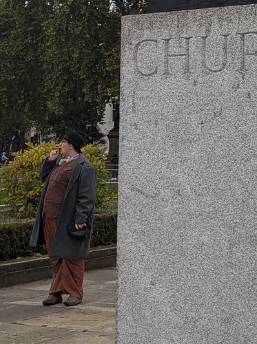 |
| Zooming in, shows it's haunted |
The Jewel Tower is easy to miss but provides fascinating history;
The Jewel Tower, built in 1365–66 for Edward III, is one of the few surviving remnants of the medieval Palace of Westminster. Designed by master mason Henry Yevele, it originally stored royal valuables and stood beside the king’s private garden, protected by a moat. It survived the fire of 1834 that destroyed much of the old Palace of Westminster
 |
| Jewel Tower |
I've never investigated Millbank before - a small public park leading to the river. Plenty of public artwork, including a pagoda to keep dope smoking workies out the rain. The Burgher's of Calais are the most impressive. Celebrating an episode of the Hundred Years' War, the sculpture was created by Auguste Rodin.
 |
| Flag waving, King of the North must be home |
Tate Britain shielded by fencing as it is worked on and no photos of MI5, should I cause a security breach. A pretty view of Vauxhall Bridge emerges from the riverside.
 |
| A metropolis within a metropolis |
Too early for pubs, but the Morpeth Arms has interest. Built for the warders of the nearby prison, it is rumoured to have tunnels direct to the Thames for the transfer of prisoners. Nice to think they got sent off to Australia with a final pint of cask before suffering a life of Castlemaine.
 |
| Not too shabby for lowly wardens |
Onto the backstreets - where I can play the game of spotting who lived at a house with blue plaque. Plenty of options but the two most interesting (to me) lived around the corner from each other.
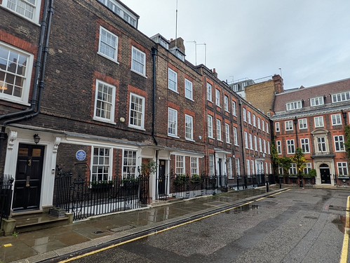 |
| Who lived in a (beautiful) house like this? |
 |
| I'd live there for over 30 years too |
 |
| And again? |
 |
| A narcissist who demanding a whole area be named after him. See also, Scott of the Antartic |
And finally (yes, I know I have largely ignored the obvious Abbeys and Palaces), a faded sign from WWII, just about visible at Number 8 Lord North Street.
 |
| Battle of Britain |

No comments:
Post a Comment