Distance - 10.8 Miles
Geocaches - 8
Start - Upper Warlingham Station
Finish - Banstead Station
It's London Loop time of the month. Cheap tickets to London ordered. Mr Piggy Sausage Rolls purchased. Alarm set for a stupid O'Clock.
Today, an alarm is not needed. The dustbins are coming with me. This means one of them is in the shower for 4:50am and then asking his mother where the iron is. The other is more slumbersome, having not got in till 2am.
To be fair, both were ready for the 5:40am departure. Even if Alex didn't have shoes or socks on. Car and train to the smoke.
I leave the pair of them at Euston Station and make my way to Upper Warlingham station, via Victoria. 8:52 and I am ready to head off.
Before starting the walk, I have to turn on my new toy. I have had my eye on an Autographer camera since I saw a review saying that basically they were rubbish but an interesting concept. I thought it could be a nice way of doing time lapse photography of a walk but wasn't going to pay the £299 price for one. A bit of sniping on ebay got me a brand new one for less than half price.
And here are the results.
Saturday, 12 April 2014
12/04/14 - Happy Valley Mappi
Basically rubbish, but an interesting concept. I do like the way that it captured the route, caught me caching and eating my Piggy savoury snack. Not sure I like the weird fish eye effect.
And the walk. Another superb stretch of the London Outer Orbital Path.
Granted the start is pants, walking through Upper Warlingham and past the gas tanks but as soon as I am up the other side of the valley, I am rewarded with great views and countryside.
The one problem with this leg off the Loop is that the trains only run from Banstead at 38 past the hour. As I hit the downs, I realise I can make the 12:38, provided I can cover a mile and a bit in 20 minutes.
This leads to some fast walking. I may have misjudged the distance as the minutes are rolling by and my sat nav is not showing the requisite amount of progress.
I start running. This is not a pretty sight for the Banstead golfers.
Two minutes left and I am at the road. 150 metres uphill to the station. I sprint. I get on the platform.
The train left 1 minute ago.
Damn Mr Piggy and his savoury delights.
I have an hour with no pub and only one side tracked cache to find. I spend the other 45 minutes bluetooth connecting my Authograher camera my android phone and rerunning the route.
I'll have a good look at the downs on Stage 6.
And the walk. Another superb stretch of the London Outer Orbital Path.
Granted the start is pants, walking through Upper Warlingham and past the gas tanks but as soon as I am up the other side of the valley, I am rewarded with great views and countryside.
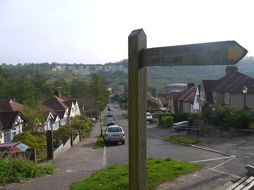 |
| Looking back the way I came and the Chalk Cliffs I walked on in Stage 8 |
The first cache of the day is a boster. Took a bit of finding and minor tree climbing, but I was in the woodland wilds, so no-one can see.
Get back onto the path and start getting a stride on, through Kenley Common and passing a WWII airfield. Eerily enough, a siren sounded as I made my way past.
Get back onto the path and start getting a stride on, through Kenley Common and passing a WWII airfield. Eerily enough, a siren sounded as I made my way past.
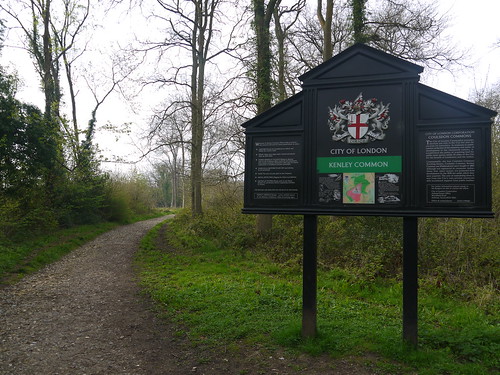 |
| More great walking on the Loop |
Cache 2 is found far more easily, even if I am muggled on signing. I don't think there were interested in what I was doing in a bush. Some straightforward country walking through horse fields before I am muggled again at cache 3. These two people were even less interested in what I was doing behind a tree.
I then arrive at the easily the best part of the Walk - The Happy Valley. This is an area of chalk downland that provides superb, wild walking.
I then arrive at the easily the best part of the Walk - The Happy Valley. This is an area of chalk downland that provides superb, wild walking.
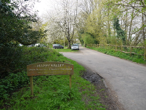 |
| This Looks Promising for the Mappiman |
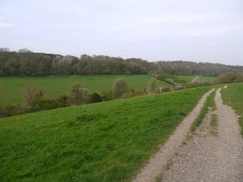 |
| It leads to this rural idyll |
I drop down to the valley floor and then climb the other side to reach the a mile long ridge path that takes me into Couldson town. The first part of civilisation since I left Warlingham.
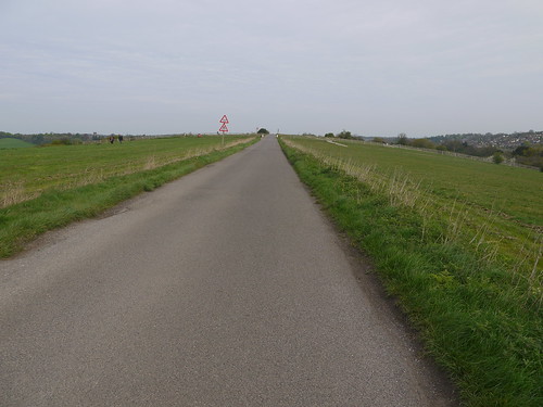 |
| Take me to Couldson |
Not much of interest in Couldson, a couple of micro caches to keep me entertained. Not too disappointed to move on, especially as the environment gets rougher and rougher the further I get out of town.
When I hit the countryside again, I am provided with a lovely view of London, albeit around 15 miles away.
When I hit the countryside again, I am provided with a lovely view of London, albeit around 15 miles away.
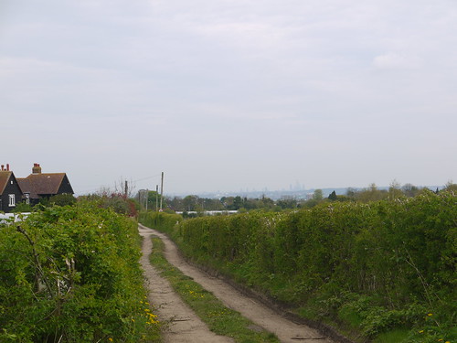 |
| London, far away over the hedge |
I have been walking for three hours now and decide that I can take a breather - stopping at the lavender fields to sit on a stile and eat my lunch.
Find a couple more caches - that were last found by a cacher called Mapman4752. What are the chances?
Find a couple more caches - that were last found by a cacher called Mapman4752. What are the chances?
The one problem with this leg off the Loop is that the trains only run from Banstead at 38 past the hour. As I hit the downs, I realise I can make the 12:38, provided I can cover a mile and a bit in 20 minutes.
This leads to some fast walking. I may have misjudged the distance as the minutes are rolling by and my sat nav is not showing the requisite amount of progress.
I start running. This is not a pretty sight for the Banstead golfers.
Two minutes left and I am at the road. 150 metres uphill to the station. I sprint. I get on the platform.
The train left 1 minute ago.
Damn Mr Piggy and his savoury delights.
I have an hour with no pub and only one side tracked cache to find. I spend the other 45 minutes bluetooth connecting my Authograher camera my android phone and rerunning the route.
I'll have a good look at the downs on Stage 6.
Get back to Euston, via Victoria and the kids meet me in the Doric Arch, 20 minutes before our train home.
An all round successful day.
An all round successful day.

Saturday, 5 April 2014
05/04/14 - Pleasures Combined
Walk Inspiration - Millennium Way Stage 11
Distance - 6.25 Miles
Geocaches - 14
Time is just too precious. Too many plans, not enough free time. So what to do?
How about combining my hobbies?
This one takes in a Top 10 County Pub, loads of Geocaches and this month's installment of the Millennium Way. Perfect for a man with more ideas than time.
The route would have us start at the Throckmorton Arms. I prefer to have Alcester as my start, as on my return, I will be delivered to my pub to investigate. From previous walk, I also know that the parking is free.
So park up and head out on familiar paths along the Monarch's way. Someone has been planting caches, otherwise I would have had these previously.
Nine caches as we make out way along Spittle Brook towards Coughton Lane. Quite a variety and I have to make use of several tools in my Geocaching bag, including Tweezers, Penknife and Magnetic Ariel effect "Bodger". Add in a couple of near tumbles into various streams and good spirits abound.
A mile on the tarmac of Coughton Lane brings us to the first real things of historical interest.
We also obtain glimpses of Coughton Court through the trees and over the heads of the new born sheep. Another walk, another Tudor reference, as this was the home of the Throckmorton Family - close friends of Henry VIII. Until he tried to divorce Katherine of Aragon.
A couple more caches on the way to pick up the River Arrow, which we follow all the way south back to the town. The walking is OK but expectations of refreshments are taking priority.
I have completed my research and I am looking forward to the eight real ales that are served at the Hollybush in town.
But I will not be denied to tick off the Top 10 pubs in my closest counties.
The pub is a proper 10 out of 10 experience. It doesn't look much on the outside but inside its has a central bar with some lovely alcoves surrounding it. The dining room and menu looked incredible.
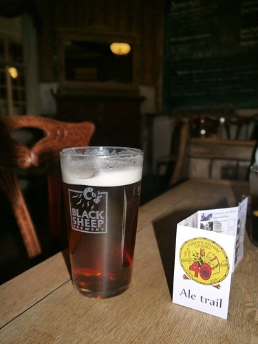
And with my perfect pint of Black Sheep, I was presented with a card to collect stamps from the top 40 real ale pubs in Warwickshire.
Could I have found a new challenge?
We return to the car by walking up the high street passing;
Alcester. You are my new favourite town.
Distance - 6.25 Miles
Geocaches - 14
Time is just too precious. Too many plans, not enough free time. So what to do?
How about combining my hobbies?
This one takes in a Top 10 County Pub, loads of Geocaches and this month's installment of the Millennium Way. Perfect for a man with more ideas than time.
The route would have us start at the Throckmorton Arms. I prefer to have Alcester as my start, as on my return, I will be delivered to my pub to investigate. From previous walk, I also know that the parking is free.
So park up and head out on familiar paths along the Monarch's way. Someone has been planting caches, otherwise I would have had these previously.
 |
| Fields of Yellow as we head out of Alcester |
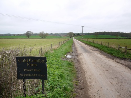 |
| Turn Right at the entrance to Cold Comfort Farm |
 |
| Easily the best GZ on route |
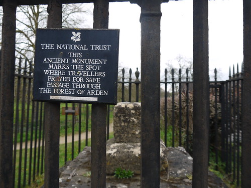 |
| Medieval Cross marking the entrance to the Forest of Arden |
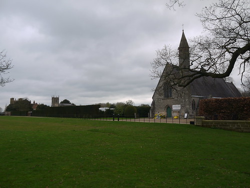 |
| From R-L, Catholic Church, Church of England, Tudor Manor House |
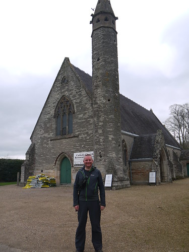 |
| Sonia wanted my feet over the top of the tower. Achieved Neither. |
I have completed my research and I am looking forward to the eight real ales that are served at the Hollybush in town.
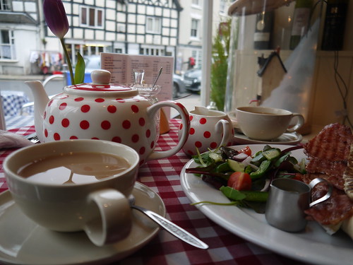 |
| However, Mrs Mappiman has other ideas |
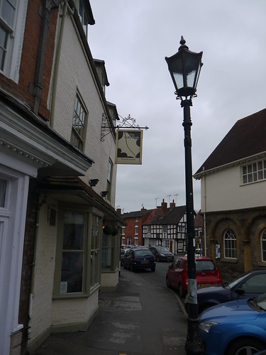 |
| Unassuming from the Outside |
 |
| Joyful on the Inside |
And with my perfect pint of Black Sheep, I was presented with a card to collect stamps from the top 40 real ale pubs in Warwickshire.
Could I have found a new challenge?
We return to the car by walking up the high street passing;
- Turks Head
- Three Tuns
- The Bear
- The Royal Oak
Alcester. You are my new favourite town.
Sunday, 30 March 2014
30/03/14 - BST
Distance - 4 Miles
Geocaches - 1
Inspiration - July 2009 Country Walking Malvern at EveryTrail
My favourite weekend of the year. It's like coming out of hibernation, knowing that after 6 months of dark evenings, I can increase my outdoor activities by taking in mid week adventures. There is only one way to celebrate and that is to pick another County Top 10 pub walk.
The pub is easy to choose. The Nag's Head in Malvern is a ten real ale classic of a pub. A suitable walk is found from a five year old Country Walking Magazine.
We park up at the pub and head for the hills.
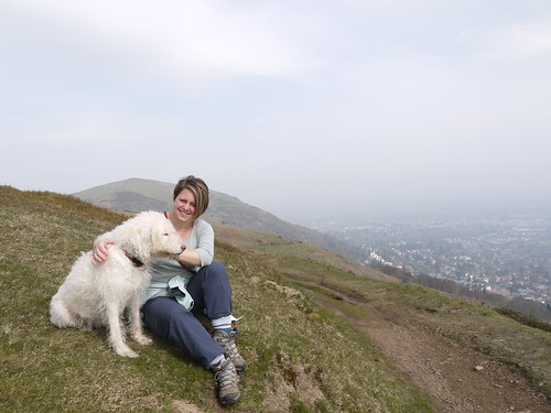
And its all uphill. We skirt our way around the back of the clock tower and have the steep climb at the back of the quarries and resevoirs. Sonia leaves me for dead. The winter spent eating pork pies everytime I make a cup of tea has left me hill unfit. Sonia shouts diet plans from her elevated position. The dog looks confused, wondering whether to keep up with her mistress or "stop to check the map" with her master.
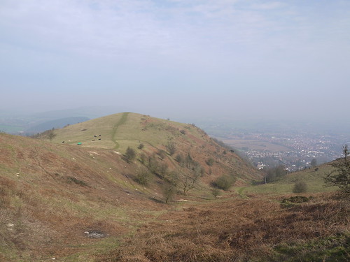
As with all hill climbs, the views of worth it when we make it to North Hill.
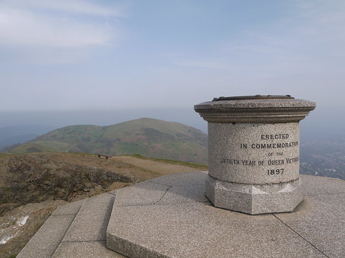
That's all the heavy work completed as we make our way past Table hill towards Sugarloaf. There is the one cache I need to find up there, so I leave Sonia on a bench as I go and retrieve. She spends her free time fighting off the attentions of gentlemen ramblers whose tongues are as silver as their hair.
Only a man of a certain age would even attempt to address a woman with the line "Do you come here often?".
One of them doesn't give up his wooing on my return and for a time we think he will follow us to Beacon Hill. However, the lure of St Anne's Well cafe means we go our separate ways.
We pick up the track with a sulky looking teenager whose dad has made him come for a mother's day ramble. At least they got him out. Ours is at home "revising".
We drop down looking for the excellent paths on the Eastern side of the hills. There is another micro to look for but not knowing the difference between a Bilbury and a Gorse Bush, I have little chance of making a find.
The walk back has everything going for it. Good paths, great views and importantly, all down hill. We soon make our way to one of the best 10 pubs in the County - The Nag's Head.
It is a superb pub. The only problem is knowing what to have. They are doing a roaring trade in Mother's day Sunday Lunches but a meal of that size seems a bit heavy. Especially for an out of condition hill walker. So how about a compromise of a Hot Beef Sandwich, with two roast potatoes and a little pot of gravy?
Next choice is even harder - which of the ten real ales to pick?
I promise to be back to celebrate the end of BST and try one of the remaining 9.
Geocaches - 1
Inspiration - July 2009 Country Walking Malvern at EveryTrail
My favourite weekend of the year. It's like coming out of hibernation, knowing that after 6 months of dark evenings, I can increase my outdoor activities by taking in mid week adventures. There is only one way to celebrate and that is to pick another County Top 10 pub walk.
The pub is easy to choose. The Nag's Head in Malvern is a ten real ale classic of a pub. A suitable walk is found from a five year old Country Walking Magazine.
We park up at the pub and head for the hills.
And its all uphill. We skirt our way around the back of the clock tower and have the steep climb at the back of the quarries and resevoirs. Sonia leaves me for dead. The winter spent eating pork pies everytime I make a cup of tea has left me hill unfit. Sonia shouts diet plans from her elevated position. The dog looks confused, wondering whether to keep up with her mistress or "stop to check the map" with her master.
As with all hill climbs, the views of worth it when we make it to North Hill.
 |
| Hazy views from a welcome bench |
Only a man of a certain age would even attempt to address a woman with the line "Do you come here often?".
One of them doesn't give up his wooing on my return and for a time we think he will follow us to Beacon Hill. However, the lure of St Anne's Well cafe means we go our separate ways.
We pick up the track with a sulky looking teenager whose dad has made him come for a mother's day ramble. At least they got him out. Ours is at home "revising".
 |
| Highest Point In Worcestershire |
 |
| Sonia has no 3G, so our botany research cannot go on line |
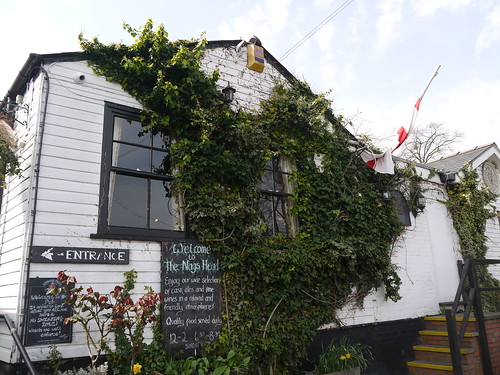 |
| Nestling in the Shadow of the Hills |
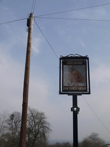 |
| Sign |
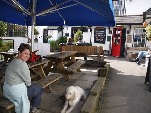 |
| Beer Garden |
Next choice is even harder - which of the ten real ales to pick?
I promise to be back to celebrate the end of BST and try one of the remaining 9.
Sunday, 23 March 2014
22/03/14 - Looping into Surrey
Distance - 12.1
Geocaches - 9
Start - Hayes (Kent)
Finish - Upper Warlingham (Surrey)
This is the walk that should have been done in February. Gales, landslips and a full cancellation of all South East Trains put pay to that. So I am a month late on the next installment of the London Loop.
The forecasters put the symbols that mean every type of weather is possible today. Rain, Hail, Wintery Showers are all promised. In reality, it was perfect walking weather.
Usual 6:40am bargain train and arrive bleary eyed at Hayes station at 9am, retracing my steps to the pollarded oaks of West Wickham Common. Some alley walking before hitting the first architectural point of interest, Wickham Court. Dating from Tudor Times, it has strong links with the Boleyn Family. And my book for the journey down? The Other Boleyn Girl by Phillipa Gregory.
My life is the Matrix.
Downhill walking to Spring Park where entry onto the loop is stopped by floods.
The detour allows me to get the first cache of the day, in-between the joggers and the dog walkers.
Proper route is picked up in Threehalfpenny Woods. This is the motif of today's walk. There is not a huge amount of interest, we pass only one pub, but the walking is superb in a series of woodlands. Perfect hiking country.
Pass the meridian marker stone but photographic evidence is impossible, as there are a group of dog walkers having a chat. I plod on to the next highlight, Addington Hill.
There are a couple of caches to find before being rewarded with a stunning view of the City. I can make out all the landmarks up to the arch of Wembley Stadium.
Leave this set of woods by crossing an unexpected tram line and enter the next set, Littleheath. A father and daughter are flying a kite perilously close to electric power lines. Did they not watch the 70s public safety films?
The London Loop shares a stretch with the Vanguard Way, which runs from Croydon to Newhaven. Inspiration for another adventure? Maybe.
Couple more caches in Selsdon Woods, where I am followed by a man in a most unsuitable bike. He is on rutted woodland tracks on a racer. I walk much faster than his wheelspinning manages.
A decision needs to be made at Hamsey Green. This is the end of the official leg of the route, but does mean catching a bus into Croydon to get home. I have already spied that another mile and a half will get me into Upper Warlingham for a train back to Victoria.
I decide to add in a small amount of the next leg's loop section to get here.
After 12 miles, I am gasping for a pint. A nice pink pub in the town greets me but it's camp decor belies the angriest set of punters I have observed. Its packed with football fans and I can only assume from their demeanor that they are Arsenal Fans.
I move on, and save myself for a more civilised pint back at the Albert in Victoria, catching the end of the game. Chelsea 6-0 Arsenal.
Geocaches - 9
Start - Hayes (Kent)
Finish - Upper Warlingham (Surrey)
This is the walk that should have been done in February. Gales, landslips and a full cancellation of all South East Trains put pay to that. So I am a month late on the next installment of the London Loop.
The forecasters put the symbols that mean every type of weather is possible today. Rain, Hail, Wintery Showers are all promised. In reality, it was perfect walking weather.
Usual 6:40am bargain train and arrive bleary eyed at Hayes station at 9am, retracing my steps to the pollarded oaks of West Wickham Common. Some alley walking before hitting the first architectural point of interest, Wickham Court. Dating from Tudor Times, it has strong links with the Boleyn Family. And my book for the journey down? The Other Boleyn Girl by Phillipa Gregory.
My life is the Matrix.
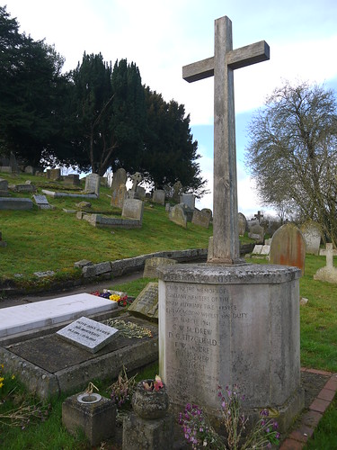 |
| WWII Firefighters Memorial in Wickham Churchyard |
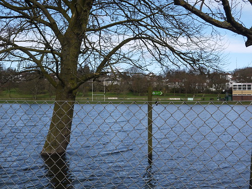 |
| Underwater Loop |
Proper route is picked up in Threehalfpenny Woods. This is the motif of today's walk. There is not a huge amount of interest, we pass only one pub, but the walking is superb in a series of woodlands. Perfect hiking country.
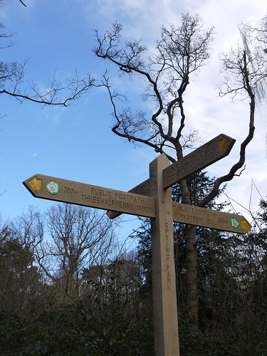 |
| Perfect Country Walking |
There are a couple of caches to find before being rewarded with a stunning view of the City. I can make out all the landmarks up to the arch of Wembley Stadium.
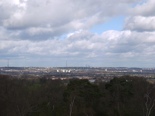 |
| View from a Hill |
The London Loop shares a stretch with the Vanguard Way, which runs from Croydon to Newhaven. Inspiration for another adventure? Maybe.
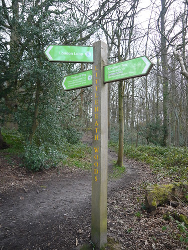 |
| More Woods |
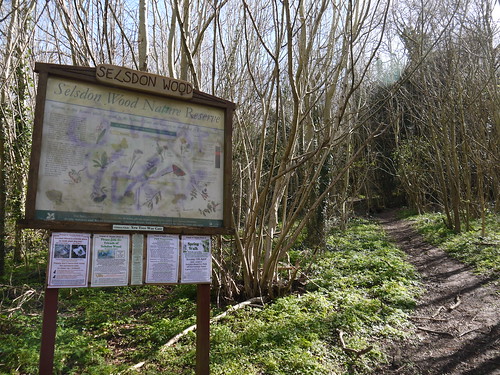 |
| You get the picture. Lots of Woods. |
I decide to add in a small amount of the next leg's loop section to get here.
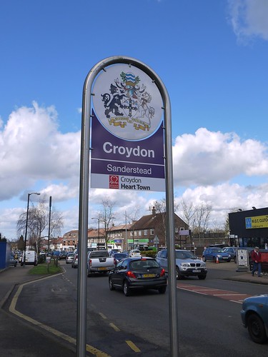 |
| The Pub at the end of the walk has been knocked down |
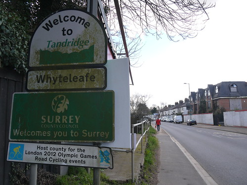 |
| Entering Dirty Surrey |
After 12 miles, I am gasping for a pint. A nice pink pub in the town greets me but it's camp decor belies the angriest set of punters I have observed. Its packed with football fans and I can only assume from their demeanor that they are Arsenal Fans.
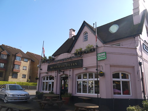 |
| Rougher than a Badger's Backside |
Subscribe to:
Posts (Atom)