Sunday, 12 April 2015

09/04/15 - Discovering the Home of Banoffi Pie

Distance - 15 Miles
Geocaches - 12
Day 1 of the South Downs Way (Other SDW Blogs - Day 2, Day 3)
Start - Eastbourne Station
Finish - Southease Station
Highlights - Windover Hill, Alfriston, Firle Beacon

The Context
It's been a while since I have had a really big adventure.  I have been lovingly caressing a book called "The Inn Way".  Not only is it a 6 day walk in the God's Country of Yorkshire, it's also involves popping into 26 pubs.  It's as if one day, God woke up and tasked someone with writing the perfect Mappiman book.  I tentatively broach the subject with Sonia, who asks whether it could be broken into two long weekends.  Unfortunately, public transport does not appear to have made it to Reeth, so I find an alternative that can.

The South Downs Way.  This is around 100 miles, starting at Eastbourne and ending in Winchester.  There is a train station exactly half way through at Amberley.  It's perfect.  I book the first half for April 2015.

Two days later, as my tea is being lovingly served, Sonia hits me with the news that she's off to Portugal with the girls for 4 nights.

The Walk


Cheap booked rail tickets mean that I do not make it to Eastbourne until 12:45.  This is half an hour earlier than expected, thanks to getting across London on the underground quicker than the booking computer reckoned was possible.  Great news - time is tight to make the Lewes train from Southease and this leaves a real possibility of a stop in Alfriston.  If you had ever been there, you would not want to just walk on through it.

Glorious weather all the way down but these are the days of the record smog levels in the South of England.  There is a picture in Saturday's paper that shows the Shard in London completely disappearing.  So although, I have a day where no jacket is required, the views are not quite as they should be.

Alight at Eastbourne in a sea fog and head through the town to the Start of the South Downs Way.
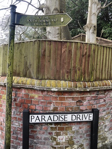
The Start
It's that good, Paradise Drive takes you there
Unless I missed it, there's no grand announcement that you are starting the South Downs Way. Paradise way leads to a turning on the left where you are out in the countryside.  No monument or signage noticed as I make my way steadily uphill on the chalk path, gaining height to get onto the ridge.

GZ of Cache Number 1
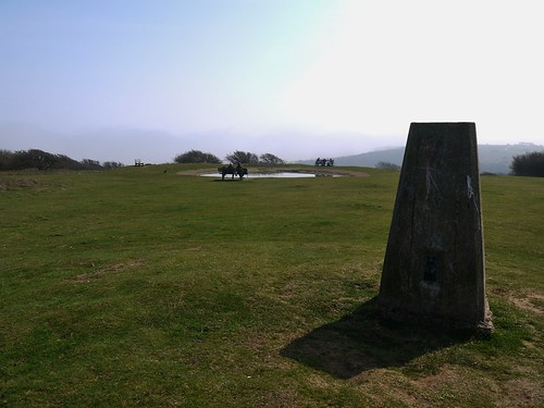
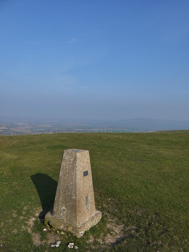
First Trig Point - with First Geocache of the Day Close by
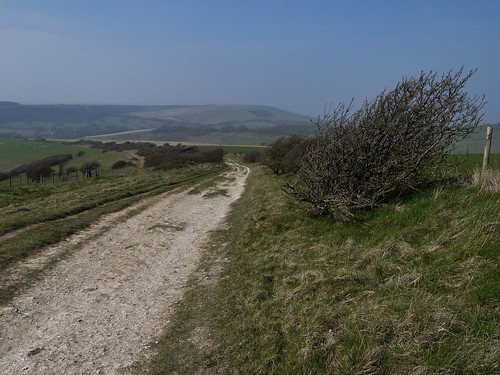
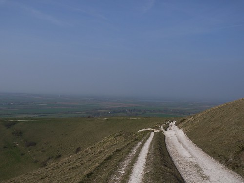
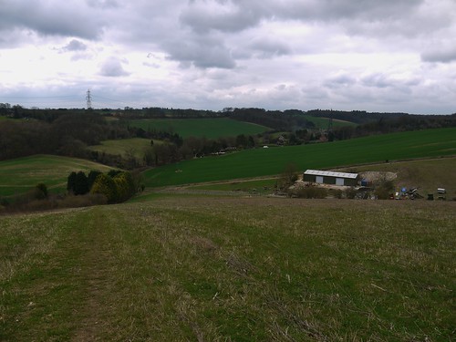
As expected, the walking is stunning.  Easy wayfinding on a broad path with views that just seem to get better and better.  And a lot of Geocaches

The South Downs Way
Early Days on the SDW - Which I appear to have all to myself
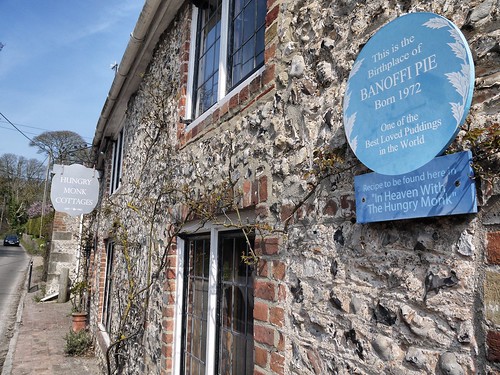
First sign of civilisation is Jevington.  Pretty little village that has a pub and a restaurant where they invented Banoffi Pie.  Not being a massive pudding man, I am unsure whether this is a good thing but the things you learn rambling.

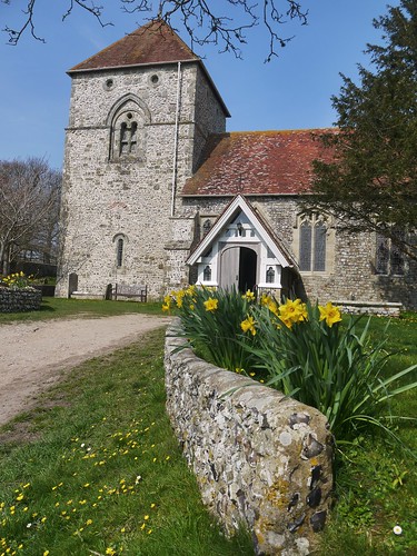
Jevington Church
Jevington Church
Jevington
A haven for pudding fans

Leaving Jevington, I play leap frog with two ramblers who I assume are father and son.  They walk for much further than their jeans would suggest but get in the way of my caching.  Eventually, I stop worrying about it and rather brazenly attack the caches.  I'm not the only one - as I meet a family of cachers who have sent the eldest son into the prickly bushes to make a retrieve.

The first real highlight of the SDW is Windover Hill, where the landscape forms a natural bowl below the path.
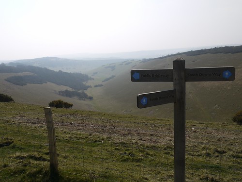
Windover Hill
Windover Hill

Windover Hill
Meandering around the Natural Bowl
We holidayed in this area back in 2008 and I remember Alfriston well.  It had several cracking pubs and as I am making good time, I can stop for the first pint on the SDW.  A choice to make, I go for a two pubs for the price of one offer.

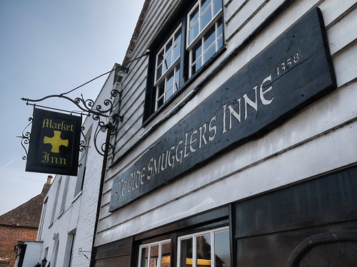
A Pub With Two Names
The Smugglers Inne and the Market Inn
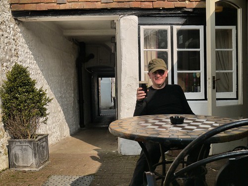
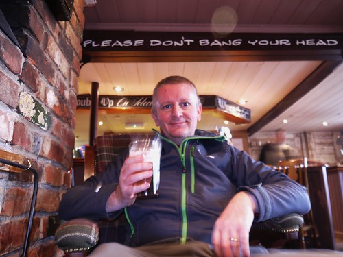
Pint Number 1 on the SDW
Harvey's Old Ale becomes Pint Number 1
Refreshed, I head back on the trail.  Always nice to have a steep climb, post pint.

Caches, views and damn fine walking are on offer as I make my way to Firle Beacon.  Sheep and the occasional mountain biker are all I have for company.
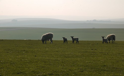
Up on Overhill
Mountain Bikers go too fast for a photo of their luxurious hipster beards.

Firle Beacon - Spot the Cache
Firle Beacon - Contains a Geocache - if you know where to look

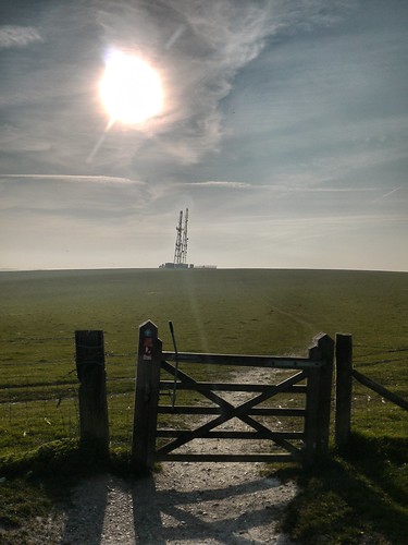
Radio Station on Birlingham Hill
The Radio Mast is near  the end of today's walking
Red Lion Pond
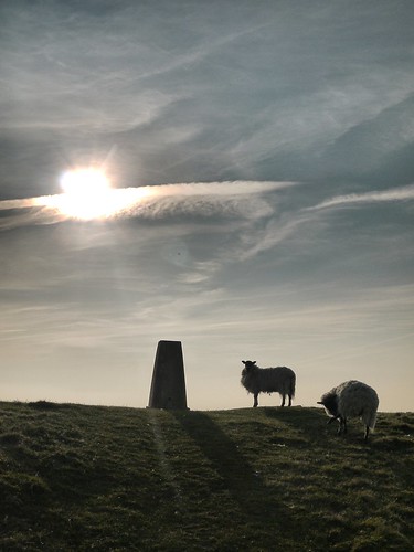
Last Trig of the Day - Red Lion Pond.  Alas, no pub.  Just sheep
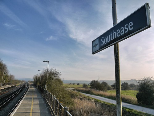
From the Radio Mast, I can see Southease Train Station.  A more desolate train station has yet to be encountered.  After 15 miles, 5hrs 15 minutes of walking and 10 minutes for a pint, I am here 20 minutes early for 18:35.

Southease - Take me to Civilisation
That relieved when the train stops, I wave at the driver
I have booked a B&B in Lewes for the night that has no presence on TripAdvisor.  Sonia has been filling my head with all sorts of horrors about the sorts of people that take in solo ramblers into their home.  Its a 10 minute walk from the Station to Paddock Lane and I knock the door of a suburban home to announce my presence.

Will I survive for Day 2?

Monday, 6 April 2015

06/04/15 - Beauty Everywhere

Distance - 7.91 Miles
Geocaches - 6
Walk Inspiration - Country Walking Magazine - Feb 1992

The unexpected answer to the question posed by my walking partner to where we heading today was Walsall.

"Why not somewhere nice, like the Cotswolds?" was the response.  My assurance that there is beauty everywhere was met with a curt "Not in bloody Walsall there isn't".

There's a couple of reasons for me to be heading the urban sprawl of the West Midlands.  1)  I looking through some (very) old Country Walking Magazinse and this was featured in a 23 year old edition.  I love eBay.  2)  The number 1 pub in the West Midlands is in Walsall and it needs checking out.

We park up at Barr Beacon, one of the highest spots in the West Midlands but cannot see any views because of the fog.  We hope these have lifted by the time we return.

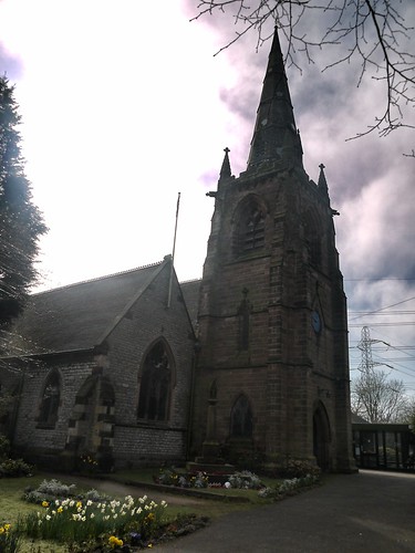
The route follows the Beacon Way in part and we follow the signposts downhill to the Church at Great Barr.

Beacon Way
The Beacon Way
Great Barr - St Margaret
St Margaret's, Great Barr

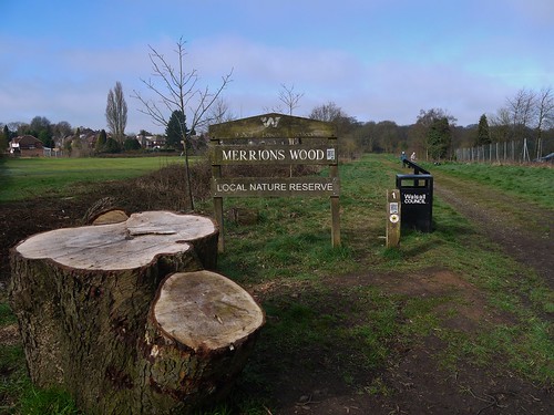
The first pocket of woodland, Merrion's Wood, is traversed.  Great paths, through woodland and we soon forget our proximity to the City.  We really could be anywhere, even the Cotswolds.

Country Park
First of three Nature Reserves
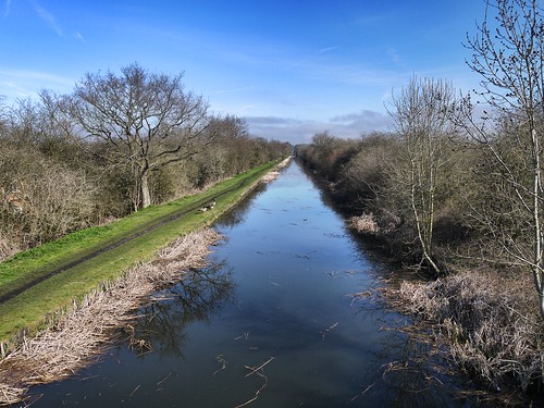
This brings us to the Rushall Canal for some dead straight and dead level walking.  I'm not usually a big fan of canal walks but this is well maintained.  No shopping trolley wheels poking out the water or the flotsam of a 1000 Tyskie lager cans.

Rushall Canal
Rushall Canal - Very Pleasant
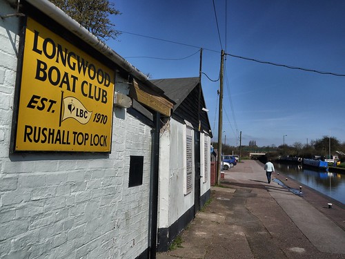
All but two of today's geocaches are along this stretch and we make a good job of finding them.  By the time we reach our turn off at Rushall Top Lock, Sonia has designs on a nice tea shop.  There isn't one of them, but there is a mobile cafe in a portacabin.  I make my move to the window but instantly met with "We're closed for Cleaning Bab".

Sonia will have to wait until the best pub in the West Midlands for refreshments.

Rushall Top
Stomping off to a very clean Portacabin
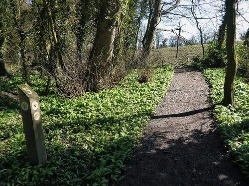
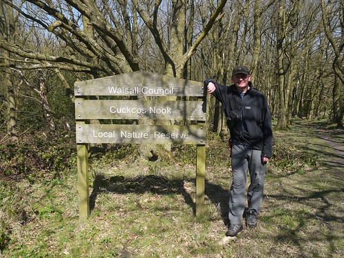
As soon as we leave the canal, we are back in another Nature Reserve - Hayhead Wood quickly merging into Cuckoo's Nook.  Both proper woodlands with superbly maintained paths.

Into the Woods
Yes, this is Walsall
Cuckoo
Perfect Walking Country

The ascent back to Barr Beacon is that gradual that we didn't notice we were climbing.  Before we know it, we are on the edge of the park, with just one lane to navigate.

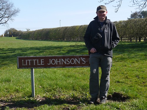
My New Abode
Sonia made me stand here - No idea why.
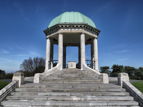
Up on the ridge and past the reservoirs for superb views.  I take a look at the War Memorial before I hear a cry of "Ice Cream", as Sonia spots the Mr Softee Van.  I know how to treat a lady.

Barr Beacon War Memorial
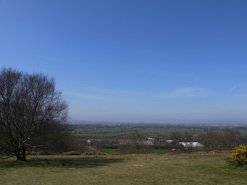
Views from Barr Beacon
Wolverhampton is down there, somewhere.
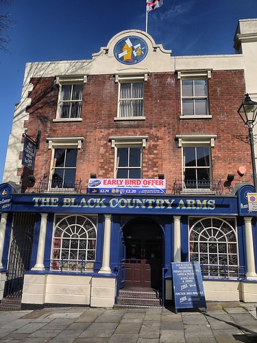
Ice Creams consumed - it's a short drive to check out the Black Country Arms in the Centre of Walsall.  Even get to park up for free, as its a bank holiday.

10 Real Ales on - all with a little pot showing the colour of the beer.  Sonia thinks they look like samples for people with different degrees of bladder infections.  That lady sure knows how to kill a mood.

Black Country Arms
Bonus Geocache right outside
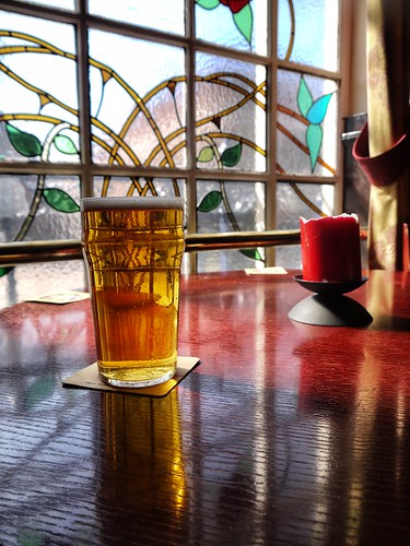
Wellingtonian Beer
Nothing medical looking about this Wellingtonian


Hats off to Walsall Council - some great paths and a walk that even surpassed my expectations.

Next week's blog from Upper Gornal.


Sunday, 5 April 2015

04/04/15 - Ridgeway in Decent Pint Shocker

Distance - 13.5 Miles
Distance on Ridgeway - 6.5 Miles
Geocaches - 14
Walk Inspiration - Self Created Stage 9 of the Ridgeway


I'm always looking for ways to improve this blog and I've noticed other walking bloggers writing gear reviews.  Having purchased some new Brasher walking socks, I'll give it a go.

Gear Review
They tell you which foot to put them on

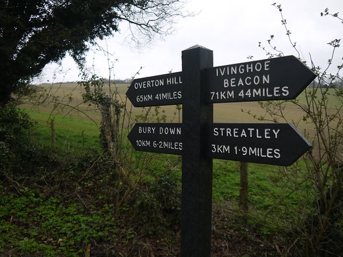
Dressed like a hiking Jimmy Cricket, I head off to Streatley, Berkshire, to complete the next stage of the Ridgeway, walking west to meet up with the crossroads where I turned off the Ridgeway at the end of Stage 8.

What's Behind and in Front
Instant Reminder of how far I have come and how far to go.  Let's call in halfway
This is the last of the chalk uplands, so I know what the walking will be like.  A broad track with sweeping views in all directions.  From now on, the Ridgeway will change character, becoming less remote and offering a different experience.

Today, I make do with the walking and the occasional geocaching, sharing the path with only a couple of cyclists.

The Ridgeway
I've had 41 miles of this glory

Turn off the Ridgeway at the crossroads just before East Ilsley, heading south to Compton.  Another pretty village to pass through, again too early to take advantage of what amenities are on offer.

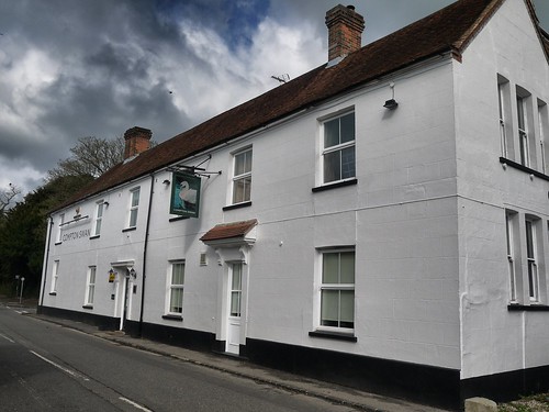
Good Looking Pub
The Swan at Compton

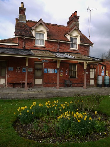
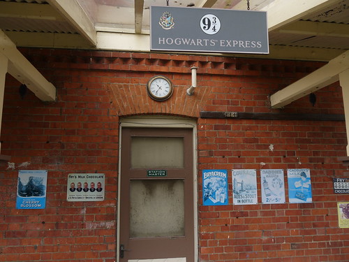
I'm making my own route back to Streatley, planning out footpaths wherever possible.  One path takes me into what I think is someone'garden but is actually a disused railway station, looked after by someone who's read too much JK Rowling.

Compton Station
Dr Beeching Victim
9 and 3/4
Goes to Hogwarts

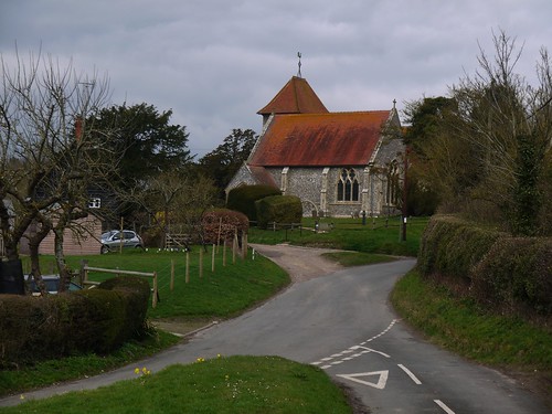
An unavoidable nasty stretch of road walking for around a mile takes me to Aldworth.

Parson's Green
Contains 7ft Medieval effigies known as the Aldworth Giants.  
The next couple of miles are along ancient green lanes where there is no traffic at all.  A couple more geocaches to break up the walking.  Eventually, I arrive at a pretty little spot called Mutton Copse, where there is a steep hill to climb, rewarding me with some nice views over the Thames from the top.

Up Hill
Huff and Puff up the Hill

Overlooking the Thames
To see how the Ridgeway changes character after Streatley
Slip slide my way down to civilisation for suitable refreshment after 11 miles walking.  I've not been very lucky with pubs on the Ridgeway, being served some simply atrocious ales, paradoxically in lovely looking pubs.  Not sure whether it's Arkell's beer or I have just been unlucky.  Ever the optimist, I prepared to give it another shot.

The Bull, Streatley
One of the Stops in Jerome K Jerome's "3 men in a boat".  I've read that - its great
Politely leave my muddy shoes under the porch and confidently stride in with my socks announcing to the world that I have them on the correct foot.  Ask the Barman for a sample of the "Streatley Best" and he assures me it is superb.  In an Italian accent.  Can I trust a cosmopolitan European for a Real Ale review?

I can and it was.

Streatley Best
Ironically, I appear to have banged my head Geocaching - Unnoticed Geo-injury gently bleeding
A superb walk and I'm really looking forward to the next stage.  As Streatley (well Goring) has a train station, I can do the next two days walking linearly and make my way from here to Princes Risborough, overnighting in Watlington.

Friday, 3 April 2015

03/04/15 - Brighter Later

Distance - 9.72 Miles
Geocaches - 23 Found, 3 DNF, 2 Not looked for
First Cache

As it's a Bank Holiday, it had to rain.  The drive down the M5 was completed in torrential rain and the weatherman were good to their word.  They predicted the rain would stop at 11am.  I start this Geocaching round at 10:23 and by the time I reach cache number 1, I am able to take my hood down.

So I am not going to get wet from above, but the paths, especially on the early (steep) sections are in pretty ropey condition.  If I had been wearing my walking shoes, rather than boots, I would have lost one to the mud.  In the end, the only mishap was a spectacular hillside slip and tumble.  At least it was only horses that observed it.

Park up at an odd little bit of common land that is next to a housing estate and covered in sheep on my return.  They're not fenced in and it makes you wonder what stops them from running off or getting run over.

Across a field to cache number 1 before crossing the m5, who's constant drone accompanies me for the early part of the walk.

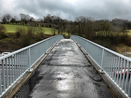
Motorway Bridge
A Bridge just for Ramblers
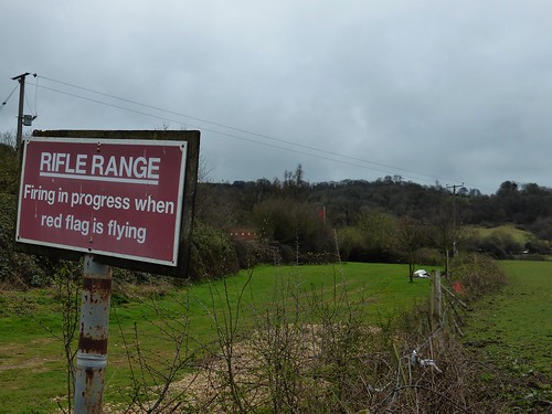
Caches 2-12 take you up hill and back down again through horse fields.  Every so often there is a series of loud bangs from a nearby farm and the mystery is solved on arrival.  A firing range.  If i'd have paid attention to the map I would have noticed that it does say "Rifle Range - Disused". Someone has recommissioned it.

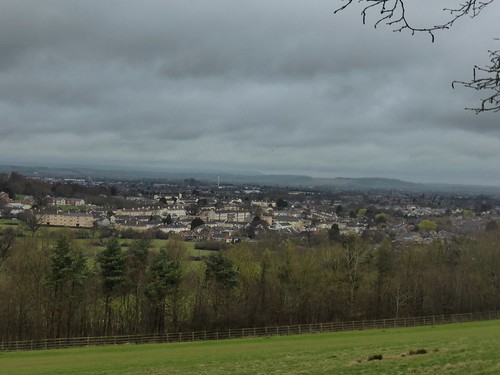
Gloucester Views
Views back over Gloucester
Keep the Red Flag Flying High
The Red Flag is flying


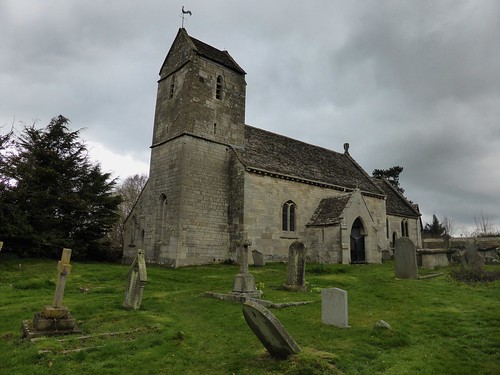
Caches 13-16 take you through Brookthorpe.  It has a pub, but I am in no state to enter their establishment, having taken my mud assisted tumble at Cache 3.  There's also a pretty little 13th Century church, with tombs dating back to the 1600s.

Brookthorpe Church
St Swithuns, Brookthorpe
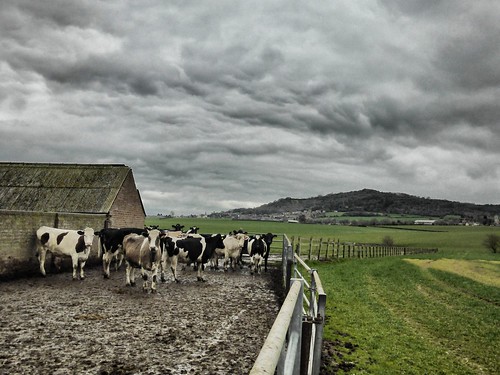
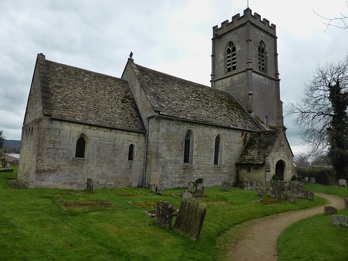
Caches 17-21 are across very flat and very green farmland, leading to Whaddon, with another 13th Century Church and an impressive school.

Cows
The Car is back in the Shadow of the Hill
Whaddon Church
St Margaret of Scotland Church, Whaddon


Caches 22-28 involve another climb and then skirting a golf course, where the golfers are the only humans that I have seen on this walk.

Throughout the round, I have been collecting numbers for a bonus and its around Cache 26 when I have a complete set.  A rather complex formula (especially when I don't have my glasses) is manipulated and the co-ords programmed.  It's always interesting to see if you have got this right, but GZ appears to be near the car and on a public footpath.  However, there are 4 previous DNF.

Is this down to the formula or is the cache missing?  I decide that I have been at this for too long to not investigate.

I record my last DNF of the day.

Thanks to Joe & June for setting up this challenging round.  I've emailed to see if I did the maths correctly :-)