Geocaches - Found 9 of 9
Villages Visited - Bourton on the Water, The Slaughters, Naunton
Walk Inspiration
Bourton on the Water
The web site where I found this walk from claim that it is the greatest walk in the Cotswolds. This is high praise indeed but is it enough to convince the Labradoodle?
Regular blog fans will know that when I appear on a weekend in my soft shell suit, she makes a run for it upstairs whilst I am fetching my boots. Well today, she met Sonia on the stairs and was shoo'ed back down and attempted another approach to getting out of the walk - pretending to be asleep. One lazy but clever dog - you have to admire her front.
 |
| Next week, I'll play dead |
Start of the walk is back through the town and over the A429 to pick up the first of the three long distance paths that make up this walk, the Heart of England Way. Head North west towards Lower Slaughter, picking up the first two caches of the day. Learn that Slaughter is from the old saxon word meaning "muddy". The paths are more paved in gold than London, due to the colour of the Cotswold stone and at this point are fine.
 |
| Lower Slaughter - Winner of Prettiest Cotswolds Village |
 |
| Path out of Upper Slaughter |
 |
| Fly By |
Close the gate and attempt my search, only for a straggler to be coming along in the distance. Go through the whole process again, only this time to met with a doffed cap to along with "how kind" messages. Feel that everything in the universe is alright.
 |
| Truth is, I need you to jog on so that I could find the cache |
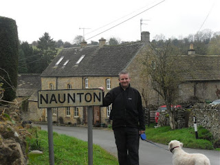
The Wardens Way takes me westbound to a nice pretty village of Naunton. Looks like there is an absolutely cracking pub there, but its too early.
 |
| Can you guess where I am? |
This is the turning point of the walk and we head south to pick up the Windrush Path - which is also the Gustav Holst Way and at times, the Donnington Ale Way. It is a good path but worthy of three names?
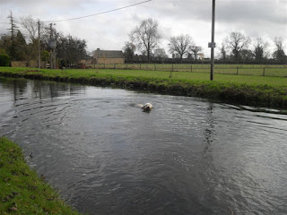
This follows the River Windrush East back to Bourton. The dog is getting into a bit of a state, so it gives her a couple of opportunities to get clean. Notice how much water is gained from where we pick up the river first, to when we get to the end - a distance of around 3 miles.
 |
| A Shallow Dribble |
 |
| A raging torrent |
This is all very pleasant and carries me back to the hoardes of tourists milling around the village. With the money that I have saved from the carpark, I can have a blow out at the Windrush Gardens Cafe. It seems to be a homing place for several other walkers around.
No doubt a great walk but its a bold claim to say the best in the Cotswolds. My money is on Belas Knapp and Cleeve Cloud.
No comments:
Post a Comment