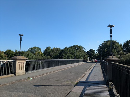
A simple walk from my "Home of Football" and into the City outskirts at the Jewellery Quarter.
The Birmingham Canal providing a green-ish corridor through an urban landscape. Graffiti, some of it excellent, rubbish and the most unusual hobo. Living in a tent at a bridge, with a pontoon harbour made of milk bottles to protect his canoe. He is friends to the geese.
Today's Walking
Ted Lasso Vibes with the Graffiti Vibes
There is a detour from the straight line of the Birmingham Canal at Asylum Bridge. The Soho Loop is the original stretch of canal from 1769. This was straightened in 1829, effectively making the Winson Green Island. And what did the Victorians put on this island? You will have guessed the prison - a mock castle building - but there was also the lunatic asylum and workhouse.
I was there
Asylum granted
Icknield Street marks the entry into the Jewellery Quarter - as well as a bit of Tom*, you will find some of the city's finest restaurants and bars/pubs. And the Red Lion reopened in the summer of 2026.
Back from the dead
Joules have done a fine job but at a cost. It's immaculate inside and out - painted a striking but not unattractive brown externally and inside, a finely polished parquet flooring. Every wall surface covered in pubby memorabilia - a lot advertising Green Monkey Helles Lager. In the heatwave, I was susceptible.
Hit the spot
Outdoor terracing - both sheltered and elevated, it's a fine addition to the area. The Rose Villa Tavern is going to have to up its game (poor beer last two visits).
The cost? The Red Lion was possibly the only place in the city you could get Bathams. The landlord told me they still have people phoning up and asking if it is still on.
Listen to your customers, publicans.
* Tom Foolery - Jewellery..... Old Brummie Rhyming Slang
There was simply too much inspiration in section 2 of Jonathan Meades Travels with Pevsner. The main topic was Georgian Pershore but how could I ignore "the most momentous building in Worcestershire".
This is the Temple of Theseus. Built in 1758 by Lord Lyttleton, so he could look out over the Malvern Hills. It is the first example of neo-classical architecture in Europe.
There's a lot going on at Wychbury Hill. I have already told the tale of "Who put Bella in the Wych Elm?". No need to repeat it here, but of course, there will be a photo of the obelisk. I also remembered that the Mysteries of Mercia Facebook page had discussed the yew trees at the iron-age hillfort. These were to be investigated.
A walk was easily fashioned, a variation of the "Rail Trail" between Hagley and Stourbridge.
The temple is not strictly on a footpath, but on the ground, there is a well trodden path - either caused by graffiti artists, drinkers who like a view or possibly even the new inhabitants, usurping Lord Lyttelton but getting the same views.
How we look after the county's most important architecture
Perfectly Proportioned by James Stuart - following a pilgrimage to measure the original
Cows had already trampled the fencing
Folly Views
Back to the proper footpaths, via the obelisk.
Obelisk
Bella - an unsolved 1940s murder victim
Next stop, the yew trees of Wychbury Hillfort and have spawned a number of legends. Was it the site of an ancient battle between the Romans and the natives? Is Wychbury Hill the final resting place of King Arthur? Are the yew trees a manifestation of fallen warriors? Probably not. Is the site use by local pagans during key calendar events? Yes. But why?
In pre-Christian pagan traditions across Britain and north-west Europe, the yew tree was revered as a symbol of death, rebirth and eternal life. Remarkably long-lived and capable of regenerating from ancient wood, it seemed to embody the endless cycle of nature, making it a powerful emblem of immortality and the passage between this world and the Otherworld. Yews were often associated with sacred sites, burial places and places of ritual, where they represented wisdom, protection and ancestral memory.
My favourite on-line resource is from the Ancient Yew Tree website. Someone went to the trouble of mapping the 23 trees, providing a summary and a description of each individual tree. You've got to love the Internet. Next, middle aged men will be writing about their walks and pints and hoping someone out there finds it of interest.
x marks SO9205581800 - a perfect place for lunch.
It's incredibly accurate and easy to follow. A circuit of the hillfort and most of the trees were identified.
One of the 23. We'll leave it there. No need for the other 22
30 minutes spent lunching in a Pagan worship spot, the GPS left on, explaining the random mess on the track recording.
Finally, a drop down to Stourbridge for one of the CAMRA's Heritage pubs. The Seven Stars.
Handy for the Station
Built for Mitchells & Butlers Brewery and opened in January 1905, the Seven Stars has an outstanding collection of M&B etched and painted windows plus much Maw & Co wall tiling.
The entrance hall has lots of light blue and cream dado tiling, which extends up the stairs and into the public bar. That room has its original counter and a superb four-bay, mirrored bar-back with a clock-adorned pediment. Below the pediment is a recently-reopened hatch to the smoke room behind. This is modernised but bell pushes remain above the benches, as do fine etched windows. The restaurant left of the hallway has nothing of historic interest bar a couple of windows.
Recently, it was closed down for a number of years, until resurrected by the Black Country Ales chain. Incredible really, they have changed nothing (apart from the drinks available) and it has gone from an unviable business to one that you are lucky to get a seat. As with all BCA Pubs, the drinks available are many, usually unheard of, a dedication to real cider and always well kept.
The second part of Jonathan Meades Travels with Pevsner details Pershore. A perfectly intact Georgian town.
A Walk Midlands Rail Trail from WalkMidlands has been on the to-do list for a while. Time to knock this off, and investigate Toyah-town with eyes afresh.
After a couple of city walks, it's good to be in the countryside again, even if this falls at the boring end of the walking scale. We have flat agricultural fields - burnt to a crisp, hard underfoot and with significant cracks in the soil ready to twist an unsuspecting ankle. The prize - Bredon Hill - is permanently in view - with only a couple of Northern Cotswold villages to break up the monotony.
Ashchurch, providing the only geocache of the day
Today's vista
Too early for Kemerton's Crown Inn - a mooch around the church instead
I'm unsure if I have approached Bredon Hill from this direction before but as with the routes I have taken, it's a gentle climb. Shady woodland at the top provides a fine location for a lunch break.
Pershore - identified by the Abbey below
The descent is via the Wychavon Way, familiar paths touching Great Comberton and the river Avon for a brief moment before more flat walking to the town.
Great Comberton Church
Pershore's old bridge declaring the walk is over
Pevsner dedicates many pages to the Abbey. I decide to only concentrate on Bridge Street - his text providing detail on design features otherwise missed, but I will spare you photos of doorways.
Bridge Street is also home to an ever dwindling number of pubs. The Brandy Cask now a private home.
The ones that remain hardly tear up any trees but after drinking increasingly warm water in a heatwave, the euro fizz available was more than welcome.
Cruzcampo and a riverside terrace
Millers Arms - former GBG and best in town (IMHO)
The Three Tuns in Pevsner's text - now a "not for Mappiman" hotel
For ladies who lunch and also a Championship Timothy Taylor outlet for cooler days
A lot going on for a simple walk between two West Midlands Railway Stations.
History West Midlands Podcasts
My monthly listen is the opening podcast about the Black Country, focusing on the post WWII glory years. Full employment, workers rights, massive house building. Setting the boomers up for a life of good luck unavailable to the future generations.
There is nothing specifically mentioned in terms of people or places to base a walk on. The Bentley Estate in Darlaston a possibility but I doubt it offers much in the way of walking or pubs. The GKN factory in Heath Street long gone. Inspiration was found from the former mining works in Sandwell Valley Country Park. A walk - the Miner's Trail - was found and adapted into the walk.
Sandwell Country Park - a pond hiding former mine works
The real interest here is from a much older age. Three information boards tell all you need to know about the spring that gave the area its name, a priory and a later hall. Only some foundations - and the unattractive, sandbagged spring remain.
Tucked away in Sandwell Valley are the remains of Sandwell Priory, a small Benedictine monastery founded in the late 12th century beside the Sand Well, a natural spring believed to possess healing qualities that gave both the priory and the modern borough their name. Following the priory's closure in 1525, the site later became home to Sandwell Hall, a grand country house built by the Dartmouth family in the early 18th century. Although the hall was demolished in 1928, archaeological excavations have since revealed the foundations of both the medieval priory and the later mansion, allowing visitors to trace more than 700 years of history in a single peaceful corner of the valley.
Priory and Hall Remains
Sandwell, bubbling up
Pub Walks in the Black Country
My next walk from this book is in Sandwell Country Park. Only two miles, and covering the afore-photographed pond, Swan Pond and the priory remains. Two miles cannot justify the public transport costs for a separate visit, so I simply add most of the loop into the walk. And the pub? The Churchfield Tavern, Little Lane is recommended for Banks Bitter and Mild.
Demolished in 2013
From the photo, it looks a mishmash of extensions, with a rather oddly positioned chimney. Research shows that somewhere there was a both a bowling green and a petting zoo for goats, horses and rabbits.
High in the list of google results was Alan Winfield's epic (aren't they always) 1988 pub crawl of West Bromwich. Added to my to-do list to see if anything still remains in this fast changing pub ticking world. 13 pubs are listed, my betting is there are no more than four remaining.
I will report back.
Dudley Geosites
Sandwell Valley Country Park and Smethwick Galton Bridge are both Dudley Geosite locations. 2 more knocked off.
Rail Trails
Of course, there is no official route from Smethwick Galton Bridge to The Hawthorns. An unofficial one from Railwalks.co.uk is only 1.2 miles (but the next stage is perfect, downloaded and ready to go). It's down to me to work out how to cross the bridge and get to Sandwell Country Park. A decent enough urban walk on properly marked walking/cycling paths. I learn just how close the Vine is to SGB station, which I am sure will come in useful. Handy twirly footbridges allow for safe crossings of dual carriageways and an interesting way to access Dartmouth Park.
SGB, 1829 and once the highest single span bridge in the world. Looks better from the canal below.
A view of Turner's Hill from a twirly footbridge
Dartmouth Park leads to Sandwell Country Park, where Park Lane can be avoided by a parallel, unmarked footpath that avoids death-by-hatchback. Into Handsworth Cemetery, where a handily placed exit leaves you opposite the Hawthorns, stadium, not station.
Proving just how much of a community club West Bromwich Albion are, they offer a lovely Garden of Remembrance. Loved ones' ashes can be left looking at the stadium. It has been my dad's home for the last 11 years.
A combination of sources for today's walk, which is possibly the most personal one undertaken.
This month's History West Midlands Podcast is about racism in 1960s Smethwick and specifically Malcolm X's 1965 visit to the area. The next leg of my "rail trails" series is between Langley Green and Smethwick.
Peter Griffiths became Smethwick’s Conservative MP in the 1964 general election after running a notoriously racist and anti-immigration campaign, winning against the national trend and displacing Labour’s Patrick Gordon Walker. A few months later, on 12 February 1965, Malcolm X visited Smethwick at the invitation of Avtar Singh Jouhl and the Indian Workers’ Association to see the discrimination faced by Black and Asian residents, including the colour bar at the Blue Gates pub, where he was not served. He described the situation in Smethwick as even worse than America, and his visit became a powerful symbol of international solidarity against racism. Malcolm X was assassinated in New York on 21 February 1965, just nine days after the Smethwick visit.
I was born in Birmingham and spent the first two years in Smethwick. In a street very near and similar to where Malcolm X visited. My parents - white, working class, moved away in 1971. I never heard them be racist but their reasons were "they didn't want their kids to be in the minority at school".
With this as a backdrop - I trace a route between the two stations, taking in key locations to the story and from my life. It's an urban walk - so certainly not pretty.
Mappiman's First House - Remembered only through photos
There's not that many pubs in the area. The first seen, the Merrivale - a burnt-out shell that is bound to be demolished soon. Most in the area are "Desi-Pubs" - a perfect blend of beer and Indian Food, mixed grill platters a speciality. The Old Chapel is a surviving traditional pub and also the oldest non-secular building in Smethwick. Long been of interest, as we drive past it from the Albion. My mom tells me stories of sharing half a cider with my dad, unable to afford a drink each, having mortgaged themselves to the hilt to purchase the two-up, two-down.
I was hoping to visit today, but it appears to be going through a change of ownership. Stonegate has it up for sale and Facebook has an enthusiastic post suggesting a new chapter is starting soon.
Old Chapel - I can claim a tick from my pram in 1970
Blue Plaque
Lunch and an interlude at Smethwick Heritage Centre in Victoria Park. A tiny room celebrating Smethwick's industrial past and West Bromwich Albion's former glories.
Picnic in a Park
The Red Cow - Peter Griffiths, the Racist MP, used to campaign from there. Now Desi
My acting career died a death before it had chance to flourish. In Smethwick High Street - where I was busy photographing the mosque, I was approached by a film producer who needed white Caucasian males to appear as extras in a movie being shot. Photos taken and paperwork part completed until I asked how long I would be needed for. Alas, shooting was between 2pm and 8pm. I couldn't commit.
A statue to Sikh Soldiers in WW1
Marshall Street - not far from Smethwick Galton Bridge - is the logical conclusion to the day's activities. A blue plaque marking Malcolm X's visit to Smethwick.
The official Rail Trails stop at Stourbridge to restart at Shirley. The powers that be decided that there is nothing worth walking on the stations in-between. I know better — and with an OS map and Google Maps with pubs of interest plotted, I fashion something of value from Langley Green to Old Hill.
Going backwards to finally get the Holdens pub tick at the Waterfall. Friday sees standard pub opening hours.
Exiting Langley Green, I find the only "green" space on the map. I should say blue — the 1-mile Titford Canal, reaching a dead end at the M5, which I discover is built on water.
I knew he made rice
The M5 — surprisingly built on water
No avoiding the roads to get back to Old Hill. A plod to ponder why drug dealers wear such obvious uniforms: grey velour tracksuits with designer man bags.
For entertainment, I have the twin activities of finding a barber’s shop and pubs — both old and new.
A repeat visit to The Britannia, at Rowley Regis. Like a ninja, I press the pedestrian crossing to arrive at the exact moment the bolt of the door scrapes open. I’m always a little suspicious of the first pint pulled of the day, but the Bass settled into perfect condition as the pub filled up with workies getting ready for a bank holiday weekend.
Pub and brewery
A monster 22 Pub (Alan Winfield lives!) on Bartrek alerted me to The Last Jar. Conveniently situated opposite a barbers, staffed only by mutes. I wouldn’t have minded, but I had rehearsed the answer to where I was going on my holidays. The pub itself was a former barbers and is now a split-level micropub. An excellent Green Duck Stronghold bitter, flawlessly presented — not a bubble in the glass and a perfect colour.
Micropub ticking in Blackheath
Finally, I time The Waterfall to be open, having previously been forced to walk past on its usual closed afternoons. A long-standing project to visit all their tied pubs gets another tick.
All downhill to the station
Unexpectedly, Bathams is available. I have never seen Holdens in one of their tied pubs. Maintaining brand loyalty, I ordered a Holdens Black Country Special, only to find it required changing — allowing me to have what I really wanted. The friendly landlady assured me the locals say she keeps it better than in the King Arthur.
One of the many challenges I have running to keep me on the streets is walking between railway stations. My usual monthly review of where the Ramblers are group walking revealed they have planned the next stage on the Wyre Valley line for me. OK, so I am going in the wrong direction, but all I need to do is turn up and try and guess which route will be taken.
A big loop on the Dudley Canal Number 2 to Bumblehole for lunch. Then onwards through Saltwells Country Park.
Bumblehole Lunch
Canal Art
Netherton's Massive Anchor
Doulton's Clay Pit in Saltwells Country Park
Could I have planned it any better than an Octogenarian Austrian Rambler? Well, it seemed rather cruel to make us look at Ma Pardoe's without paying them a visit. Especially as it was honking it down with rain. Again.