Showing posts with label Worcestershire. Show all posts

Saturday, 26 September 2026

26/09/26 - Abberley, St Michaels

Autumn Equinox and Michaelmas


Two dates very close to each other on the Pilgrimage calendar.

The Autumn Equinox marks the point when day and night are approximately equal, a moment of balance before the long slide towards winter. It sits neatly alongside Michaelmas, celebrated on 29 September in honour of St Michael the Archangel, traditionally seen as a protector and a figure of strength and courage. Michaelmas was one of the four quarter days of the English year, marking the end of the agricultural year and the beginning of a new one. For an Autumn Equinox pilgrimage, the two traditions make a useful pairing: walk through woodland, fields, orchards and old lanes, looking for the signs of harvest and the changing season, before finishing at a St Michael's Church if there is one nearby. The walk becomes a small journey from the balance of the Equinox towards Michaelmas, combining the seasonal landscape with the Christian tradition of the archangel whose feast marks this turning point.

I know just the church - The Norman St Michael's in Abberley - fallen into ruin in the 1850s, with just the chancel and chapel remaining. A proper explore to be had, before the walk gets going.
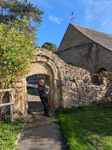
St Michaels, Abberley
Gillet on, marking the transition to winter
St Michaels, Abberley
Flying buttress failing to save the church
St Michaels, Abberley
Doors Open...
St Michaels, Abberley
The last feast, cracked

The walk is straightforward and for large parts, on the Worcestershire Way - woodland up onto Abberley Hill, where the occasional (wonderful) view appears through the trees.

View from Abberley Hill
Woodbury Hill, from Abberley

Just to round off the day  - lunch at the Manor Arms. Over 300 years old and the building has doubled up as the local court. Over the years, we have seen it come and go - from a village local to its current guise as a posh gastro pub with rooms.

At least it's open.

The Manor Arms, Abberley
The parking needs to be paid for.

Walk Details

Distance - 4 miles

Geocaches - 2

Walk Inspiration - Adventurous Pub Walks in Worcestershire - Walk 

Previous Celtic Pilgrimages - Imbloc, Spring Equinox, Beltane, Summer Solstice, Lammas


Friday, 25 September 2026

25/09/26 - Worcestershire Cakes and Ales Stage 3 - Upton-upon-Severn to Pershore

Welcome to the Monkey House

I'm taking massive liberties with this stage of the Cakes and Ales guidebook. Again, the author wants a very lengthy walk - 15 miles - and to introduce a big hill. This time, Bredon Hill. It could be argued that I have recently walked over Bredon into Pershore. The real reason for the massive diversion is that I am near to a place that I have wanted to go to for a long time and that is only open on Fridays and Sundays. 

Most of the blog will be dedicated to the Cider House, Defford.

This leaves the walking a little dull - over the river at Upton, to head east on the Wyche Way across agricultural fields. Views of the Malverns behind and Bredon in front. Nothing really of interest until the decision point at Strensham, where I leave the official route to plough my own furrow.

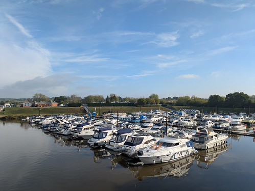
Upton Marina
Upton Marina
Malvern Hills
Hills behind - The Malverns
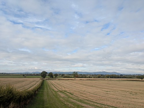
Bredon Hill
Hills in front - Bredon
Strensham Church
More than just a service station - Strensham Church - Door Locked

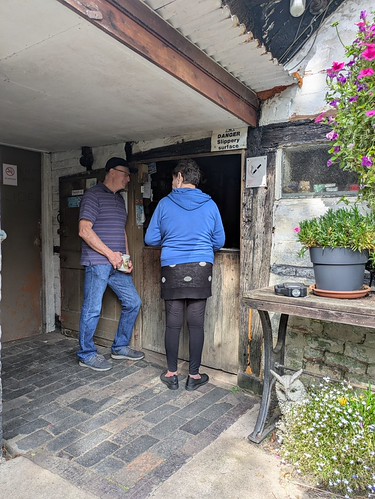
The Cider House is one of only four dedicated cider houses left in the country. I've done my research - I know its opening times (Friday Lunch, Sundays and Wednesday in Summer). I know that it's cash only. I know that there is no bar and cider is dispensed from a hatch in a barn door.  I know that it's been managed by the same family for the last 150 years. But time is meaningless here. I could have been drinking in the Middle Ages.

The Monkey House, Defford
The main door with its weathered sign
The Monkey House, Defford
Queuing at the serving hatch

Not ordering a beer and having paper money allowed me to be accepted by the landlady and a friendly gang of farm hands and workies taking advantage of the limited opening hours. Unsure how some of them would be going back to work. I had two pints of dry and found myself singing on the top deck of the X50 back to Worcester. Dispense is from the barrel, via a jug and only untappd suggested the brew may have a name - Woodmancote Dry. Note that the ABV is unknown.

Previous check-ins suggested this was my brew

The strength of the brew may go some way to explaining how the place received it's nick-name of the monkey house. I'll leave the CAMRA Real Heritage Guide explain;


What else did I discover? I thought I was missing out on a cocktail when a lady asked for a "Carpet Square". Nothing so fancy, it was exactly that - a carpet square to sit on, if the bench seating is too hard on your backside. And if it rains - everyone can go inside to the "tool-shed".

The Monkey House, Defford
Inside the tool-shed

A roof, a luxury not extended to the male facilities - a roofless wall, which if you are 6ft - you can peer over to view the countryside that you should have been walking.
  

Walk Details

Distance - 7.5 miles

Geocaches - 3

Walk Inspiration - Stage 2 of the Worcester Cakes and Ales Trail

Previous Stages:


Friday, 18 September 2026

17/09/26 - Craycombe House, Fladbury

Serendipity


The sort of strange coincidence that I love.

Five weeks ago, I had never heard of the author, Francis Brett Young. Yet there was enough motivation to join a Walkspace West Midlands group walk to find locations that were important to him and his haunted house novel, Cold Harbour.

My latest Travels With Pevsner walk provided the usual high amount of inspiration. I could have walked to the Chateau Impney, one of the Wells (Tenbury/Malvern) or Ribbesford House but how could I ignore Craycombe House? 

The former home of Mr Young!


Craycombe House sits to the North of Fladbury - a charming village on the River Avon, with a mill, a couple of pubs and a doors open church. In planning, it remained a question of how close I could get to the house. A promising looking footpath sits in the woodland above the property. Another rambler - attempting to create a long-distance path in honour of Tolkien - states that the property does come into view.

On the Wychavon Way

Only one way to find out.

For transportation purposes, the walk starts at Cropthorne - with a handy stop on the X50.  A collection of thatched cottages and a firmly closed church.

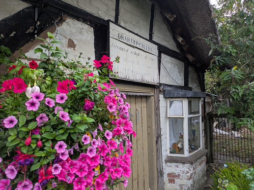
Cropthorne Architecture
The main street in Cropthorne
Cropthorne Church
Cropthorne Church

Across the River Avon at Jubilee Bridge, through the village and across the golf course - homing in on the target. Somehow, I did manage to receive a personal tour of the church by the warden. On explaining my quest, he did say that the house is now owned by a banker, who likes his privacy. He's certainly let the trees grow to provide cover.

The River Avon at Fladbury
The Avon
Fladbury
Fladbury Signage - the Anchor Pub in the background
Craycombe House, Fladbury
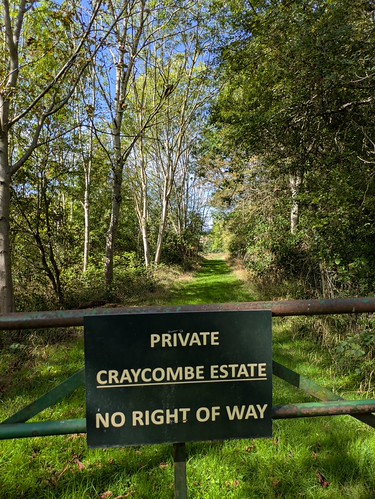
Banker's Privacy

I start to think my quest is going to end in failure. Yet perseverance at Machine Farm - where they have removed all PROW markers and let the hedges consume the stile - provides the required result.

Craycombe House, Fladbury
There she is!
Craycombe House, Fladbury
As good a view as I am going to get - short of knocking on the front door.

Success celebrated at the Anchor Pub - a solid looking locals pub, with outdoor seating on the village green. They keep excellent Wye Valley HPA.

Walk Details

Distance - 7 miles

Geocaches - 1


Thursday, 10 September 2026

10/09/26 - Powick Hospital

Church, Civil War and the Madhouse

This month's History West Midlands Podcast is about Powick Hospital. Growing up in Worcestershire in the 70s, this was often referenced. Any odd behaviour, however mild, would be met with "You'll end up in Powick".

Interesting podcast. I had no idea of the scale or the fact that each authority was responsible for creating a "madhouse".

Powick Mental Hospital began life in 1852 as the Worcester City and County Pauper Lunatic Asylum, built as a direct consequence of the Lunacy Act and County Asylums Act of 1845. These Acts required counties and county boroughs to provide accommodation for paupers suffering from mental illness, rather than leaving them in workhouses or private madhouses. Worcester took a little persuading before finally agreeing to build its own institution at Powick, where the first patients arrived on 12 August 1852. Originally designed for around 200 patients, the asylum expanded considerably and eventually accommodated around 1,000. It later became Powick Mental Hospital and closed in 1989, with most of the complex subsequently demolished.

It would appear that a World In Action documentary in the sixties hastened its demise.  The images in this YT video are from that programme. 


A walk to determine if anything remains on the ground. This can be linked in to an investigation of St Peters and St Lawrence Church. No point going to the Medieval bridge. It's still awaiting repair, although (slow) progress is promised.

The Hospital

A little more research was completed. The Internet Archive, my new favourite resource for antiquated books, contains the annual reports from several years in the early 1900s. 

The next page details mortality rates, escapees and how they were captured.

The bus stop is called Hospital Lane. The site was redeveloped extensively for housing (what else) after the hospital's closure. A load of photos from the early nineties at Geograph, where we have a candidate for first "urban explorer".

Hospital Lane, Powick
In the right place

The early photos show a massive rambling complex of buildings. Only one remains, the central office block, which has been repurposed as flats and offices.


The Church and Pub

Nothing else medical to explore, I focus my attentions on the English Civil War. 

Powick found itself at the heart of the English Civil War on more than one occasion. In 1642, the first significant clash, the Battle of Powick Bridge, saw Royalist cavalry defeat a Parliamentarian force; nine years later, the village was again caught up in the Battle of Worcester, the final major battle of the war. The Red Lion, an early-17th-century building, is said to have been pressed into service as a hospital for wounded soldiers during the fighting. Meanwhile, the tower of St Peter and St Lawrence's Church provided the Royalists with a useful lookout, its elevated position giving a commanding view towards the bridge and surrounding countryside. Parliamentarian troops eventually fired on the tower to discourage its use, leaving the remarkable pockmarks and shot holes still visible in the stonework today. Archaeological research confirms Civil War musket and other shot in the vicinity, while studies of the tower suggest that at least some of the damage was caused by small-bore artillery rather than simply musket fire.

And I time things perfectly. Well sort of. The pub offers little hope - with midweek opening times at 3pm. The church is usually doors closed. But on a Thursday between 10am and midday, the volunteer ladies are doing a weekly clean and keen to allow a mooch around. Information boards on both the hospital and the war are on display.

The Red Lion, Powick
Brick exterior of the pub covering up the original timber framing
Powick Church
Approach to Powick Church
Civil War Musket Holes, at Powick Church
Target practice on the south side of the tower
The Walk

A simple crossing of the Powick Hams, where I need to find elevated access to the Southern Relief Road to cross the Severn. Note to future self - as the map is unclear - an access road is available right next to the water. Then follow the river back into Worcester - spotting more Civil War information boards.
The River Servern
Worcester - ahead
Diglis Hotel
Refreshment stop  - The Diglis Hotel

Walk Details

Distance - 7 miles

Geocaches - 1

Walk Inspiration - History WM Podcast

Monday, 7 September 2026

07/09/26 - Worcestershire Cakes and Ales - Stage 2 - British Camp to Upton-upon-Severn

Chasing our sheep, waving a machete, shouting "Meat"

The second stage of the Cakes and Ales book takes me across Castlemorton Common. A name that will be of significance to ravers, hippies and New Age Travellers of a certain age.


Castlemorton Common in Worcestershire became the unlikely epicentre of Britain’s early-1990s free-party movement when an estimated 20,000–40,000 people descended on the common over the late May Bank Holiday in 1992, following the police disruption of the Avon Free Festival. For almost a week, sound systems including Spiral Tribe and DiY provided a huge, largely uncontrolled outdoor rave of techno, acid house and free-party culture. The sheer scale of the event—and the intense media coverage and political alarm it generated—turned Castlemorton into a symbol of a supposedly lawless youth counterculture. It was not the sole cause of the government's subsequent crackdown, but it provided the perfect political pretext: the Criminal Justice and Public Order Act 1994 gave police extensive new powers against unlicensed raves and trespass, most notoriously defining a rave in terms of gatherings of 20 or more people where music was characterised by a “succession of repetitive beats”. The Act also strengthened trespass laws and targeted New Age Travellers, squatters and other forms of protest and direct action.

Last week, I watched a documentary film - Free Party:A Folk History. Ironically, paying a tax dodging, American multinational £4.49 for the pleasure. I am unsure this is what the creators would have wanted. It all came flooding back. The youth tribes that no longer exist or indeed have been replaced by anything new. Whereas we had distinct subcultures - which drugs and repetitive beats brought nicely together - today we have insular, morose kids that if they do go out, it is wearing massive headphones. Lost in both their and to our worlds.

The moral outrage seems rather quaint too. I can remember the nightly news updates. I can remember the politicians and the press in a tizz. And for personal impact, you cannot help but feel sorry for the lady in the above video at 3:15 minutes in. No one wants their livestock bothered by machete wielding carnivores. 

The Walk

The guide book ambitiously demands that you walk 15 miles, including five miles on the ups and downs of the Malvern Hills from Worcester Beacon to British Camp. This needs to be curtailed. A) I have walked it many times and B) there is a hard stop on the last bus home from Upton-on-Severn. A combination of buses and uber gets me to the British Camp Car Park for a compromise.

British Camp Reservoir
British Camp reservoir under grey skies

The hills are lost after Hangman's Hill, dropping down to the east and the rave site of the common. Castlemorton village providing a break from the bleak and sheep but even then, little to explore. The doors to the church firmly "doors locked". They may have had trouble in the past from dreadlocked crusties in paratrooper boots.

Castlemorton Church
Barred from St Gregory's
Castlemorton Tump
I'll entertain myself with a Tump
Castlemorton Tump
The Tump

Flatlands - that saw plenty of Civil War action - through the grounds of Eastington Hall and before long, into Upton-upon-Severn.

Looking back over Castlemorton to the Malvern
Looking back across Castlemorton to the Malverns

There is plenty to admire from this small, yet historically important town. They run many and varied festivals over weekends - with a Country and Western event added in 2026 to the more established folk, blues and pop weekends that took place earlier in the year.

There are enough pubs - 8 - that I have had it down as a potential pub crawl location. This might need addressing - as the Kings Arms and the Star Inn offered no cask ale. 

Ye Olde Anchor Inn - the single Good Beer Guide recommendation - becomes a two pint stop.

Ye Olde Anchor, Upton-upon-Severn
Proper Job at the best pub in Upton

Walk Details

Distance - 11 miles

Geocaches - 7

Walk Inspiration - Stage 2 of the Worcester Cakes and Ales Trail

Previous Stages:

Wednesday, 26 August 2026

26/08/26 - Pershore Bridges

Meddling Parents

Investigation required for the Part 3 of Travels with Pevsner. Jonathan Meades does a fine job of describing an impressive looking home, but fails to tell the viewer where it is. Thank the lord for Google Image Search, which informs me it is Wyke Manor, Wick.


Pevsner states;

This eminently picturesque large house just NW of the church is in fact entirely an evocation. It has all the motifs of genuine Worcestershire timber-framing and groups them suggestively, It was done in 1923 round a Georgian core.

Wyke Manor, Wick
1923 Wyke Manor, Wick

There's more to the story than Pevsner lets on. The house is privately owned by the Hudsons. During WWI, Aubrey Hudson wanted to marry a young local girl. His parents didn't approve and asked his CO to transfer him away. So they sent him to the front. He lasted two weeks. 

The house contains and is a shrine to him.

My chosen walk appeared in a recent Country Walking Magazine. A figure of 8 loop with the focus point at the Pershore Bridges Picnic area.

Pershore Bridges
20th Century meets 15th Century

The first loop to the hamlet of Pensham. All agricultural fields in the shadow of Bredon Hill.

Pensham Fields
First half walking
Bredon Hill from Pensham
Bredon Hill

Then into Wick, where there is more to discover than just the manor house. A signed, and notice-boarded History Trail tells you all about Viking raids up the Avon and how to build cruck houses.

Wick History Trail
Alas, the FYI Geocaches are lost

Walk Details

Distance - 6.5 miles

Geocaches - 2

Walk Inspiration - Travels with Pevsner and Country Walking Magazine, June 2026, Walk 9


Tuesday, 11 August 2026

11/08/26 - The Thatched Tavern, Honeybourne

Comparing Ancient Worcestershire Pubs

It's a matter of days before the new edition of the Good Beer Guide is replaced. Where does time go?

My usual commitment is to ensure that my home county, Worcestershire remains "greened". There are two entries to tick.

Today, it is Honeybourne. Technically two villages - Church Honeybourne and Cow Honeybourne. Until 1958, one was in Worcestershire and one was in Gloucestershire. Its fortunes have improved with the coming of the railways - first being on the Cheltenham Line and more recently on the London-Worcester line.

The walking was always going to be agricultural. At times the paths were lost to 6ft corn crops. At others, I was walking - quite legally on the right of way - through strawberry poly-tunnels.

Honeybourne Crops
Lost again
Honeybourne Strawberry Tunnels
Lunchtime snacks available. Bring your own sugar.

The walk was largely perfunctory - designed to work up a thirst. 

The Thatched Tavern, Honeybourne is the new 2026 tick. And I am having no problems in finding it.

Thatched Tavern, Honeybourne
One day, all pubs will be so well signposted

However, the walk takes me through Bretforton. Lovers of pubs know what this means. It would be rude not to say hello to an old friend. The Fleece Inn is described in one of my pub books as "one of the best half dozen historic pubs in England".

Both pubs appear in my 1960s guide "Historic and New Inns of Interest" and are of a similar age. A chance for me to compare and contrast.

The Fleece Inn, Bretforton


The memories of my last walk here - snow on the ground. What we would give for such days again!

Fleece Inn, Bretforton
The Fleece in a heatwave

The building is more than 500 years old and half timber-framed. A former longhouse farmstead - home to animals and humans - and in the same family until donated to the National Trust in 1978. 15 generations of the Byrds, the former owners, are found in the adjacent churchyard.

Rambling inside - there are low doorways, a tiny narrow bar and a rear dining room. Here you can see the famous "witch marks" at the fireplace, should you be lucky enough to get a seat.

The Fleece Inn, Bretforton
I was lucky on snow day, 2024

I do manage to get a table inside - in front of the 300-year old pewter dining set display. Uley Brewery Pig's Ear is on, as always.

Fleece Inn, Bretforton
In front of the family heirlooms

The Thatched Tavern, Honeybourne


I'm not sure how much of the C13th infrastructure remains. Again, it's half timbered and unlike the 1960s guide book, the A-framing can be seen from the other end, not where a more modern extension has been added.

Thatched Tavern, Honeybourne
That's the architectural angle! Two tree trunks pegged together for support

Unlike the Fleece, once inside, you could be anywhere. A modern bar... modern furniture... I wandered around, looking to see anything to photograph. To the delight of pensioner diners and knock-off early workers, there was nothing.

The cask range a little pedestrian. An HPA and another pale ale with a not-to-be-trusted handwritten pump clip.

It does have things going for it - a wonderful beer garden, regular and early opening hours (11am daily) and in these troubled days of cost of living crisis - reasonably priced and deliciously chilled keg lagers.

Walk Details

Distance - 8.5 miles 

Geocaches - 5

Walk Inspiration - Jarrold The Malverns to the Warwickshire, Walk 19