Saturday, 25 July 2020

25/07/20 - The Thames Path from Lechlade

Distance - 9 Miles
Geocaches - 9
Pub - The Plough at Kelmscott
Walk Inspiration - Walks along the Thames Path - Walk 4

Back on the Thames Path, following a route from a  lovely little Guide Book that details walks from the Source to Greenwich.  This is Walk 4 and is notable for the point at which the Thames ceases to be navigable by boat and the first lock.

The route is a tiny 3 miler - not worthy of the journey down - so I extend it to walk into Kelmscott.  This transpires to be a genius move for reasons that I will detail later.  Surprisingly, I would have taken in three counties (Gloucestershire, Wiltshire and Oxfordshire) even if I had stuck with the original route.

Starting point Lechlade.  I can feel the town's history as I make my way up the high street.  The centre point is its church with a little market square in front.  As always, the Mappiman eye is on the post walk watering hole.  I spot the oldest (the Swan), the biggest (the New Inn Hotel), the first Lechlade micro brewery (The Crown) and a closed down former Arkells House (now unnamed, but was an Italian restaurant on Google Maps).  Decisions will be made on my return.

The Swan
Oldest
The New Inn and Church
Biggest
The Crown
First Micro Brewery

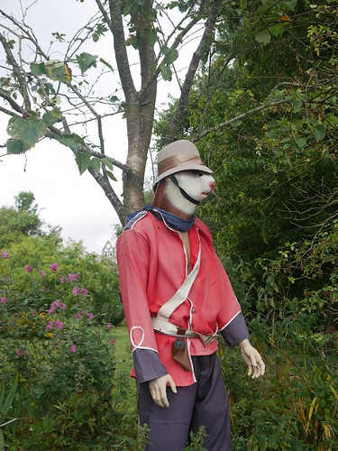
The first part of the walk is a there and back diversion to Inglesham Church. There must be a reason the guide wants us to go there, especially as no one likes re-tracing steps. It's right next to the Thames, where the first crossing of the day is made and then across a couple of fields - complete with a guard that gave me quite a shock when I noticed him out the corner of my eye.

Crossing the Thames new Inglesham
First Thames crossing today
Guard
I really have no words

The church is not too much to look at from the outside but unusually for me, I try the door, finding it unlocked. Inside is quite amazing - 400 year old wooden box pews, wall murals from the C12th and a 1000 year old carving of Mary and Jesus.

Inglesham Church
Church Exploration
Inglesham Church
Ancient Texts
Inglesham Church
And Carvings

Suitably humbled, its back to the River and back into Lechlade, walking under the Halfpenny Bridge, with its little toll house on the side.

Halfpenny Bridge, Lechlade
Halfpenny Bridge - the Toll Cost
The Thames all the way to Kelmscott now, with the course of the river seemingly unable to make up its mind in which direction it wants to flow.  Much snaking, passing many WWII pill boxes and the first lock, St Johns. Here is a statue of Father Thames, originally created for the 1851 Great Exhibition, before moving to a couple of places along the nascent Thames.

Pill boxes along the River
Preparations for the German Land Invasion
Father Thames Statue
Father Thames

The OS Map shows the Big Blue Cup of Joy at the tiny hamlet of Kelmscott.  And this, blogfans, is why I love my walking adventures.  For once, the map holds true and the a more delightful village pub I could not have hoped to find.  12:03pm.   Of course, I pop in.

Kelmscott Plough
Village Cross no doubt beheaded by Cromwell
New rules are followed - hand sanitizing in the garden before entry, paying by card but old habits die hard.  I probably broke the rules by returning my empty Hook Norton glass.

To get back to Lechlade, its agricultural field walking through wheat crops.  The Trout Inn offers a break point, should you so desire, but I press on, with the clouds looking increasingly ominous.

Back into Lechlade
The storm broke 10 mins after I finished the walk
The Plough was indeed an inspired choice - the Crown was all locked up, the Swan reopens in two days time and I was more seduced by the chipper than the New Inn.


Saturday, 18 July 2020

18/07/20 - Chiltern Chain Walk - Stage 7 - Chesham

Distance - 12.1 Miles
Geocaches - 14
Walk Inspiration
Previous Stages - Stage 1Stage 2Stage 3Stage 4Stage 5, Stage 6

More Chiltern loveliness on the Stage 7 of the Chain Walk. 

Stage 7 starts in Chesham.  Wikipedia says its known for its four B's - Boots, Beer, Brushes and Baptists.  I'll let you guess which 50% I take advantage of.  I know it more for Chess Valley Walk and being the terminus of a branch of Metropolitan Line.  I also know that a wonderful pint of Fullers ESB awaits at the Queen Head - if its survived Covid.

This part of the Chilterns offers superb walking but rather boring pictures.  The paths are broad, mud free and through a variety of terrain - wheat fields, ancient green lanes and mature woodland.

Wheat Fields
Broad Paths Agricultural Fields
Green Lanes
Ancient Green Lanes
Woodlands
Mature Woodland
The river Chess is briefly kissed at Latimer - a pretty little village centred around a square.  No refreshments to be had there, that joy is available 8 miles into the walk at Lye Hill. I wait for ages for a pub and then two come at once.

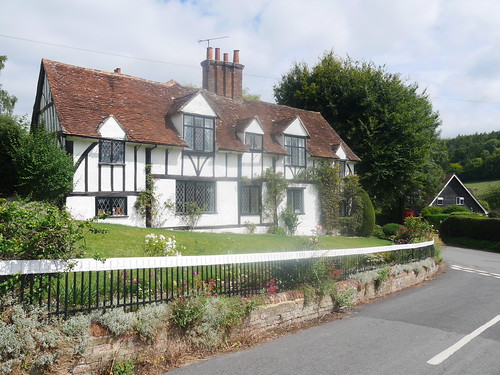
Latimer Cottages
Pretty Latimer Cottages
Ley Hill Pubs
The Swan and the Crown - Ley Hill

Despite the Crown being open, I chose to walk on by. I have my sights set on the Black Cat in a little hamlet called Lye Green.  Two reasons - its in the Good Beer Guide 2020 and according to that bible, Timothy Taylor is in permanent residency.
But a hard decision needs to be made.  I am back in the Geocaching Chiltern 100 territory and there are another 32 to find.  They may be currently disabled, due to unnecessary pressure being put on the CO for maintenance when there are bigger problems in the world, but I have been granted permission to log my finds.   Heading to this pub means missing out on three. 

Never in doubt - despite the warning from Google Maps that its is temporarily closed, a half mile diversion was made.

The Black Cat, Lye Green
It would appear that google was only half correct.  Talking with a local dog walker, the pub has seemingly permanently gone.   Their website has the FA Cup semi finals listed on the "What's On?" page - so we can only assume it's an auto-feed.  Either way, it leaves me with a conundrum as to whether covid affected pubs can be ticked.

More worryingly, I am lunch-less, but rising mirage like at the next main road is a posh gastro pub.  After an 18 year rambling career I have my first mid walk pizza.

Lazy Pig
Rambler Friendly
Spirits are raised enough to check if Albion are consigned to another season in the Championship.  We need an unlikely Stoke victory against Brentford to keep destiny in our own hands in the last game of the season.  They pull it off and the rest of the walk is spent singing "Deliah".

The most scenic part of the day's walk comes on the Chiltern Link path along a dry chalk stream valley, leading me back into the town.

Nice return into Chesham
Finest part of the day's walk
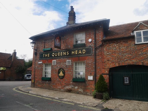
The Queens Head is found and found to be opening in four days time - so the elusive ESB remains untasted post lockdown  Instead, I work out how Greene King's track and trace and one way systems work in the unworthy of recording Red Lion.  Stella Artois reassuringly better than GK IPA.

Queens Head, Chesham
Chesham's Best


Monday, 13 July 2020

12/07/20 - The Lion Inn - Winchcombe

Distance - 6 Miles
Geocaches - 4
Walk Inspiration - Pub Walks in the Cotswolds - Walk 5
Good Beer Guide Tick - #479

One week after Super Saturday and I get my first post lockdown Good Beer Guide Tick.   The Lion Inn in Winchcombe is expecting visitors.

Lion Inn, Winchcombe
Social Distancing at the Lion Inn, Winchcombe
The walk is a variation of a short classic from this most walker friendly of towns.

I follow the Cotswold Way along Puck Pitt lane and out into the gorgeous countryside of the lower slopes of Salters Hill.

Nottingham Hill from the slopes of Salter Hill
Nottingham Hill, from the Cotswold Way
The destination - Hailes Abbey, where I can peak over the long grass for a glimpse of the ruins of a C13th Cistercian Abbey.  For once, its not that I am too tight to pay the entrance fee - its still temporarily closed.

Hailes Abbey through the long grass
Hailes Abbey from the other side of the fence
A clamber up a quiet lane to Haile on the Hill for views that are the same as those from Broadway Tower.   Worcestershire opening up below like a patchwork quilt.

Views from Haile on the Hill
Looking across to the Maverns from Haile on the Hill
The Gloucestershire Way returns me to town, where I hope this short but hilly walk can be rewarded in a suitable manner.

I approach the C15th Coaching Inn with some trepidation.  Of the handful of pubs that I have been to over the last 8 days, each has a different approach to the rules.   The Lion Inn's website states that you must book a table - but does this apply to the thirsty Geocacher that just wants a pint?

I am met at the door and ask nervously for a drink in their garden.  After hand sanitising and a passing on of details, I am escorted to their delightful garden.  After a few short moments, a lady delivers my requested Wye Valley Butty Bach.

This is what I normally have in my yet to re-open local.  Four months of various bottle deliveries from the UK, Belgium and Germany is forgotten at the first sip.

When it is on form, you cannot beat a hand pulled Butty.

Butty Bach - first for 4 months.
Liquid Perfection

Thursday, 9 July 2020

09/07/20 - Tarka Trail to Ilfracombe's Prince of Wales

Distance - 7.5 Miles
Geocaches - 11
Walk Inspiration - CW Magazine, Nov 1998, Walk 1

Telling friends and family we were holidaying near Ilfracombe elicited two types of response.  The tactile momentarily winced.  The more brazen extolled "what do you want to go to that dump for?".

We'll make up our own minds.

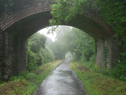
Today's walk was adapted heavily due to the conditions.  Two days of rain hadn't totally cleared, and the thought of slopping through agricultural fields did not appeal. The former track-bed of the Barnstaple to Ilfracombe railway line was tarmacked, dog off lead friendly and was appealing enough to turn into a there and back walk.

Its also Geocache laden, so I was able to find some on the way out, some on the way back and some not at all.

Tarka Line
Walking the Tarka Line
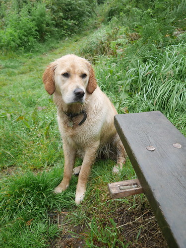
Hide and Seek with Guide Dog Abi
Guide Dog Abi, finding water, playing hide and seek
Abi helping with Geocaching
But helping with the Geocaching
Easy navigation and walking into the town to complete our survey, primarily looking for somewhere open to get a drink.

First thing we find is the landmark theatre - strangely reminiscent of the Sheffield Cooling Tower next to the M1.  The little beach front - with no anti dog warnings - is more appealing.

Theatre or Electricity production?
Theatre or Electricity Production
Capstone Point
Beach side romp

I've made a note of the Good Beer Guide pubs in town.  The Hip and Pistol is not quite reopen, the Wellington must be supporting the rule that you cannot judge a book by its cover and this leaves the Admiral Collingwood.

It looks mightily impressive from the outside but the sign font looks oh so familiar.  Although I have not downloaded the NeverSpoons app, I'm not quite ready to give Father Jack my money yet.  Having seen the latest posters of mistruth, this is even more unlikely in the near future.

Please don't mix politics and beer.  Politics and lies, OK.
Besides, Wetherspoons still have an outside dog ban.  We'll keep looking.

The search takes us the harbour, which is quite delightful.  Hand made pasties and ice-creams can be purchased and plenty of seating to enjoy them on.

Harbour
Damian Hirst Statue - Verity
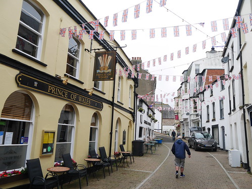
Fore Street seems a decent place to head for a drink - with the George and Dragon and Prince of Wales adjacent to each other but the latter the only one open before 4pm.

It wears is age well - signs suggesting a building has been here since 1280 and the bar area dominated by a 700 year old well that was found during C19th rennovations.

More important than that was an unlikely find of Timothy Taylor Landlord.  The first time I have found the king of beers since lockdown.

Prince of Wales
Fore Street - put out the bunting for a two pubber
Prince of Wales
Where to balance your TT Landlord

We continue our walk along the high street.  In the interests of positivity, I will leave the blog there.

Our friends and family were half right.


Wednesday, 8 July 2020

08/08/20 - Geocaching at Combe Martin

Distance - 6 miles
Geocaches - 43
First Geocache

If you have a plan, you have to stick with it... regardless of the weather.  I had a cache trail setup on the GPS from Combe Martin.  One look at the window and it became obvious that this would be a solo outing.... biblical rain, teeming in over the hills.

Guide Dog Abi and Mrs M decide to stay in, watching Good Morning Britain and researching "Best Devon Cream Teas" for this afternoons entertainment.

I head off - albeit without my good camera - grabbing one of the few road side parking spots on the way into Combe Martin.

Not going to do war and peace on the blog - I have a lot of logging to do - but the highlights..
  • Kevham is one of the best CO I have found for some time.  The caches are all handmade, raising a smile and well maintained.   Thank you so much - if you read this and let me know which pub you drink in, I'll leave you a pint behind the bar - assuming a) I visit it and b) it is open.
  • The walk takes me over the highest point of the South West Coast Path - on Hangmans Hill.
  • Of course, this was in the clouds.  All I can tell you is that it has a giant cairn on the top.
  • Goretex does not work.   I am soaked through to my non goretex pants
  • Its hard to cache when there is steam and water droplets on your glasses
  • In this part of Devon, when you are not going up, you are going down
Here are the few photos from today.

Combe Martin
Combe Martin Beach - no one there ay 8am in the rain
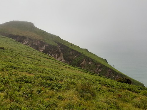
Little Hangman Hill
Little Hangman - Big Hangman was in the clouds
Combe Martin Church
Combe Martin Church - near the end of the round

Home, showered and dry and I think I have just enough time to log my caches before heading to May Cottage Tea Rooms, Croyde.

Tuesday, 7 July 2020

07/07/20 - Woolacombe to Bull Point

Distance - 6.5 Miles
Geocaches - 15
Walk Inspiration - AA Pocket Walks - Walk 9


In this post lockdown world - we are certainly doing our bit to revive the economy.  Our first contribution is when we pull up to the large car park at Woolacombe Beach and see it's £8 per day.  £4 if you can be back by 1pm.  Unlikely, we have plans for a pint and takeaway fish and chips.

Note to futureself - the less salubrious car park over the road is half that.

Woolacombe Beach
View from an £8 car park
The beach at Woolacombe is dog friendly, if you are heading in the other direction to our plans.  We take Joy down for a look at what she could have won and start the walk proper - heading North to the lighthouse at Bull Point.

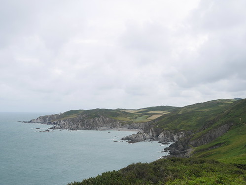
This must be the South West Coast at its most rugged.  Beautiful views out to Lundy and rollercoaster ups and downs, with the colour scheme changing from lush green sheep pastures to bleached white rocks.   A delight - made even better by a fantastically varied geocache trail - that proved fun until Guide Dog Abi got bored with all the hanging around.

Abi looking at what she has won
Guide Dog in Training Abi wishing we stayed on the beach
Devon Coastline
Our route for the day


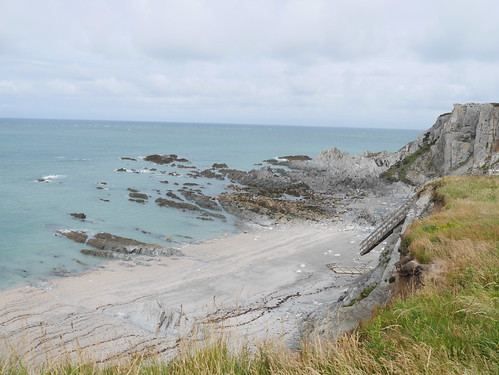
In the distance, we saw the steps down to Rockham Beach.  There was some deliberation about whether to drop down the steep decline, knowing we would have to climb back up.  On arrival, the reason for the lack of human activity was all too clear.

Rockham Beach - inaccessible
Stairs no more at inaccessible Rockham Beach
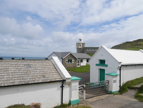
Bull Point - our turning around point - is not too far in the distance.  Prayers were made that there would be a tea shop but these were rendered unanswered - all there is a lighthouse - complete with fog horn.

Bull Point Light house
Bull Point - and the Turning Point
Mortehoe is a little inland village.  We were meant to only skirt the perimeter but on OS Map inspection, we spotted the Big Blue Cup of Joy.   Its midday - the pub is calling.

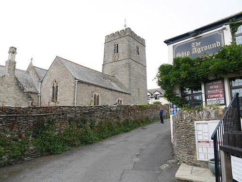
And it couldn't have been a prettier scene - dominant church and a wonderful little pub called the Ship Aground.  Double whammy on the disappointment stakes - the pub will not reopen until the risk of covid has been eliminated.  The chipper doesn't open until 2pm - although Mr Chipper is at work 2 hours early - distracted by his fishing rod delivery from Parcel Force.  We can only assume he is going self sufficient.

What sort of animal doesn't serve lunch until 2pm, Mrs M asks?  Only Devonian cider from the village stores will placate her.

Ship Aground and Morthoe Church
Church and Pub - the lovely looking Ship Aground
Korev and Devon Cider
Snakebite love  - making do with Cornish Lager and Devon Cider
As good as this was, it turned out to be another mistake - around the corner from the church is the fully functional Chichester Arms - looking both lively and earthy.

Chichester Arms
A case of "look what you could have won"
Its all downhill back to Woolacombe.  Mrs M has googled the best fish and chips shops - and of the ones open, its the Captains Table that has the highest reviews.

I am sent to work out the new rules - which involve waiting at the door until someone comes and serves you.

Delight at the fact that they are doing takeaways is only tempered when Fish and Chips twice comes to £23.90.

These masks mean that everyone gets to play at Dick Turpin.

Monday, 6 July 2020

06/07/20 - The Hunters Inn at Heddon Mouth

Distance - 6 Miles
Geocaches - 11
Walk Inspiration - Walk 56 AA 1001 Family Walks

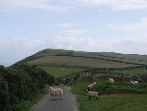
We have found the high point of the South West Coastal Path.  The clue was on the OS Map, where we start our walk at a little pull in above High Cliff.  At least it is all downhill to Trentishoe Church, on a sheep shared lane.

Start of the Ramble
Heading downhill, budging sheep out the way
Trentishoe Church
Trentishoe Church
We hit the valley floor - finding the River Heddon - and the pub that we will return to under mechanical power.  Abi decides that all this walking is hard work and takes advantage of the facilities.

Abi takes a rest
Trout fishing, guide dog in training style
The route follows the River Heddon to its exit to the sea.   A delightful walk through woodland, before turning gorge-like, across broken stones to a rocky beach.

Heddon Mouth
Onto the beach
Its here that the real work starts... a stiff climb up onto those High Cliffs on the South West Coastal Paths.  Views are earned.  Geocaches are found.

High Cliff
Dog's face says "we are supposed to be on holiday"
The good news is that once gained, the height is maintained all the way back to the car.

Onwards to the pub - The Hunters Inn is now in the hands of the National Trust - having been purchased in 2018 for £1.2m.  Looks like they are still spending money on it.

Hunters Inn
Work in Progress
Its a cavernous hotel that offers plenty of space for social distancing.  The barrels out front are to separate those that have booked from those that are on spec.  Little need, on a Monday Lunch Time.

We are met at the door - taken to a huge room we have to ourselves, following at all times the one way markers, taped to the floor.

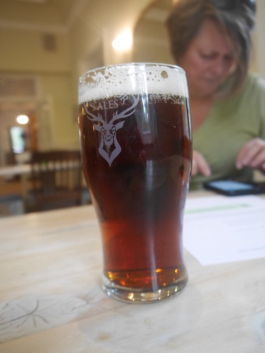
It does mean that we have our drinks served to the table - a decent pint of Exmoor Stag.

Exmoor Stag
Mrs M doing the Untappd Checkin