Showing posts with label Cicerone. Show all posts

Tuesday, 4 August 2026

04/08/26 - The Teme Valley at Eardiston

New Cicerone Guide Klaxon

I do like the Cicerone Day Walks Guides. Always interesting, always on the right side of challenging. And my home county has a new 2026 release.

Saves me having to think too hard

Having the car, I decide on Walk 2. The Teme Valley. I ask AI what to look for in the hamlets of Eardiston, Stanford Bridge, Orleton, Eastham and Lindridge. It replies, "There is nothing of interest there." Knowing me, as it does so well, AI then suggests a blog theme.

One theme that might work well is that "nothing happened" is actually the story.

It's not wrong.... I don't pass a church or a pub on a 12 mile route. Especially cruel when much of the walking is through cider apple orchards and hop gardens. Worse than that, my own fears from knowing the area are confirmed. Badly overgrown paths - to the point that it's nearly a non-starter - and ridiculously steep woodland climbs.  Walls Hill Woods is a case of one step forward, three steps back and pulling myself up by any available root.

That said, the occasional superb view presents itself and with no distractions, I can plod on at a reasonable speed. Stopping only for lunch on the AMCO at Eastham Bridge.

Entertainment in Eardington
How Eardington Locals Entertain
Lindridge Views
Down Valley
Lindridge Views
Up Valley to Abberley School Clock Tower

The OS Map does have one Big Blue Cup of Joy at Lindridge. A surprise that it lasted as long as 2009. Even more surprising, it had a short lived life after that as an Indian Restaurant. This was followed by a period of dereliction before being tarted up as a private residence. Rubbing the locals' nose in it by naming it "Nags Head House". 

No one likes Pedigree anyway

Walk Details

Distance - 12 miles

Geocaches - 3

Walk Inspiration - Cicerone Walks in Worcestershire, Walk 2


Thursday, 9 July 2026

09/07/26 - Charmouth to Lyme Regis, for the Brewery Tap

Diversion but Destination Remains the Same

Today's route was downloaded from the Cicerone book "Walking the Jurassic Coast". The good thing about the Cicerone books is that they publish regular online updates. As you would expect - this area has a lot more updates than others. The most unstable cliffs in the country.

Leading a group walk for five, it was a good job I made a visual inspection from Charmouth beach of the short route to Lyme Regis. The cliffs are now terraces, collapsing in stages. The footpath that would have crossed Black Ven and the Spittles is no more.

The SWCP - which we eventually followed - has been routed further inland. It requires more road walking than we would like but there is a pavement. And annoying golfers at Lyme Regis Golf Club is always to be encouraged.

SWCP to the side of Lyme Regis Golf Club
Off the road and into the woods, next to Lyme Regis Golf Course
Across the fariways
Eventually, the SWCP crosses the fairways

There's a stretch of path that is labelled on the OS Map as the Wessex Ridgeway. On the ground, it also has roundels for the East Devon Way - for which this stretch is either the end or the beginning. It's a wonderful path that hugs the river Lim, right into town. Past the pretty houses and if you look carefully, you may see decent sized trout bobbing around in the more still parts.

Along the Lim
The hidden River Lim path through town

It also leads to the town's best drinking spot. Lyme Regis Brewery Tap (the brewery is actually in Axminster now) is in a converted mill, right on the water. 

Last time I was here, it was a paddleboard of three thirds. One of our party wanted to repeat the experience with a paddleboard of pints - a bitter, a New England IPA and a South Coast IPA.

Lyme Regis Brewery Tap
I'm taking the photo - can you guess the inventor of the "pint tester board"?

The walk back to Charmouth could have been along the beach - but not at high tide. I think that we were all glad that a) 2:50pm was high tide and b) the 2:53pm bus was bang on time. That on time, gentle jogging to the bus stop was required.


Walk Details

Distance - 3.25 miles

Geocaches - 0


Friday, 21 March 2025

21/03/25 - Pub Crawl in Barnards Green, Great Malvern

One Day, Three Guide Books

The Cicerone book, Short Walks in the Malvern Hills, lives up to its name. A 2 mile stretch from the town up to St Ann's Well and back.

To make the most of the Connecta Worcesertshire Bus ticket, I've combined it with a stretch to Barnards Green. The reason for being in Malvern in the first place? A random selection from Hidden Places in Worcestershire.

St Ann's is well known to me. Birthplace of the Malvern Water Cure promoted by those healthy Victorians. Another example of things regressing in this country, there is now a sign saying bacteria has been found in the water and it must be boiled before consumption.

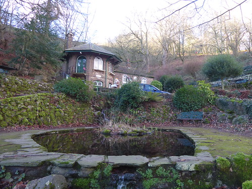
St Anns Well
Don't Drink the water

Back to town and then through the handsome housing and onto Malvern Common.

Malvern Common
Today, I'm down here. Normally, I am up there.

Barnards Green is a suburb of Great Malvern, nestled at the foot of the Malvern Hills. It has a bit of everything—local charm, practical amenities, and a surprisingly lively pub scene for its size.

Starting with the Three Horseshoes. A couple of cottages knocked together and large open plan inside. I couldn't warm to it for two reasons. Elton John, at his honky-tonking best, on too loud. And despite a good hunt around, not a single comfy seat to be found. I even tried the garden. 

The Timothy Taylor Boltmaker was in fine condition.

Three Horseshoes, Malvern
Sky Blue

Whereas I was the only punter in pub 1, the car park was overflowing at the Bluebell. The good people of Malvern obviously love a Gastropub. They must have more money than sense. Courage Directors at an eye watering £5.85. Little of note, other than an ornate wooden bar that wouldn't look out of place in a church.

The Bluebell, Malvern
Battleship Grey

The "Closed Pub" feature on Pubsgalore.com is used for the Forresters Arms. All on-line resources say it's open, yet the door is firmly bolted at 1:45pm on a Friday afternoon. A quick search takes me to the Admiral Taverns Facebook page, where they are looking for new tenants. Comments range from "What Again?" to "I wouldn't touch it with a barge pole".

Forresters Arms, Malvern
Half and Half

Saving the best to last is the perennial Good Beer Guide Entry The Morgan. Keen pricing and excellent beer. The Wye Valley full range is always on offer but I was never going to turn down cask Jaipur. I was that impressed with the £4.40 charge that it felt churlish to ask for the rest of the pint. 

The Morgan, Malvern
On second thoughts, I should have

Walk Details 

Distance - 5 Miles

Walk Inspiration - Pub Walks in Malvern, Hidden Places of Worcestershire and Cicerone Short Walks in the Malverns


Sunday, 7 January 2024

07/01/24 - St Ann's Well and Worcestershire Beacon

 Guide Dog Ivy's Last Hurrah


Exactly a year since Guide Dog Puppy #3 came to be trained in the dark arts of public transport, cafe culture and pub etiquette. 

Baby Guide Dog Ivy
She'll grow into those paws

We have 24 hrs until the puppy snatcher comes. Where to take her for her last hurrah?  The Malverns never disappoints.

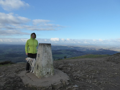
This is a familiar walk from town, to St Ann's Well, along the eastern side to Wyche, where Shire Ditch will make you the highest living things in Worcestershire.  

St Anne's Well, Malvern
St Annes Well for a potential first refreshment stop
On the Way to the Worcestershire Beacon
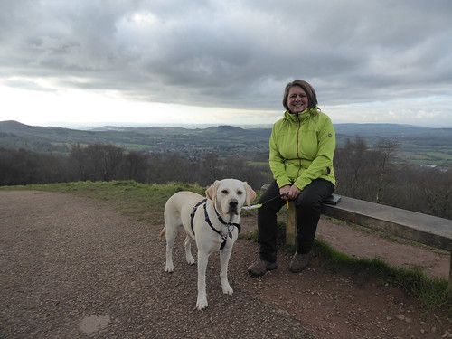
Guide Dog Ivy and the stricter of her two handlers
Highest Dog in Worcestershire
The Highest Dog in Worcestershire

The drop down return to town is along the Green Valley.  

When we meet people and get talking about Ivy, the inevitable question is "But how do you give them back?"

The short answer - cry loads and drink beer.

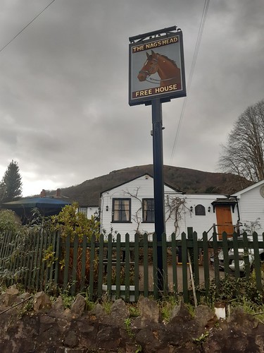
Starting at the best pub in the land.

The Nag's Head, Malvern
Something for everyone at the Nag's Head

Walk Details

Distance - 4 Miles

Geocaches - 0

Walk Inspiration - Cicerone Short Walks in the Malvern Hills, Walk 1