Distance - 74 Miles
Start and End Point - Alvechurch Station
Start Date - 05/10/13
End Date - 01/03/14
Geocaches Found - 58
The BrummieRing Summary at EveryTrail
As is customary after completing a Long Distance Path, a summary blog is required;
Inspired by the Capital Ring, I aimed to create something similar for myself in the country's second city. Armed with little else than an OS map and a sense of adventure, in one night, I plotted a round route and setup the website to track progress. The original plans and aim held and over four months, I worked my way around the City on a variety of good footpaths and canals, with as little road walking as possible.
The Best Section - There were a number of highlights. For pure walking, Stage 1 and Stage 11 had some excellent countryside and great views.
The Worst Section - You would have to stretch the imagination to get much joy from Stage 5. It started in Wednesbury. It past the West Midlands Bull Terrier appreciation Society. It then followed a canal all the way to its destination in Hamstead.
The Phases - (Click on Phase Hyperlink for Walk Details)
05/10/13 - Alvechurch - Phase 1
12/10/13 - Longbridge - Phase 2
19/10/13 - Old Hill - Phase 3
09/11/13 - Tipton - Phase 4
24/11/13 - Wednesbury - Phase 5
06/12/13 - Hamstead - Phase 6
19/12/13 - Sutton Coldfield - Phase 7
04/01/14 - Coleshill - Phase 8
25/01/14 - Marston Green - Phase 9
08/02/14 - Solihull - Phase 10
01/03/14 - Earlswood - Phase 11
Showing posts with label BrummieRing. Show all posts
Showing posts with label BrummieRing. Show all posts
Sunday, 2 March 2014

Saturday, 1 March 2014
01/03/14 - Mission Accomplished
Start - Earlswood Station
Finish - Alvechurch Station
Distance - 6 Miles
Caches - 2 Found, 1 DNF
Stage 11 of the Brummie Ring
BrummieLoopPhase11 at EveryTrail
The last piece of a plan that was hatched back in September 2013 has been completed. Phase 11, the final stage of the Brummie Ring, has been completed. Five months after setting off from Alvechuch Station, I return.
This sounds more heroic than it really is. I did a couple of legs every other weekend.
And this was a fitting end to the odyssey. We had sunshine. We had glorious countryside, including a trig point adorned hilltop. We had two pub stops and an exceptional lunch at the Coach and Horses on Wetheroak Hill. Even Sonia came, to join in the celebration nosh up.
The infrequency of the trains to Earlswood meant that a 5 mile journey would have taken a connection at the City Centre and 90 minutes. So we ordered a taxi. He was bang on the dot of 9:30, as arranged, and expressed mild interest in the finale of our challenge.
Dropped off at Earlswood Station, we gaiter up and head off down lanes. A shame that the first mile or so was along lanes, but our patience is eventually rewarded with some stunning walking.
Cache number one is found in the tunnel under the M42. We are in good conversation, which means a couple of detours as I am not really looking at the Sat Nav. It didn't help that the footpaths have been rerouted around Newlands Farm since my OS Map was printed.
We work our way to the trig point at Hob Hill. There is a cache here, but we will add to the previous DNF. Not to worry, the views over the M42, Longbridge and the Lickey Hills are stunning.
We can see Alvechurch in the distance, and we walk along great paths to reach our destination.
Time to reflect on what we have learned and discovered on our circumvention of the 2nd City.
On arrival at Alvechuch, we take a tour of the town.
I wanted to eat a big slap up meal at the Red Lion. Sonia is nothing but diligent in her research and the slaggings that this pub had taken on tripadvisor meant that he had a quick drink only. We couldn't stay for much longer, as the smoke from the real fire was billowing into the lounge.
So we drive on for a much better experience at the Coach and Horses. What a find. A brewery and a choice of three different menus. This will not be the last time I come here.
With this long distance path ticked off, I can get back to more regular walks. And dream up my next challenge.
Finish - Alvechurch Station
Distance - 6 Miles
Caches - 2 Found, 1 DNF
Stage 11 of the Brummie Ring
BrummieLoopPhase11 at EveryTrail
The last piece of a plan that was hatched back in September 2013 has been completed. Phase 11, the final stage of the Brummie Ring, has been completed. Five months after setting off from Alvechuch Station, I return.
This sounds more heroic than it really is. I did a couple of legs every other weekend.
And this was a fitting end to the odyssey. We had sunshine. We had glorious countryside, including a trig point adorned hilltop. We had two pub stops and an exceptional lunch at the Coach and Horses on Wetheroak Hill. Even Sonia came, to join in the celebration nosh up.
The infrequency of the trains to Earlswood meant that a 5 mile journey would have taken a connection at the City Centre and 90 minutes. So we ordered a taxi. He was bang on the dot of 9:30, as arranged, and expressed mild interest in the finale of our challenge.
 |
| A nice little hut to put on our waling wear |
Cache number one is found in the tunnel under the M42. We are in good conversation, which means a couple of detours as I am not really looking at the Sat Nav. It didn't help that the footpaths have been rerouted around Newlands Farm since my OS Map was printed.
 |
| Once in Newlands Farm, we had great views |
 |
| One of the best parts of the Brummie Ring |
 |
| Which provides these views |
Time to reflect on what we have learned and discovered on our circumvention of the 2nd City.
- Canals. Lots of Canals
- An Abbey
- Taking the dog on the train
- To Tipton
- Tramps. Lots of Tramps.
- Eating sausage sandwiches under a canal bridge near Wednesbury to shelter from the rain
- With Tramps
- 3 pubs in Solihull
- Sonia was driving that day
- The sense of achievement of completing a project
- And this is where we walked
On arrival at Alvechuch, we take a tour of the town.
 |
| Alvechurch. In Spring |
I wanted to eat a big slap up meal at the Red Lion. Sonia is nothing but diligent in her research and the slaggings that this pub had taken on tripadvisor meant that he had a quick drink only. We couldn't stay for much longer, as the smoke from the real fire was billowing into the lounge.
 |
| Bad Reviews on Trip Advisor. And their Lion isn't Red. |
 |
| But I can celebrate anywhere |
So we drive on for a much better experience at the Coach and Horses. What a find. A brewery and a choice of three different menus. This will not be the last time I come here.
With this long distance path ticked off, I can get back to more regular walks. And dream up my next challenge.
Saturday, 8 February 2014
08/02/14 - Penultimate
Distance - 8 Miles
Geocaches - 8
Start - Solihull Train Station
Finish - Earlswood Train Station
The Brummie Ring
The adventure nearly draws to a close. I have one leg to go. Sonia is coming with me on that for the celebration slap up dinner in Alvechurch. Before that, I have got to devise and deliver a leg from Solihull.
Initially, I was going to have this leg end at "The Lakes" station. However, in the 21st Century, this is a request stop. I have no idea how this works. If you are on the train, do you pull the emergency cord to make it stop? Ding a bell? If you want to get on it, do you have to lie down on the tracks and hope the driver sees you?
I have enough trouble getting on a bus, so I decide to make the end of the walk at Earlswood Station. They only go every hour, but at least there is no boarding complexity.
Spend most of the week checking the weather. Looks like I will miss the rain and just have gales to deal with. I can cope with that. Train from Kidderminster to Solihull and alight to get the nearby sidetracked cache. I did not have time to do this at the end of the last leg, as I was rushing for the train.
Someone has dumped their stash of cassettes in the undergrowth at GZ. You have to despair of humanity. Daniel O' Donnell, for god's sake. No wonder he didn't want to throw them in his own bin. Garbage men talk.
After a good rook for tunage, I get into the walk proper. Skirt the edges of Solihull, going past the Holiday Inn, Courts, Cop Shop and then pick up the now defunct Solihull Way.
This provides nice walking, as I go along alleys and green lanes. 2nd cache of the day is a cheekily hidden and not aided by the number of dog walkers around. 3rd takes me by surprise at its size.
First bit of greenery today is Hillfield Park. A nice expanse of football pitches, play areas (with zip wire) and a lake.
The 4th cache is meant to be huge, but I get my first DNF. I am sure it is around, just couldn't find it. Arrive at the Shirley's outskirts and nip down a footpath into proper countryside. With cows. And Sheep.
This brings me to the village of Cheswick Green. It has some history, first recorded in 1250 as Chesewic, which means Cheese Farm. It all looked rather disappointingly 1970's to me, although it did have a cache and a new build pub called the Saxon.
There is some road walking next, but its all very pleasant with a proper footpath and limited traffic. At last, I get a cache with a TB. This is the first of the year. I must have been looking in the wrong places.
The highlight of the walk is easily Earlswood Lakes. On the OS Map, they look exactly like a pair of jeans. They are even denim blue. I get to walk alongside and then through the middle of them, meeting Clowes Wood at the tip of the right hand leg.
I look at the time on my GPS and realise that I can make the 11:54, if I get a wriggle on. The trains only come once an hour, so it is reasonably important. Especially as there is no pub at the station.
I go as fast as my legs will carry me but I am challenged by ill defined paths and plenty of flooding. Eventually, I get my bearings which are alongside the track, but I still cannot make rapid progress because of the mud and floods.
With just another couple of minutes rapid walking to the station, along comes Mr Train. Punctual as ever. I resign myself to missing in it and take solace in a cache that I was going to do on the next leg.
Get to the station at 11:58. What to do? No pub but there is a garden centre. I may be thirsty, but I am not mental, so I decide to go and look for another cache. Think about walking to Wythall, the next station up, but the rain starts. Get the cache, and return to the station for a half hour wait.
I do get company at 12:52. But it is the local nutter. The blog is not the right place to record the conversation but it continued on the train. I thought I had lost him, but he came and found me and proceeded to ask me several more questions about car maintenance, bus services and the depth of flood water in the Worcestershire, Berskshire and Surrey areas.
Geocaches - 8
Start - Solihull Train Station
Finish - Earlswood Train Station
The Brummie Ring
BrummieRingPhase10
The adventure nearly draws to a close. I have one leg to go. Sonia is coming with me on that for the celebration slap up dinner in Alvechurch. Before that, I have got to devise and deliver a leg from Solihull.
Initially, I was going to have this leg end at "The Lakes" station. However, in the 21st Century, this is a request stop. I have no idea how this works. If you are on the train, do you pull the emergency cord to make it stop? Ding a bell? If you want to get on it, do you have to lie down on the tracks and hope the driver sees you?
I have enough trouble getting on a bus, so I decide to make the end of the walk at Earlswood Station. They only go every hour, but at least there is no boarding complexity.
Spend most of the week checking the weather. Looks like I will miss the rain and just have gales to deal with. I can cope with that. Train from Kidderminster to Solihull and alight to get the nearby sidetracked cache. I did not have time to do this at the end of the last leg, as I was rushing for the train.
Someone has dumped their stash of cassettes in the undergrowth at GZ. You have to despair of humanity. Daniel O' Donnell, for god's sake. No wonder he didn't want to throw them in his own bin. Garbage men talk.
 |
| Unbelievable - why use a bin, when the woods will do? |
 |
| A Dead LDP |
First bit of greenery today is Hillfield Park. A nice expanse of football pitches, play areas (with zip wire) and a lake.
 |
| Hillfield Lake |
 |
| Shirley - so good, Billy Bragg wrote a song about it. |
There is some road walking next, but its all very pleasant with a proper footpath and limited traffic. At last, I get a cache with a TB. This is the first of the year. I must have been looking in the wrong places.
The highlight of the walk is easily Earlswood Lakes. On the OS Map, they look exactly like a pair of jeans. They are even denim blue. I get to walk alongside and then through the middle of them, meeting Clowes Wood at the tip of the right hand leg.
I look at the time on my GPS and realise that I can make the 11:54, if I get a wriggle on. The trains only come once an hour, so it is reasonably important. Especially as there is no pub at the station.
I go as fast as my legs will carry me but I am challenged by ill defined paths and plenty of flooding. Eventually, I get my bearings which are alongside the track, but I still cannot make rapid progress because of the mud and floods.
With just another couple of minutes rapid walking to the station, along comes Mr Train. Punctual as ever. I resign myself to missing in it and take solace in a cache that I was going to do on the next leg.
Get to the station at 11:58. What to do? No pub but there is a garden centre. I may be thirsty, but I am not mental, so I decide to go and look for another cache. Think about walking to Wythall, the next station up, but the rain starts. Get the cache, and return to the station for a half hour wait.
 |
| 30 minutes is a long time in the Earlswood Tundra. |
Sunday, 26 January 2014
25/1/14 - Plane Spotting
Distance - 7.3 Miles
Geocaches - 4
Start - Marston Green Station
Finish - Solihull Station
The Brummie Ring Phase 9
Brummie Ring Phase 9 at EveryTrail
Sonia is working in Birmingham today. Seems the perfect excuse to share her rail commute and continue on to Solihull for Phase 9 of the Brummie Ring.
I need to get to Marston Green and careful planning with TravelInfoDirect shows that the 71 bus goes from Coach Stand G, directly outside Solihull Station. Oh I do love plotting my adventures. Bang on 9:20, the bus turns up for my 30 minute trip. Sat Nav Turned on so I know where to get off.
Minor drama at the destination, the Police are moving a stolen Mondeo, carelessly abandoned in my bus stop. I watch the ensuing drama (well, a repmobile being winched onto a flat loader) with a handy sausage sandwich and cup of tea from the Cafe that was closed at the end of Stage 8.
Once refreshed, move on to the walk. And it is a boster, possibly the best yet on the BrummieRing.
Straight from the station, I am in Sheldon Park, which allows me to skirt three parts of the airport perimeter.
A man comes up to me and asks if I saw the previous plane. I replied in the negative and he rambles on about how he couldn't tell if it was a 777 or a 747 but it was unusual as it was in all gray camoflage. I have to cut him off in mid flow before he thinks I am a fellow plane spotter. I reply that I have only just worked out how the 71 bus works.
The walking is great, with the added drama of an inbound or outbound flight. I just have to follow the fence.
There is a lonely remnant of the abandoned Solihull Way. It is still marked on my OS map, but the signage has nearly all disappeared.
Sheldon Park turns into a Golf Course but has turned into a total slosh pit. The way is totally flooded. I wonder how I will get through but when I see two joggers just jump on in, I know it should be OK for a man in goretex everything. They have seriously misjudged the depth, it is knee high. Still, their screams and frolics keep me entertained.
Exit the airport, over a road and along some alleys and I am delivered into the next highlight, Elmdon Park. The council bought this land in the 40's. It was a former stately home. Its high elevation provide some fine walking and views across the Midlands.
Drop down and the next few caches are available. The next is 4m up in a tree. I can see it. I am not going to climb it. Especially when there are so many families around. The next few are along a series of alleys that skirt the perimeter of the Land Rover Factory. Most are found. One isn't.
After a short length of road walking, I pick up the Grand Union Canal. Have it all to myself, save for a couple of canoeists who paddle on by. One more cache and one more DNF.
The peace and solitude is only broken up by a series of texts telling me that Sonia will be later than expected from work. No problem to me, I am nearly in Solihull and I am sure that there will be some way of entertaining myself. I have a book and £20.
Its nice to have the freedom of a couple of unexpected hours in a strange town. Hostelries await.
The first pub is a little too posh for me but I do take advantage of their outdoor astroturf and seating area to de-gaiter. And it looks like Solhull, poshest part of Birmingham, is also suffering from the credit crunch.
Choice of pubs. I have done my homework and the Sadlers Arms is the best rated. Presumably by people who think that the neck is the perfect place for a tattoo. Nice enough inside and the landlord comes round with a tray of Monkey Brain cocktails that he has knocked up. I stop counting as he reveals the fourth alcoholic ingredient.
Move on to the town centre proper and pop into the Masons Arms for lunch. Its going to be Scampi. I am asked whether I want to supersize it, and I think why not, I have plenty of time, a score and have worked up an appetite.
In exactly the length of time it takes me to walk back to my table (plus 30 seconds) my meal is delivered. I am told where the cutlery and condiments are, without the offer of them being fetched and count my deep fried shrimps. There are eight of them.
Thank god I supersized.
Decide that I will catch the 14:17 back to Kidderminster and meet Sonia there. The train goes through an incredible thunder and lightening storm, with massive hail stones. In January.
A spectacular end to the possibly my favourite part of the Brummie Ring.
Two to go.
Geocaches - 4
Start - Marston Green Station
Finish - Solihull Station
The Brummie Ring Phase 9
Brummie Ring Phase 9 at EveryTrail
Sonia is working in Birmingham today. Seems the perfect excuse to share her rail commute and continue on to Solihull for Phase 9 of the Brummie Ring.
I need to get to Marston Green and careful planning with TravelInfoDirect shows that the 71 bus goes from Coach Stand G, directly outside Solihull Station. Oh I do love plotting my adventures. Bang on 9:20, the bus turns up for my 30 minute trip. Sat Nav Turned on so I know where to get off.
Minor drama at the destination, the Police are moving a stolen Mondeo, carelessly abandoned in my bus stop. I watch the ensuing drama (well, a repmobile being winched onto a flat loader) with a handy sausage sandwich and cup of tea from the Cafe that was closed at the end of Stage 8.
Once refreshed, move on to the walk. And it is a boster, possibly the best yet on the BrummieRing.
Straight from the station, I am in Sheldon Park, which allows me to skirt three parts of the airport perimeter.
 |
| Off on their all inclusive Hols |
The walking is great, with the added drama of an inbound or outbound flight. I just have to follow the fence.
 |
| Stalag Walking |
 |
| Abandoned LDP |
Exit the airport, over a road and along some alleys and I am delivered into the next highlight, Elmdon Park. The council bought this land in the 40's. It was a former stately home. Its high elevation provide some fine walking and views across the Midlands.
 |
| Beacon and First Cache Location |
 |
| Pool in the Park |
 |
| Land Rover |
 |
| All the way to London |
Its nice to have the freedom of a couple of unexpected hours in a strange town. Hostelries await.
The first pub is a little too posh for me but I do take advantage of their outdoor astroturf and seating area to de-gaiter. And it looks like Solhull, poshest part of Birmingham, is also suffering from the credit crunch.
 |
| But what sort of Real Ale for they have? |
 |
| De-gaiter and decide I am probably not the sort of punter they are after. |
 |
| The Monkey Brains are on Me |
 |
| Historic Solihull - left of TouchWood |
Thank god I supersized.
Decide that I will catch the 14:17 back to Kidderminster and meet Sonia there. The train goes through an incredible thunder and lightening storm, with massive hail stones. In January.
A spectacular end to the possibly my favourite part of the Brummie Ring.
Two to go.
Saturday, 4 January 2014
04/01/14 - Les 4 Clint
Distance - 6.1 Miles
Geocaches - 4
Start - Coleshill Parkway
Finish - Marston Green Station
Brummie Ring Phase 8
Brummie Ring Phase 8 at EveryTrail
Happy New Year Blogfans. Plans have been made but before I get started on new adventures, I've got to finish off what I committed to last year.
The first walk of 2014 will be Phase 8 of the Brummie Ring. 3 to go after this stage. Despite the remnants of the worst storm of 20 years still hanging around, Sonia wants to come as well.
So we head off for Marston Green Station. Free parking for rail users, but I have completed my Internet based homework and I know that a single to Coleshill Parkway (5ish miles away) is £7.50. Each.
We think about getting a Cab, but despite Sonia's iPhone saying there is a cab firm in Station Road, it seems to be well hiddden.
Train it is. Not to worry, the train change over provides opportunity for a coffee and a sausage sarnie at New Street.
I knew the walking at first would be a bit dodgy. We have to get out of the business park that has sprung up since the OS Map was produced. These means that some of the footpaths have disappeared but we do manage to get out to the countryside at the A446 / M42.
Anyone wanting to follow in our footsteps on the Brummie Ring is going to need to get a wriggle on. For the first time in my walking career, I have found evidence of how the HS2 rail line will affect footpaths.
And these laminated signs are not the only information that is provided on route. It took me a while to get what the message was, as the L and I were a touch close together. And either our graffiti artist is a gent or it was Les the Lady doing the vandalism.
This section of land is marked as the Belt on the OS Map. It is sandwiched directly between the M42 and the M6, so the experience of walking the excellent paths is marred by the droning vehicles.
After crossing the M6, and another dual carriageway, we pick up what is marked on the OS Map as the Solihull Way. It is still marked with the badges of three Long Distance Paths, but the Solihull Way is no longer maintained.
Sandwiched between a dual carriageway and tower blocks, this wins my prize as strangest LDP found.
I drop down the bank for my first cache of 2014 whilst Sonia uses Google Maps to determine when she can expect to get out of the rain. Back up the bank and along the roads to the Cole Bank Nature Reserve.
During the plotting of the walk last night, I knew that a section would be alongside the River Cole.
Normally, it would have been fine walking. Today, its a slosh pit. I am OK as my boots are watertight and I have gaiters. At time of writing, Sonia has neither but I am taking her to Go Outdoors tomorrow. Its amazing how high she can get mud up the inside of her legs. She insists its because she is closer to the ground.
A couple of enforced detours because of the conditions, but we more or less follow the planned route along Kinghurst Brook, finding Chelmsley Wood and a last couple of caches.
Youths with chips pass us and Sonia, who didn't want sausage based snacks on the train, is reminded of her hunger.
There is a cafe at Marston Green Station. Closed on a Saturday. We head into the small town and the only pub available.
Geocaches - 4
Start - Coleshill Parkway
Finish - Marston Green Station
Brummie Ring Phase 8
Brummie Ring Phase 8 at EveryTrail
Happy New Year Blogfans. Plans have been made but before I get started on new adventures, I've got to finish off what I committed to last year.
The first walk of 2014 will be Phase 8 of the Brummie Ring. 3 to go after this stage. Despite the remnants of the worst storm of 20 years still hanging around, Sonia wants to come as well.
So we head off for Marston Green Station. Free parking for rail users, but I have completed my Internet based homework and I know that a single to Coleshill Parkway (5ish miles away) is £7.50. Each.
We think about getting a Cab, but despite Sonia's iPhone saying there is a cab firm in Station Road, it seems to be well hiddden.
Train it is. Not to worry, the train change over provides opportunity for a coffee and a sausage sarnie at New Street.
I knew the walking at first would be a bit dodgy. We have to get out of the business park that has sprung up since the OS Map was produced. These means that some of the footpaths have disappeared but we do manage to get out to the countryside at the A446 / M42.
 |
| Once squeezed through the checkpoint, all paths are in order |
 |
| Didn't have time to digest it all, but assume its bad news for this path |
 |
| Love Is - declarations on trees |
After crossing the M6, and another dual carriageway, we pick up what is marked on the OS Map as the Solihull Way. It is still marked with the badges of three Long Distance Paths, but the Solihull Way is no longer maintained.
 |
| Strange LDPs |
I drop down the bank for my first cache of 2014 whilst Sonia uses Google Maps to determine when she can expect to get out of the rain. Back up the bank and along the roads to the Cole Bank Nature Reserve.
 |
| Cache 2 just the other side of this fence. |
 |
| Yesterday's Fears Confirmed |
A couple of enforced detours because of the conditions, but we more or less follow the planned route along Kinghurst Brook, finding Chelmsley Wood and a last couple of caches.
Youths with chips pass us and Sonia, who didn't want sausage based snacks on the train, is reminded of her hunger.
There is a cafe at Marston Green Station. Closed on a Saturday. We head into the small town and the only pub available.
 |
| 44, Great Big Menu and she orders a Fish Finger Sandwich |
Thursday, 19 December 2013
19/12/13 - When Maps and Sat Nav both Fail
Distance - 8.1 Miles
Geocaches - 5
Start - Sutton Coldfield
Finish - Coleshill Parkway
Stage 7 of The Brummie Ring
Brummie Ring Phase 7 at EveryTrail
This has taken some planning. Initially, I planned to walk to Water Orton railway station. Then I checked the train times - 1 train into BRM every 2 hours. The railtrack app did present some options - I could change at Coleshill Parkway. Checked the map - there's not even a station marked at Coleshill.
Turns out its a new development. And until September 2015, they are offering free parking. So, with an out of date in car sat nav I head off, park up and buy my ticket to Sutton Coldfield. £8:30. What they lose on parking, they are adding to the train fares.
Simple enough change at New Street and within 45 minutes, I am out of Sutton Coldfield station and onto stage 7 of the Brummie Ring. First a couple of distractions.
There is a sidetracked cache at the station. When I arrive at GZ, two men disappear behind the advertising hoardings. They are either cachers or this is a gay cruising area. The amount of time they spend there makes me think it could be the latter, but once they have gone (three's a crowd in any hobby), I see the logbook has been signed today.
Then I realise that I'm starving. And there are the golden arches of obesity opposite. So I battle my way through the school kids and moms with buggies and do a festive special happy meal.
I have been here 45 minutes and not got anywhere.
So I head off with purpose, up the hill by Trinity Church and down to Rectory Park. Where the sat nav gives up the ghost. I can see the maps, but I have no dot to show where I am. So that's that for the caches and I have to rely on old school map navigation.
Road walking for a bit before hitting the countryside at the Anvil Pub.
I have road walking but it is at least in the countryside. There is a nice verge to avoid any of the white van drivers who are going at it like loons whilst talking on mobile phones.
I reboot the sat nav for the 3rd time and miraculously it comes to life. I am back in the caching game.
Find a couple of caches on the way to Over Green. Another nice looking pub, the Cock Inn, would have been good for a facebook checkin. From their car park, I hit the real countryside, with some nice views.
These fields bring me to Curdworth, where I negotiate a series of secret alley ways before walking around the boundary of the first school. It just had to be break time, as I go round two sides of their fence with all the kids gawping.
Final cache of the day is on the bridge over the m42/m6 toll road intersection. 13 lanes of motorway are crossed.
Then I have to make my way to the station. The OS Map has nice fields of Newlands Farm but he has obviously sold out to haulage firms, as there is now a series of dual carriageways and massive trucks.
Lorry drivers have a bad name. Clarkson thinks they like nothing better than a bit of casual Student murder. On a Channel 4 documentary, a lorry driver in a ridiculous mask claimed at least 70% of them are doggers.
There is a sign telling them to stop it. Whatever it is.
The next sign is just as vague but makes me think that I have walked a little too far.
Finally, we walk past Coleshill Sewage Farm. Oh the romance.
So would I have chosen to do this walk for pleasure? Maybe not. It is just another stage serving its purpose of getting one stage closer to finishing the Brummie Ring. The Capital Ring had some dodgy sections as well.
Geocaches - 5
Start - Sutton Coldfield
Finish - Coleshill Parkway
Stage 7 of The Brummie Ring
Brummie Ring Phase 7 at EveryTrail
This has taken some planning. Initially, I planned to walk to Water Orton railway station. Then I checked the train times - 1 train into BRM every 2 hours. The railtrack app did present some options - I could change at Coleshill Parkway. Checked the map - there's not even a station marked at Coleshill.
Turns out its a new development. And until September 2015, they are offering free parking. So, with an out of date in car sat nav I head off, park up and buy my ticket to Sutton Coldfield. £8:30. What they lose on parking, they are adding to the train fares.
Simple enough change at New Street and within 45 minutes, I am out of Sutton Coldfield station and onto stage 7 of the Brummie Ring. First a couple of distractions.
There is a sidetracked cache at the station. When I arrive at GZ, two men disappear behind the advertising hoardings. They are either cachers or this is a gay cruising area. The amount of time they spend there makes me think it could be the latter, but once they have gone (three's a crowd in any hobby), I see the logbook has been signed today.
Then I realise that I'm starving. And there are the golden arches of obesity opposite. So I battle my way through the school kids and moms with buggies and do a festive special happy meal.
I have been here 45 minutes and not got anywhere.
So I head off with purpose, up the hill by Trinity Church and down to Rectory Park. Where the sat nav gives up the ghost. I can see the maps, but I have no dot to show where I am. So that's that for the caches and I have to rely on old school map navigation.
Road walking for a bit before hitting the countryside at the Anvil Pub.
 |
| No Stopping - full of Burger - but the Countryside is ours from now on |
I reboot the sat nav for the 3rd time and miraculously it comes to life. I am back in the caching game.
 |
| Find something on the verge to make me realise I am not the only one who has had Sat Nav Issues |
 |
| Outstanding in my field |
 |
| I'm a lonely oak |
Final cache of the day is on the bridge over the m42/m6 toll road intersection. 13 lanes of motorway are crossed.
Then I have to make my way to the station. The OS Map has nice fields of Newlands Farm but he has obviously sold out to haulage firms, as there is now a series of dual carriageways and massive trucks.
Lorry drivers have a bad name. Clarkson thinks they like nothing better than a bit of casual Student murder. On a Channel 4 documentary, a lorry driver in a ridiculous mask claimed at least 70% of them are doggers.
There is a sign telling them to stop it. Whatever it is.
 |
| What is Car Cruising on Hams Hall? |
 |
| How far is Coleshill from France? |
Finally, we walk past Coleshill Sewage Farm. Oh the romance.
So would I have chosen to do this walk for pleasure? Maybe not. It is just another stage serving its purpose of getting one stage closer to finishing the Brummie Ring. The Capital Ring had some dodgy sections as well.
Saturday, 7 December 2013
06/12/13 - Dead Centre of Birmingham
Distance - 7.48 Miles
Geocaches - 5
Start - Hamstead
Finish - Sutton Coldfield
Stage 6 of the Brummie Ring
What an unusual day. I find myself on short term career break, between jobs like a resting actor. Having driven to Birmingham to hand in my laptop, pass and (thank the lord) mobile phone, I can have a go at being retired for December.
How should I take a bit of time for reflection? I know, I'll go and add a stage to the Brummie Ring.
And my planets are aligned. I get the last free of charge parking space in Sutton Coldfield Station. Are you watching Kidderminster? Then I get to the platform and the ticket man has shut up shop so he can scuttle off to the loo. His gait suggested a big job in store. Get on the platform and try to buy from the machine on the platform. Massive queue. Maybe it was his number 2 number 2? The first train pulls up, so I think I will buy it from the conductor. He doesn't come. So free parking and a free ride.
I will donate the £2.30 to charity.
Alight at Hamstead station and head uphill for more canal walking. It does give me the opportunity to replace the cache I inadvertently destroyed on Stage 5. Not totally altruistic, as I can grab another smiley.
A couple of caches along the canal require me to text home from a non smart phone to decipher clues. Do you know what Bathmophobia means? Seriously hope my new job comes with an iPhone. If not, I think I will be off to carphone warehouse. Or I could confiscate Alex's when he is next naughty.
In the main, the canal is fine. We have a drop of 106ft at Perry Barr Locks, pass the Alexandar athletic stadium and a nice reservoir. However, GZ for cache three of the day is a bit grim.
At long last, I say goodbye to the canal. The rules of the BrummieRing are that refreshment stops cannot be passed by. Even when they are as rough as this.
It is surprisingly busy. Not my sort of place, they have no real ale. Of any type. Honestly, what sort of a pub is this? I settle on a Guinness. Well I say I settle, the bar lady pour 2/3rds of it and leaves it on the bar before heading off. This is fine practice but it only works when they come back to finish it.
I am left staring at my celebratory pint for an age. Probably longer than it takes me to drink it and head into Witton Cemetery.
It may be ghoulish, but i do like a good cemetery. Head through it, reading the dates on the gravestones. One is adorned with a big fat santa claus.
The walking continues to surprise, as we pass Witton Lakes and then head into the recreational ground. Middle of Birmingham and I am managing to cut a green a leafy trail through it. Just what I hoped for the Brummie Ring.
Stop off for an urban cache with TB drop off.
I now I have a bit of main road walking to contend with and I try and break it up by heading through a housing estate. Hit a dead end. OS Maps are good, but they don't help with alleyways. However, it is worth it. I am accosted by a lady who has just got off the mobility bus. She asks me, "Do you know anything about that?" in an angry voice. I ask what. She points at a Satellite dish.
It transpires that someone has erected a dish on the side of her house and she knows nothing about it. I suggest that a) she follows the cable to find the culprit and b) she doesn't target future domestic disputes at ramblers.
The road walking is worth it, as we head into Sutton Park. I have walked here before and you could spend days exploring. A superb location and a great place to end the walk.
Another excellent stage added onto my odyssey.
I drive back and get stuck in the usual M6 traffic. And what can I see - Witton Cemetery and the Safe Harbour pub. I shall notice it every time from now on.
Geocaches - 5
Start - Hamstead
Finish - Sutton Coldfield
Stage 6 of the Brummie Ring
BrummieRing - Phase 6
What an unusual day. I find myself on short term career break, between jobs like a resting actor. Having driven to Birmingham to hand in my laptop, pass and (thank the lord) mobile phone, I can have a go at being retired for December.
How should I take a bit of time for reflection? I know, I'll go and add a stage to the Brummie Ring.
And my planets are aligned. I get the last free of charge parking space in Sutton Coldfield Station. Are you watching Kidderminster? Then I get to the platform and the ticket man has shut up shop so he can scuttle off to the loo. His gait suggested a big job in store. Get on the platform and try to buy from the machine on the platform. Massive queue. Maybe it was his number 2 number 2? The first train pulls up, so I think I will buy it from the conductor. He doesn't come. So free parking and a free ride.
I will donate the £2.30 to charity.
Alight at Hamstead station and head uphill for more canal walking. It does give me the opportunity to replace the cache I inadvertently destroyed on Stage 5. Not totally altruistic, as I can grab another smiley.
A couple of caches along the canal require me to text home from a non smart phone to decipher clues. Do you know what Bathmophobia means? Seriously hope my new job comes with an iPhone. If not, I think I will be off to carphone warehouse. Or I could confiscate Alex's when he is next naughty.
In the main, the canal is fine. We have a drop of 106ft at Perry Barr Locks, pass the Alexandar athletic stadium and a nice reservoir. However, GZ for cache three of the day is a bit grim.
 |
| Who dumps shoes at a canal? |
 |
| Fortunately, it mainly looks like this |
 |
| Unsafe and nowhere to moor your boat |
I am left staring at my celebratory pint for an age. Probably longer than it takes me to drink it and head into Witton Cemetery.
 |
| Birmingham's Largest Cemetery |
The walking continues to surprise, as we pass Witton Lakes and then head into the recreational ground. Middle of Birmingham and I am managing to cut a green a leafy trail through it. Just what I hoped for the Brummie Ring.
Stop off for an urban cache with TB drop off.
 |
| Ping Pong in the Park |
It transpires that someone has erected a dish on the side of her house and she knows nothing about it. I suggest that a) she follows the cable to find the culprit and b) she doesn't target future domestic disputes at ramblers.
The road walking is worth it, as we head into Sutton Park. I have walked here before and you could spend days exploring. A superb location and a great place to end the walk.
 |
| We are in Birmingham |
 |
| And here I am |
I drive back and get stuck in the usual M6 traffic. And what can I see - Witton Cemetery and the Safe Harbour pub. I shall notice it every time from now on.
Monday, 25 November 2013
24/11/13 - Staffordshire Bull Terrier Appreciation Society
Distance - 5.8 Miles
Geocaches - 3
The BrummieRingPhase5
Start - Wednesbury Parkway
Finish - Hamstead
I am back adding a new section to the BrummieRing.
Thanks to a combination of Micky Flanagan performing at the NIA and me having some Holiday Inn points to use up, I am doing this leg in the way that it was intended. I am starting in the centre of Birmingham, saying my goodbyes to Sonia as she gets the Kidderminster Train from Snow Hill and I get the Tram to Wednesbury Parkway.
With both our modes of transport leaving at 9:30am, we are chasing each other out of the station. I don't get a wave.
25 minutes later, I am disembarking at Wednesbury. Its grim on an overcast sunday morning. To start, I have some road walking to pick up the canal, which is my main walking footpath.
A diversion for a cache brings me to an appreciation society for the most frequently spotted canine on this odyssey.
After passing a pub and a couple of shops (lollipop and water purchase), I pick up the Tame Valley Canal.
The canal is my walking superhighway to end of this leg. It does provide much nicer walking than the previous canal stage.
I am elevated, which often provides good views. I also cross several aqueducts, the most impressive being the M5 slip road onto the M6. Countless times I have driven under here without realising a canal crosses it.
The canal becomes increasingly leafy. There are two types of fishermen on display, the human worm danglers and a more impressive natural hunter, which I stop and watch for a while.
As I progress towards Hamstead, I have some great views over Birmingham. First time we have seen it since stage 2.
Have a bit of a disaster with the last cache of the day. It is dangling from my exit bridge on a bit of fishing wire. The wire is all tangled up in a plant on the side of the bridge. My gentle attempt to retrieve results in a snap and the cache disappears to its doom, never to be seen again.
A log of shame coming up.
Hit Hamstead. The chance of refreshment is thwarted by it being on only 11:57. But this is good news, as the trains only run once an hour on a Sunday at 11 minutes past.
Glad that the next phase has only a little bit of Canal Walking. They have got a touch monotonous.
Geocaches - 3
The BrummieRingPhase5
Start - Wednesbury Parkway
Finish - Hamstead
I am back adding a new section to the BrummieRing.
Thanks to a combination of Micky Flanagan performing at the NIA and me having some Holiday Inn points to use up, I am doing this leg in the way that it was intended. I am starting in the centre of Birmingham, saying my goodbyes to Sonia as she gets the Kidderminster Train from Snow Hill and I get the Tram to Wednesbury Parkway.
With both our modes of transport leaving at 9:30am, we are chasing each other out of the station. I don't get a wave.
25 minutes later, I am disembarking at Wednesbury. Its grim on an overcast sunday morning. To start, I have some road walking to pick up the canal, which is my main walking footpath.
A diversion for a cache brings me to an appreciation society for the most frequently spotted canine on this odyssey.
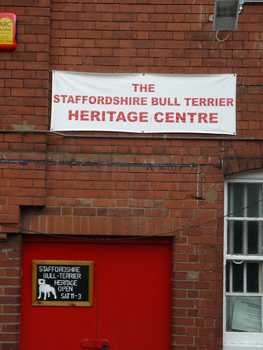 |
| You couldn't make this up, could you. |
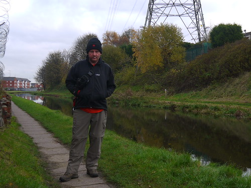 |
| Canal all the way to the end of Phase 5 |
I am elevated, which often provides good views. I also cross several aqueducts, the most impressive being the M5 slip road onto the M6. Countless times I have driven under here without realising a canal crosses it.
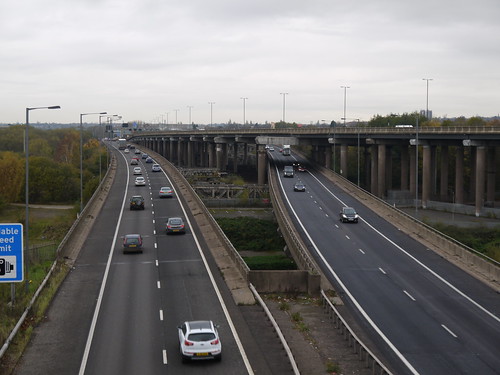 |
| A Canal Runs over it |
 |
| Great Hunter |
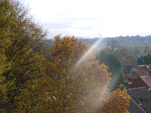 |
| Birmingham - in the Sunshine |
A log of shame coming up.
Hit Hamstead. The chance of refreshment is thwarted by it being on only 11:57. But this is good news, as the trains only run once an hour on a Sunday at 11 minutes past.
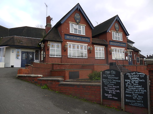 |
| Too Early on a Sunday |
Saturday, 9 November 2013
09/11/13 - Canalysis
Distance - 6.2 Miles
Geocaches - 3
Start - Tipton
Finish - Wednesbury
Stage 4 of the Brummie Ring
Adventures come in many guises. I have been reading about the Yorkshire 3 peaks, the welsh 3000's and the people bagging Wainwrights.
This week's adventure has been working out how to catch the bus from Wednesbury Parkway to Tipton.
Buses scare me. Only the old truly understand them. Getting them to stop to get on is a challenge... knowing where to get off, an impossibility.
Things couldn't go better though. We drive to Wednesbury Parkway tram station and come out the car park. The 313 is due at 9:06. It is 9:05 when we hit the shleter. Immediately the bus comes. Two singles to Tipton is not a phrase Sonia thought she would ever say out loud, but we are on and away. Sat Nav is turned on, so that I can have an idea of where we need to get off. The concentration means that I miss all the sights.
At the right place, I ding the bell and we are off, picking up the BCN main line canal to our official start at Tipton Station.
Not too much to say about the walk. The BCN Main Line is an OK canal. There is a lot of litter and the rainy conditions mean that we are probably not seeing it in it's best light.
We have a slight detour down the Gower Branch line to get our first cache of the day. A distraction from the weather.
We continue and leave the BCN Main Line to pick up the Walsall canal. This means coming off the Towpath and taking the road bridge. Its the half way point and we hope for refreshments.
Looks promising.
Sonia had higher hopes of the Log Cabin Cafe. She was expecting seats and a roaring fire. She made do with Bacon Sarnie to complement my sausage and black pudding. To get out of the rain, we head under the bridge on the Walsall Canal.
There are fishermen there. We experience black country humour in all its glory as they ask we have bought them any and they say "never mind, we are having fish and chips" when they land a gudgeon.
We say bye to our new friends and continue north on the Walsall Canal. The rubbish gets us down. Cans of every sort of Polish Beer ever invented break up the mounds of dog poo.
At cache location number 2, we find the culprits (beer not poo). A gang of half a dozen al fresco 10am boozers, who on completion of a Tyskie, lob the empty into the cut. And there are a lot of empties.
Find the cache and move onto number 3 for the day. A previous DNF, is found today. Just as a youth on a motorbike with no helmet comes whizzing paste.
Sonia is kind of relieved when the walk comes to an end. Will she come for BrummieRing Stage 5?
Geocaches - 3
Start - Tipton
Finish - Wednesbury
Stage 4 of the Brummie Ring
Adventures come in many guises. I have been reading about the Yorkshire 3 peaks, the welsh 3000's and the people bagging Wainwrights.
This week's adventure has been working out how to catch the bus from Wednesbury Parkway to Tipton.
Buses scare me. Only the old truly understand them. Getting them to stop to get on is a challenge... knowing where to get off, an impossibility.
Things couldn't go better though. We drive to Wednesbury Parkway tram station and come out the car park. The 313 is due at 9:06. It is 9:05 when we hit the shleter. Immediately the bus comes. Two singles to Tipton is not a phrase Sonia thought she would ever say out loud, but we are on and away. Sat Nav is turned on, so that I can have an idea of where we need to get off. The concentration means that I miss all the sights.
At the right place, I ding the bell and we are off, picking up the BCN main line canal to our official start at Tipton Station.
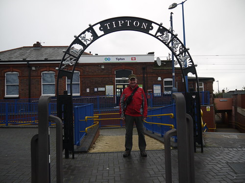 |
| Let's start the Brummie Ring, Phase 4 |
We have a slight detour down the Gower Branch line to get our first cache of the day. A distraction from the weather.
We continue and leave the BCN Main Line to pick up the Walsall canal. This means coming off the Towpath and taking the road bridge. Its the half way point and we hope for refreshments.
Looks promising.
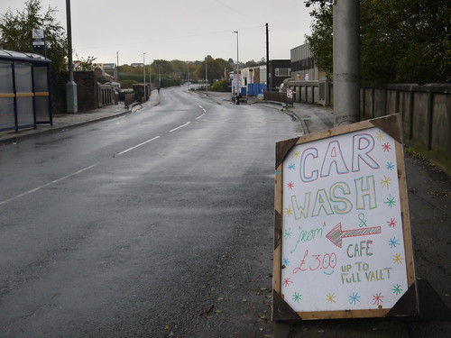 |
| A sign to a cafe.... and a car wash |
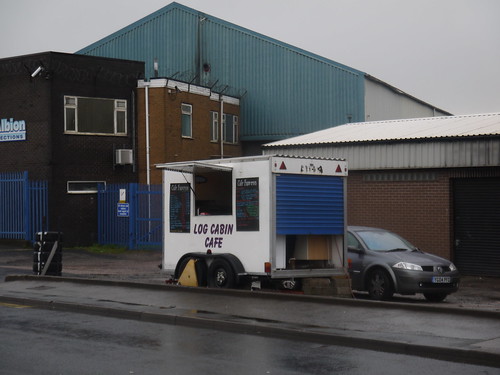 |
| It's the Log Cabin Cafe |
There are fishermen there. We experience black country humour in all its glory as they ask we have bought them any and they say "never mind, we are having fish and chips" when they land a gudgeon.
We say bye to our new friends and continue north on the Walsall Canal. The rubbish gets us down. Cans of every sort of Polish Beer ever invented break up the mounds of dog poo.
At cache location number 2, we find the culprits (beer not poo). A gang of half a dozen al fresco 10am boozers, who on completion of a Tyskie, lob the empty into the cut. And there are a lot of empties.
Find the cache and move onto number 3 for the day. A previous DNF, is found today. Just as a youth on a motorbike with no helmet comes whizzing paste.
Sonia is kind of relieved when the walk comes to an end. Will she come for BrummieRing Stage 5?
 |
| If she doesn't, she will miss submerged shopping trolleys. |
Subscribe to:
Posts (Atom)