Friday, 10 July 2026

10/07/26 - Uplyme to Lyme Regis

Borderland

I am guessing the river Lim marks the boundary of Dorset and Devon. Not that there is any condiment faux pas to be made regarding baked goods.

Being 100% honest, I wasn't necessarily up for this walk. We had completed an hour with the dog before the heatwave really struck home and the thought of going on a march in the midday sun was only appealing to mad dogs.

Yet Mrs M was right. She also found Gyros for lunch. So hats off to Mrs M for the encouragement.

The walk was meant to start in one of the Lyme Regis car parks - but in a bid to save £8, I notice a big blue cup of joy at the village of Uplyme - en route. This is the Talbot Arms and it has a large car park. It is only on our return that an A-board has been placed saying "Parking only whilst using the pub". We did use the pub and there was plenty of space.

The walk creator was really keen to show the Cannington Viaduct. Footpaths were available that would have avoided a there and back walk under it. An impressive architectural feat, especially when you consider it was only in operation for 62 years. It would take modern Britain longer than that to build it today.

Cannington Viaduct
Mrs M lightening the mood by commenting it's a fine place for suicides

Lanes, woodland and fields take us to the SWCP on Ware Cliffs, via a steep and perilous descent at Chimney Rock. 
Chimney Rock
Chimney Rock
Views from the SWCP, west of Lyme Regis
On the SWCP, looking towards Golden Cap

Downhill all the way to the Cobb end of Lyme Regis. The conditions today making it impossible to ask Mrs M to channel her inner French Lieutenant's Woman.


View from the Cobb
View from the Cobb

An endless choice of refreshment options in Lyme Regis. Personally, we're never going to walk past a sign at the Royal Standard offering Gyros. It's been long enough that we've forgotten how tricky a pitta bread stuffed with sauce, chicken, salad and chips can be to eat. 

Our sauce covered beard (me), shins and walking papoose (Mrs M) are soon hidden away from the crowds as we follow yesterday's discovered River Lim Path all the way to the pub to pay for parking.

The Talbot Arms, Uplyme

A pleasant enough single roomer that could only be improved with air-conditioning. Three of the Otter Family of beers were available but it was far too 'ot to risk cask. I need to work on my pronunciation, but this Spanish Lout really hit the spot.

The blog is due a change of direction.

The Talbot Arms, Uplyme
The Mahous are on me

Walk Details

Distance - 6 miles

Geocaches - 4

Thursday, 9 July 2026

09/07/26 - Charmouth to Lyme Regis, for the Brewery Tap

Diversion but Destination Remains the Same

Today's route was downloaded from the Cicerone book "Walking the Jurassic Coast". The good thing about the Cicerone books is that they publish regular online updates. As you would expect - this area has a lot more updates than others. The most unstable cliffs in the country.

Leading a group walk for five, it was a good job I made a visual inspection from Charmouth beach of the short route to Lyme Regis. The cliffs are now terraces, collapsing in stages. The footpath that would have crossed Black Ven and the Spittles is no more.

The SWCP - which we eventually followed - has been routed further inland. It requires more road walking than we would like but there is a pavement. And annoying golfers at Lyme Regis Golf Club is always to be encouraged.

SWCP to the side of Lyme Regis Golf Club
Off the road and into the woods, next to Lyme Regis Golf Course
Across the fariways
Eventually, the SWCP crosses the fairways

There's a stretch of path that is labelled on the OS Map as the Wessex Ridgeway. On the ground, it also has roundels for the East Devon Way - for which this stretch is either the end or the beginning. It's a wonderful path that hugs the river Lim, right into town. Past the pretty houses and if you look carefully, you may see decent sized trout bobbing around in the more still parts.

Along the Lim
The hidden River Lim path through town

It also leads to the town's best drinking spot. Lyme Regis Brewery Tap (the brewery is actually in Axminster now) is in a converted mill, right on the water. 

Last time I was here, it was a paddleboard of three thirds. One of our party wanted to repeat the experience with a paddleboard of pints - a bitter, a New England IPA and a South Coast IPA.

Lyme Regis Brewery Tap
I'm taking the photo - can you guess the inventor of the "pint tester board"?

The walk back to Charmouth could have been along the beach - but not at high tide. I think that we were all glad that a) 2:50pm was high tide and b) the 2:53pm bus was bang on time. That on time, gentle jogging to the bus stop was required.


Walk Details

Distance - 3.25 miles

Geocaches - 0


Tuesday, 7 July 2026

07/07/2026 - The Royal Oak, Charmouth

Golden Cap Views

Charmouth becomes the base of our latest dog sit. 5 days in heatwave number 3 of 2026. We are unsure how many of the planned walks we will manage to execute but we start with the shortest.

Charmouth is a picturesque coastal village in west Dorset, located on the Jurassic Coast between Lyme Regis and Bridport, where the River Char meets the sea. Famous for its fossil-rich cliffs and dramatic scenery, the village has a fascinating history, including visits from royalty. Catherine of Aragon is said to have stayed here in 1501 before her marriage to Prince Arthur, while the most famous visitor was the future Charles II, who hid in Charmouth in 1651 after defeat at the Battle of Worcester while attempting to escape to France. An Adventure Lab Cache points us to the Abbot's House, which has provided accommodation for both of these royal guests. And considering one was Charles II, it's no wonder the Monarch's Way LDP runs through it.

The Abbots House, Charmouth
Royal Patronage at the Abbot's House

We've walked Golden Cap several times but never from this direction. Alas, due to the heat and the dog we are in charge of being 70 (dog years) we decide to shorten the walk a mile from the summit. There are plenty of escape routes to make this possible. The walk follows the Monarchs Way over cliffs before walking back to town via Stonebarrow Hill.

The River Char meets the Sea
The footbridge across the river Char, where it meets the sea
Looking back towards Lyme Regis
Looking back from the Monarch's Way, over Lyme Regis
On the Way to Golden Cap
Mrs M and Bluebell agreeing Golden Cap is just too far.

Back into town, for a choice of refreshments. Charmouth hosts two pubs, the Royal Oak and George, one cafe and one chipper.

We were told the Royal Oak is the posher of the two. This is probably due to the prices, as it is a Palmers tied house. Less than two weeks since I paid the most for cask at another one of their outlets, the Ferry Inn, Salcombe.

Royal Oak, Charmouth
Not quite needing a mortgage for a round today

Legendary pub crawler Alan Winfield declared this the best pub in Charmouth, and I intended to discover whether his judgement still held true before the end of the week. Admittedly, his review was from 2000, when Charmouth could probably boast another six other pubs. I only have the George to visit.

The Palmers 200 was certainly in good enough shape to earn an early vote of confidence. A happy blend of locals and visitors created the right atmosphere, with tourists doing what tourists do best: loudly debating the cost of car parking (a conversation I was so desperate to join with). Add in the friendly staff, and the signs were already pointing towards Alan having got this one right.

Walk Details

Distance - 4.5 miles

Geocaches - 5


Friday, 3 July 2026

03/07/26 - The Old Royal Library, Malvern

Late, for the Summer Solstice 

This was meant to be walked on 21st June. It was also meant to be walked at sunset. I was meant to light a fire. My first excuse is that I have been busy on the coastal walking. My second excuse is that we have the 1am England Mexico game this weekend. I am not staying/getting up late twice in succession. My third excuse, I would be shot for lighting fires in the tinderbox heatwave we are experiencing.

Summer Solstice: The Longest Day

June brings the great pivot of the year: the Summer Solstice, when the sun seems to pause at its zenith before beginning its slow decline.

It's a festival of fire and light, of fullness and ripeness, of standing still in the very height of things.

Pilgrimage at midsummer has always been drawn to the great circles of Stonehenge, Avebury and Callanish, where sunrise aligns with ancient stones in a drama that has played for millennia. And, of course, in a more contemporary way, Glastonbury Festival, always occurring around Midsummer's Day.

But it can be as simple as walking to the highest hill near you, lighting a small fire, and watching the sun dip late before rising early once again.

For my highest hill, I have picked the County Top of Worcestershire - the Beacon. 

A short but beautiful walk that I know well. Up the 99 steps to St Annes Well, yomp along the spine of the Malverns and then work my way back to town along the western side of the hills. Four locations of an Adventure Lab Cache telling the history of the working donkeys of Malvern, adding to the entertainment.

St Annes Well, Malvern
St Annes Well
Traditional Caching with views
Traditional Caching, with views
Worcestershire Beacon Toposcope
The Toposcope
Worcestershire Beacon Trig Point
Trig Point Bagging

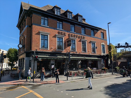
To finish a perfect day, Black Country Ales have opened a new pub, the Old Royal Library. Directly opposite the Unicorn, which has subsequently closed down. The two things may be related, but the Unicorn has survived years opposite a much cheaper (and grander) Wetherspoons. They were used to competition.

The Old Royal Library
New Pub in Town - The Old Royal Library


Everything one would expect from a BCA - the usual decor, cobs, bewildering range of unknown breweries and real cider/perry.

Walk Details

Distance - 5 miles

Walk Inspiration - Julie Royle's Worcestershire Walks Book 2
Geocaches - 6

Previous Celtic Pilgrimages - Imbloc, Spring Equinox, Belatne

Wednesday, 1 July 2026

01/07/26 - Kingswear, for the Seven Stars at Dartmouth

Beat The Clock


A new walk for us today. Requiring a ferry and on the other side of the Dart Estuary, it may not quite be within the South Hams that we have come to love so much.

We've a lot to pack in today. A 6 mile walk, two ferry crossings and a substantial lunch. It's pack-up day today and England KO at 5pm. We intend to be on the road back to the Midlands bang on 7pm, hopefully to contemplate quite how we will watch the next round at 1am on a Monday morning.

That's a problem for another day. First, we have to work out how to fit all this activity in when the longest of long stay car parks in Dartmouth is 4 hours. I mean, we would use the park and ride but it has 1-star reviews, my favourite complaining that there are no buses to take you park. So that's just an out-of-town "park" then, is it?

The walking is superb. Once across the estuary, we march inland first - heading up to Higher Brownstone before dropping down to the coast path at Coleton Fishacre and Pudcombe Cove. The coastline home, after dolphin and seal watching on the Mew Stone. Such a rollercoaster route - we are either walking up or down, which of course eats into our available time.

The Dart Estuary
The Dart Estuary
A holloway up to Higher Brownstone
A holloway leads to Higher Brownstone
Heading towards Mew Stone
Coast Path to the Mew Stone
One of the Froward Points
Having a breather after one of the "ups"
Mew Stone
The Mew Stone - home to dolphins and seals
Mill Bay Cove
Ziggy demands a swim at Mill Cove

On completion, we have an hour to spend before eviction. Fish and Chips (£36 for two, but Rockfish was in the Telegraph's best Chippers 2026) and a bench. Ziggy charged with protecting us from an ever growing number of circling seagulls.

This leaves time for a very quick pint at the new 2026 Good Beer Guide Tick. The Seven Stars advertises itself as Dartmouth's oldest pub. Probably reason enough for a visit. Perhaps not quite reaching the cuteness of last year's entry, The Cherub, but the beer was excellent. A cool Jail Ale rounding off a fine week of exploration.

Seven Stars, Dartmouth
The Seven Stars - Dartmouth's Oldest

Walk Details

Distance - 6.5 miles

Geocaches - 3

Walk Inspiration - 40 Walks In Devon

Tuesday, 30 June 2026

30/06/26 - Burgh Island from Ayrmer Cove

£2 for a plastic cup

Here I go again, on a stunning walk in the South Hams. This is an easy one, to a special place. 

Catch it right, and you can walk on a sand bar - with waves lapping at your feet to the east and to the west and visit the oldest pub in Devon, The Pilchard.

You've just got to navigate a bit of a stupid system. Beer, of below quality, is served in plastic glasses for which you pay a £2 deposit. I've got a problem with plastic glasses at the best of times, but having a system that doubles the queuing time in an oversubscribed pub is beyond ridiculous. Two sets of punters, early off season on a tuesday and it took 10 minutes for the one member of staff to stop making coffees to give provide the deposit refund. Mrs M convinced this is a ruse, with most people giving up and keeping the cup as a souvenir.

Blog ranting over - this is a simple walk from a National Trust car park. A holloway leads down to Ayrmer cove and then the coast path runs past Challaborough Caravan City to the island.

Holloway to Ayrmer Cove
Ziggy loving the shady holloway
Ayremer Cove
Ayrmer Cove
First views of Burgh Island
Tide looking good for a walk to Burgh Island

Despite the earlier slagging of the Pilchard, there are things in its favour. A 10am opener and a beer garden with unbeatable views. Time it when you can get inside and it's all you'd expect from a ancient, smugglers inn.

The Pilchard Inn
A sea tractor, should the tide be in
The Pilchard Inn
Ahoy there shipmates
The Pilchard Inn
The £2 Plastic Cup, with ropey Dartmoor Legend

A rollercoaster of ups and downs through the tiny village of Ringmore for the return.

Walk Details

Distance - 4.5 miles

Geocaches - 3

Walk Inspiration - 40 Walk in Devon 

Monday, 29 June 2026

29/06/26 - The Ferry Inn, Salcombe

Save Up for Portlemouth Down


This is another of our "must walks" in The South Hams.

Salcombe Town lies on one side of the Kingsbridge Estuary. It's all winding streets, artisan gin and equally artisan ice cream outlets, with plenty of other shops competing for your holiday dollar.

A £3 ferry ride is all it takes to reach the opposite shore, where golden sandy beaches and some of South Devon's finest coastal walking await. We studied the ferry over coffee. The largest combined fare for the 3 minute journey. £36. No wonder it was the same chap piloting it as last year. Pound per hour, he is the richest man in Devon. A title the landlord of the Ferry Inn, which we will come to later, is desperate to steal.

This short but spectacular route passes the idyllic Mill Bay and Sunny Cove before opening out onto dramatic clifftop paths leading to Gara Rock and Portlemouth Down. From there, the walk loops back inland along a wonderfully atmospheric sunken holloway, providing a fitting finale to a memorable circuit.

The Salcombe Ferry
A fine way to start/end a walk
Mill Cove
The coves on the east side of Kingsbridge Estuary
On the way to Gara Rock
At the sea, heading towards Gara Rock on Portlemouth Downs
The holloway home
A shady holloway for the return

Devon CAMRA must have been reading my blog. There is always one pub in Salcombe in the Good Beer Guide and after last year's walk, I pronounced the pint at the Kings Arms, their recommendation, the worst of the entire week. They have been stripped of their entry and in 2026, this belongs to the Ferry Inn.

Whatever happens, it will be the winner of most spectacular entrance to a Good Beer Guide pub.

The Ferry Inn, Salcombe
Mrs M (and Ziggy) looking forward to the Ferry Inn
The Ferry Inn, Salcombe
Unobstructed view from ferry
The Ferry Inn, Salcombe
Side On

And possibly winner of best view from a beer garden.

Ferry Inn, Salcombe
Palmers 200, looking over to where we walked

Of course, there is a catch. This 1749 boozer is a Palmers house. A phrase that normally induces an ache in the wallet. Add that to a tourist pub, with a view, in a place where the kids are called Ophelia and Tarquin and expect the worst.

Two pints - £15.30. 

No Crisps.

Walk Details

Distance - 7.5 miles

Geocaches - 0

Walk Inspiration - Komoot

Sunday, 28 June 2026

28/06/26 - The Albert Inn, Totnes

The South Hams Way

Totnes throws off quirky Glastonbury vibes. Interesting people, independent shops and three Good Beer Guide Pubs. Just the one open for business at midday on a Sunday - but they do Sunday Lunch. A suitable enough temptation to drag Mrs M from her desired coastal walks.

It was during our last visit that I discovered the South Hams Way. A newly launched Long Distance Path tracing the perimeter of the area for 100 miles. A section from Totnes along the River Dart to Ashprington provided the opportunity to complete an inland section.

Another on the list?

The walking is easy... The footpath is surprisingly distant from the river - possibly due to its tidal status and the climb into Ashprington very steep. But it's a pretty little village, complete with a functioning pub - The Durant Arms.

The River Dart
As far as you can sail up the Dart to Totnes
The South Hams Way
The Dart broadening out near Ashprington
Devon Views
Devon Views
Looking over Totnes from the South
After lane walking from Ashprington, views over Totnes

Into town - where the only outlet selling mystical stuff needs to be in liquid format. 

The Bay Horse Inn - a 1pm opener. On a weekend.  Strange hours.
Copperhead Ales Taproom - must be religious. They don't open on a Sunday at all.

This leaves the Albert Inn. A Taproom for the Bridgetown Brewery. 

The Albert Inn, Totnes
Einstein a-go-go

There has been a weekend long beer festival running. I know this, as my first two choices marked on the chalk board have sold out. This left a mild or a Pale Ale (Accolade) from the brewery to try.

A good atmosphere in the pub, as veterans from the previous two days festivities finished their walk of shame for more of what didn't kill them to make them stronger. The barman announced his surprise to see each and every one of them.

Walk Details

Distance - 6.25 miles

Geocaches - 4

Walk Inspiration - Komoot


Saturday, 27 June 2026

27/06/26 - Bolt Head

The gentlemen morning drinker is better served at 'Spoons


Another perfect walk from Komoot. Mrs M goes as far as to say it is her "walk of the year". Interesting, as a variation of the route won a similar accolade back in the dark covid days of 2020.

Today, we battle the "lanes" of the South Hams to start at East Soar National Trust Car Park. Not the official South West Coast Path (we follow this on the way back, underneath our current position) but fine views in all directions.

View from the top of Sharp Tor
Looking up the estuary to Salcombe

Beautiful woodland walking through Overbecks brings us to a decision point. We know the beach at South Sands is not "dog-friendly". We also know that it is our only potential refreshment stop - having ignored the honesty tea and coffee facilities at Soar Farm. We decide a view of the Salcombe Castle ruins is worth the effort. And what an inspired decision that was.

At the first A-board with the word "bar", we head down a steep slope to what turns out to be the South Sands Hotel. A stunning terrace, overlooking the beach. Other patrons? Drinking champagne out of the required chalice. Fear not, their kids have Aston Villa tops on, so it ain't that posh.

Mrs M sends me off to order a flat white. I ask if she is sure, as I am going for a cool, refreshing beer. As is the wont of all women, she says that she will just have some of mine. It may be 9:45 am, but we have been up hours and time works differently when you are on holiday. Alas, their licence only covers them for residents until 10:30 am. Villa parents look smug with their pinkies out, as I contemplate googling the nearest 'spoons.

All is not lost. The coffees were delicious and no more than Starbucks, as Rockerfella Mrs M points out to me. 

And what a view - the castle, a fort and a sea tractor that we both agree will never make it across the estuary.

South Sands, Salcombe
Transpires the tractor is just a jetty and passengers disembark to a proper boat

Refreshed, we tear ourselves away for what is possibly the best walking of all of the SWCP.  The climb to Bolt's Head is proper Lord of the Rings territory. The sea views can be taken for granted but the gnarly rock formations are something a little different.

Climbing to Bolt Head
Mrs M and Ziggy
Climbing to Bolt Head
A seaward facing retaining wall for safety

Another route added to the "South Hams Must Be Walked" list. If we come next year, no planning will be required.

Walk Details

Distance - 5 miles

Geocaches - 2