Friday, 29 April 2011

29/4/11 - Wychbold - Curse of the Royal Wedding

Distance - 3 Miles
Geotrail
Number of Caches - Should have been 18
Number Attempted - 9
Number Found - 8

Wychbold Part 1 at EveryTrail


Needed to get out of the house this morning to avoid my daughter and mother in law having a royal love in on the TV. Things haven't got off to a great start as I was Mappiman the Taxi last night. When I should have been in bed at 10:30pm, I was instead there at 12:30 after having to pick her royal highness up from some school prom. Despite a giggle at the girls attempting to look elegant in heels that would put Lady Gaga to shame, but looking more like Bambi on ice, it meant that I was too wired from the journey back to sleep properly.

Up early to get to a new geotrail over at Wychbold. Things get off to a bad start when I realise that I haven't loaded the GPX file in and my Windows SmartPhone GPS must have turned itself off incorrectly as it is saying it has 0% battery left. This turns out to me a lie - but has me worried I won't have the juice to get around properly. God Damn Bill Gates.

Park up at the Church and then head out of a possibly the wrong footpath, as I am joining the trail at a funny point. I am concentrating that hard on finding the first cache that I haven't paid attention to where I should be going and have somehow managed to cut the walk almost completely in half.

Head through some sheep fields to the birdwatching cache. See evidence that quite a few cachers have been here before.

Overzealous searching
I am walking past the huge transmitters back to the main A38 road.  Notice that I probably should have gone over the railway line and picked up a wider loop.  Never mind, I can still navigate the increasingly difficult stiles that gives the dog a problem.  Eventually navigate the final padlocked gate, 5' stile to reach the A38 and go down the path to little gains farm.  Wonky stile on the left that we manage to get across and then into a field of ponies. 

This is turning into a dog agility show and at the 3rd stile, the three ponies on the other side of the fence will not move.  I climb over and attempt my best Rowdy Yates impression to yee-hah them out of the way but the stubborn mules will not go.  The Labradoodle refuse to leap this one, so I head back to the road to pick up a footpath a bit further down which will lead me to the caches. 

Guardian Keepers of the Cache

Back to the road and down the Paper Mill lane (another cache in the series at the end of here).  At the end of this track, I should be able to pick up a footpath going west.  It is there, but badly overgrown with stingers.

Get through that in Geodog
Manage to get over (dog under) a five bar gate to the side and then end up literally in someones back garden.  I am on a right of way but I can understand the owner's reluctance to maintain this path as you are in their garden.  Hence, an unavoidable wade through 3ft Stingers to get through.

A bit of backwards and forewards to pick up the caches that the Ponies so badly wanted me not to get (other cachers, bring sugerlumps or a French Recipe book to make passage).  I am then out on the A38 again, back up Church Lane for the last cache and the car.

Stop at McDonalds.... Realise that my grumpiness has probably been caused by a lack of decent coffee.  Get home and see the Wedding.... doesn't she look beautiful.  Not Kate, Elton.

On review, I have more or less exactly cut this trail in half... I shall return.... possibly without snoop dog.

Wednesday, 27 April 2011

26/4/11 - Callow End Pub Walk

Distance - 3 Miles
From - Pub Walks around Malvern
Number of Caches - 1
Cache
Number of Pubs - 1, The old Bush
What was on the Mixed Grill - Steak, Pork Chop, Lamb Chop, Bacon Steak, Sausage, Liver, Kidneys, Onion Rings, Mushrooms and a nice bit of garnish.


At long last, a proper mixed grill.

Another bucket list - tick off the 20 pub walks around Malvern.  Well it keeps me out of the pub.

A lot cooler than of late.  An easy straightforward walk from the pub car park heading out towards the Hills and quickly turning back at Deblin's green.  Return route takes you up onto some common land called Old Hill.  All views obscured by the trees.

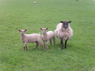
Sonia liked the inquistive sheep.  In fact, she liked them that much that she had one for her tea.

The one in the middle now only has three legs.

Callow End at EveryTrail

Monday, 25 April 2011

25/4/11 - Habberley Valley Geotrail

Distance - 4.5 Miles
Number of caches - 11
Number found - 10
First cache

Habberley Valley Geocaching at EveryTrail


Wasn't sure whether to go today.... I looked at this trail and the lack of clues and some older logs meant that this was going to be a tough and igenious round.  As I am not the greatest at looking for things, I thought Mrs Mappiman would come and give me a hand... after all, she is the first port of call for when ever anything is put away missing in the house.

Alas, she was in the gym, along with generation +1 and generation -1, so I went out alone in Nature's gym to find this.  This is a small walk, but a couple of stiff climbs but you are rewarded with stunning views.  Good trails and all caches on footpaths to make it a very good circular walk.

I am proud of myself that I managed 10 out of 11 on a solo trip, as most had no clues and were incedibly well contrived.  Thanks to Captain Parsley for a stunning round.  In the interests of letting others enjoy the search, I cannot say anything here or in the logs but there is plenty to smile about on this round.

The other great thing is that I spend a lot of time travelling the country looking for the most beautiful locations and at times on this walk, I have forgotton that some of them exist on my own doorsteps.  Click on the everytrail link for some of the scenery photos.  Others below

Track

Stream part of the Walk

Miserable Labradoodle - Why do we spend so much time hanging around in the woods?
Released my first travelbug in one of the caches - lets see how far this goes.

A stunning collection of caches.  Highly recommended.

Sunday, 24 April 2011

24/4/11 - Enville - but where's the hill?

Walk - One Hundred Hill Walks around Birmingham
Distance - 7 Miles
Geocaches - 8

Enville at EveryTrail


There was a major problem with this walk - despite it appearing as walk 97 in One Hundred Walks around Birmingham, there was no hill in the actual walk.  I can only assume that Richard Shurey was running out of locations as he neared the end of his book.

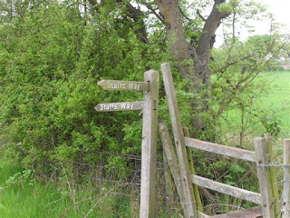
After taking in the first cache at a bench opposite the church, we headed into someone's back garden to pick up the Staffordshire Way.

Not trespassing, but if it was my garden, I would have built a dividing fence

Staffs way on the start of the walk.
The Staffs Way is a good path.  I have followed it south from here through the Enville Estate before but this is the first time I have headed north.  One huge cache on the way to Lutley.  Nothing at Lutley, but we turn right, still following the Staffs Way and Sonia demonstrates why she is useless at Hide and Seek.

Can you see me?
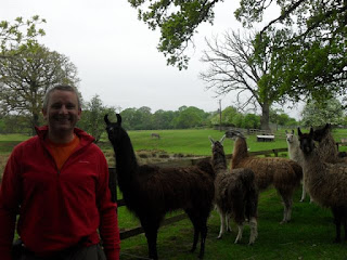
This leads on to Mere Hall Farm, with its Menagerie of animals - everything from a Peacock, to Llamas.  There is a cache here called "Animal Farm" and I ask Sonia what she thinks its is called and she replies "Donkey Derby".


More Midlands exotic wildlife.

After passing through the pools, we come off the Staffs way onto Highgate Common. More tiny caches here and lots of dog walkers.  Nice area, as you walk under the light planes coming into Halfpenny Green airport.  Again, nice walking.
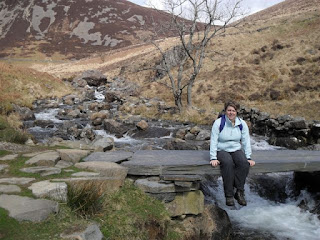
Highgate Common
After walking through the common and realising there is no hill on this walk, we have a long, disappointing trudge back down lanes that are busy with cars - all 4x4 types whizzing down.  This is a pain and a sad end to the walk. 

Quite a releif to eventually get back to Enville... unfortunately, 20 mins too early for the Cat to be open, so we return home to find Ellie has covered the Kitchen, iPad and everything in between in Rock Cake goo.  Still, they were nice.

Pleased to get home.

Saturday, 23 April 2011

22/04/11 - Stella with Mappiman

Distance - 10.3 Miles
Walk from - CW Magazine Sep 2008
Number of cache - Only Two
First Cache

The Slad Valley at EveryTrail


At school, they forced us to read Laurie Lee's Cider with Rosie.  They would have been better served if they had bought us on a field trip to the area where the book was set.  Although, I doubt the 15 year old me would have appreciated it as much as I did today.

The Slad valley always appears on Britains Best walks lists - including the top 100 that Country Walking Magazine put together.  Ticking these off has to be another life goal, so on a glorious bank holiday, I packed my camel pack and camera and headed off to Painswick.

Painswick represented the half way point when I completed the Cotswolds Way four years ago.  I completed it over two weekends, so was picked up after stage 1 and dropped off for stage 2.  As a result, I haven't explored the town before, but dropping down the steep streets, there are myriad shops and pubs tucked away.  The Royal Oak was a very welcome stop off place on my return and the Stella was well earned.

Once dropping to the Valley floor, I climbed up through Cockshoot and Blackstable woods.  This was good walking with excellent view of Painswick in the distance.  The woods provided a bit of shade from the Sun, which meant that my hat and glasses, which undoubtedly made me the coolest walker in Slad, were not really required.  A few photo opportunities.

Painswick From Cockshoot

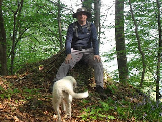
Coolest Walker in Slad - My dog's arse

Bluebells
A little bit of roadwalking - although very quiet country lanes, before picking up the most scenic part of the route in the valley at Famish Hill near the Camp.  This was exceptionally beautiful and I had the place to myself.  It's a lengthy stretch of walking, climbing up and down the valley sides and criss crossing the valley floor. Frequent gasper stops were required to survive Nature's gym.

I speak dog - she said "What are you doing?"

After all this strenuous walking in the sunshine, we arrive at Swift's hill.  The route doesn't actually require me to climb this one last stretch, but there is a cache at the top, so it would have been rude not to.  I am rewarded with the best views of the day, looking out to Stroud in the distance.  It was a bit too hazy to make a good photo, but I did stop for a while to drink in the views.

Time to roll over and nap.

Convice the dog to pose... there is a treat in it for her - no walking tomorrow.
There are other humans on this hill - for the first time today.  Being at one with nature must have brought the romance in a couple of 60 year olds.  As I walked down off the hill they were lay down in a passionate embrace.  We respected their privacy and gave them a wide berth.

Another drop down into the outskirts of Slad (some expecptional properties here) and have another stiff climb up to woods.  I must admit, after nine miles of this, I am getting a bit fed up with another climb, but I know that I am not far from the pub now.  Get up onto a long wooded ridge through woods, emerging at Bull's cross for my 2nd and final cache of the day.

Then, it's just a question of the drop and climb through Painswick.  Decided on the Royal Oak, not because it was the first pub on route, but because of its promised of good food (met) and beer (met).  Sat in the garden, eavesdropping on a group of ladies planning their route on the Cotswolds Way.

A great way to enjoy the unseasonably warm Easter and another top 100 walk ticked off my bucket list.

Tuesday, 12 April 2011

11/4/11 - Capital Ring Phase 2

Distance - 4 Miles
Starting Point - Falconwood
Ending Point - Grove Park
Number of Caches -2
Walk Details
Stage 1

Capital Ring Phase 2


Having never been to Falconwood before, who would have thought I would be back so soon.  Take the train  from Waterloo East to Falconwood and avoid the temptation of going for a chicken and ribs combo again and head off.  The skies are omninous and although it never rains too much, the hood is up for a large part of this walk.

I modified the start slightly to take in a couple of caches on the Green Chain walk, which the Capital Ring shares for many miles along the route.  The caches are straightforward and there are only two but at least I have recorded some progress on this odyssey.

Interesting building number 1 is the Eltham Conduit... there is no sign or anything saying what it was or did, but it looked interesting enough to warrant a photo.

Answers on a Postcard
This soon leads to Eltham Palace.  You have to pay to get in, and the Website says that it is worth it.  I tried to sneak a peak over the walls.  Didn't get a photo that did it justice.... so I lifted one from the web.


This leads onto St John's Walk which is easily the best part of the walk.  I almost didn't notice, as the texts were coming in about the boy being safe and well in America but look to your right for an awesome panorama of the City.  I think we are about 5 miles from Canary Wharf but you can pick out all the major structures from St Pauls, to Post Office Tower and the Eye.  What is amazing is how the Shard is going to dominate the sky line.

Lots of Photos on the everytrail link.

What I am circumnavigating
From this ancient walk way, I am deposited in Mottingham... this looks a nicer part of London than both where I start and finish on the walk.  Across a few fields and I walking alongside the wonderfully monikered Quaggy River.  It looked like an open sewer, if the truth is told.

The one rule I have on this walk is stop at any pub on route.  Phase 1 had a grand total of 1 - at the end.  Phase 2 follows suit.  I checked Grove Park on google maps and the Baring Hall hotel looked like it would do.  You can zoom in and read the menu.

Alas, like all explorers, I had to man up and cope with the major adversity on reaching the destination.

No tea for Mappiman

20:03 Back from Grove Park back into Charing Cross and a closer look at many of the sites that I could see in the distance.  A quick visit to the Coach and Horses on Romilly Street.  If you are ever in London go to this pub.  They have a cockney knees up on the old joanna on a Wednesday.

Sunday, 10 April 2011

10/4/11 - Micro Trail from Stourport to Bewdley

Distance - 7.6 Miles
Number of Cache - 9
Number found - 8
Number of Brummies eating chips with their tops off, showing tattoos - 394
First Cache

Crobba Cache Trail


This is a first for us - a caching trail out on our bikes.  Weather is glorious, bored to tears by the Villa vs. Newcastle game, so at 5:30, we get the bikes out the garage and head off to take in this newly laid trail.

Down canal to chav central that is Shipley's and the head upstream to Bewdley.  Convinced there is a sale on at a Burberry's hat shop.

We don't get off to a great start - cache 1 has to be logged as a DNF.  We spent 20 mins there going through every angled post but no joy.  In reflection, I reckon its in a hollowed out hole on the underside of one of the posts as we had a thorough look.  There was a previous find today, but they had to phone a friend, so maybe they will offer advice!

Cache 2 is straigtforward and Cache 3 is the highlight.  Another lengthy hunt, but what views.  I have been here many times but never clambered up the rock face.  Really pleased to eventually get the cache.

Camera lady said breathe in... believe me, I was.
Cache 4 put a smile on my face and then its carry the bikes up to the bridge and back down the other side for the return trip.

All the caches here to the bridge at stourport were easy enough and well placed / hidden.  The path was just about passable on a bike, but I do feel like I have been in the grand national now I am writing this an hour on my return.  Think I need to upgrade my bike.  There were a couple of stiles to hioke the bike over and of course, getting it up the metal steps when we get to cache 9.

Then a quick blast through town.  Road riding, avoiding souped up corsas with big fat exhausts.

Very nice trail - thanks crobba.  Get home and find out I missed nothing on the football.

Saturday, 9 April 2011

09/04/11 - Flyford Flavell - Geocaching

Distance - 4 Miles
Number of Caches - 9
First Cache
Most unusual animal observation - Llama

Flyford Flavell - Geocaching


No-one told me this starts at Worcestershire's pub of the year.  If I had known, I surely would have saved this round of caches for a nice Summer's evening, where a pint would have been most welcome.  As it was closed, I had to make do with a ginger beer from the village stores and watch Sonia attempt to eat a Bakewell Tart in one go.

There are a lot of Geocache rounds in this area and I have had my eye on this one for a while.  Parked up at the pub, head down the lane and then left onto Fields.

Couldn't have picked a better day for it.  Beautiful blue skies and the first walk of the year without a fleece.

Foot Bridge at Cache 3
After cache 3 we walked along a path that ran adjacent to a field of Llamas.  They were interested in the labradoodle and she was interested in them.  I can only think that the Llamas felt she was one of their own that we had cruely experimented neck shrinkage on.

Talk Necked Labradoodles?

Perfect circular walk that brings us onto the Wychavon way.  Can't go wrong with directions or caches, although the last one of the series appeared to be in a car showrooms car park.  As there were a couple of people in the office, I felt it inapproapriate to go looking.

Perfect way to spend a Saturday morning and has set me up for the weekend now.  Thanks to unowho67 for the setup and maintenance of this one.

Tuesday, 5 April 2011

04/04/11 - Capital Ring - Stage 1

Distance - 4.5 Miles
Walk Details
Start - Woolwich
End - Falconwood
Geocaches - None (Surprisingly)

Capital Ring - Part 1 at EveryTrail


Here's some new goal to aim for... walking around London in 15 different stages.  The light evening are with us, so if I manage to get one a month in whilst down in London working, I should be able to finish it in three years.

Leave London Bridge and arrive at Woolwich Docklands in 20 mins.  The walk gets off to a very dodgy start... well sign posted from the station but taking you straight through bandit country as you walk through a high rise estate.  Lots of suspicous hoodies hanging around on street corners.  At one point a man in a russian bear trappers hat comes out and shouts at some youth - "Oi - why keep running from me - you know I am going to get you sooner or later".

Doesn't exactly fill you with confidence.

Soon in Maryon Wilson park.  Proper jumpers for goalposts here with the next generation of Wayne Rooney's practising their swearing.  Who would have thought the first animal that I see today would be deer as you walk through the middle of a urban farm.

First bit of impressive architecture can be seen in Charlton Park.  Across the playing fields that say "No Dogs" and the people walking their dogs on them, you can see the impressive Charton House.  One of London's finest Jacobean buildings. 

Charlton House
A little bit of road walking before coming out on the wilds of Woolwich Common.  This is soon crossed as you come out at the wonderfully (for South London) named Shooter's Hill.  A stiff climb up through Eltham Common in woodland brings you to the equally wonderfully named Severndroog Castle.  Sounds like its out of "A Clockwork Orange".

Where the Droogs Live
This had some droogs hanging around on BMX's practicing being American Gangsters.  Didn't fancy tolchocked by these bolnoy vecks, so I scuttled away, going downhill from the sweeping views to Falconwood Station.

Stage 1 complete - the walking was good, and wild for an inner city.  The signposts were so good, I didn't have to use satnav once.  Nice to be out in the fresh air on an evening but I would be lying if I said I felt 100% safe.

Sunday, 3 April 2011

2/4/11 - Cadair Idris - Fat bloke on a mountain

Distance - 5.5 Mile
Ascent / Descent - 3100 Ft
Walk from - Classic Mountain Walk in numerous guides
Geocaches - 4

Cadair Idris at EveryTrail


Works out Panoramic on Camera


Spent the week looking at the weather forecasts, hoping for clear skies to make the effort worth while.  The prediction was good, but was changing on a hourly basis.  By close of play on Friday, it was cloudy until 1pm, clearing for the afternoon.  Having plotted the route, acquired company for the walk and most importantly, invested in sandwich fillings, the only option was to go ahead with the plan.

Alarm went at 6:30am and we were in the car for 7am.  Car covered in rain and we headed west into increasingly omnious looking black clouds which did clear to leave low lying grey miasma.

Parked up at the Minffordd... first question that Sonia always asks is "do they have toilets". I passed the first test of the day by responding in the positive.


There is a sign to Cadair Idris, which takes you steeply up the side of a waterfall stream. The path soon opens out into a beautiful wooded glen and the going is made better by having steps built in. Bit like walking a giant staircase


I know that we are coming back on this route from Mynydd Moel (go on, get that through the spell checker) - so check out that there is a bridge across the waterfalls before forking left onto the hill proper.

There are no views, and everything is in mist. This is not a bad thing, as although there is no danger, you are gaining heigth at a rapid rate, walking along a sheer cliff drop as you make the way to Penygadair. Sonia would have been pooping it if she could see the drops to Llyn Cau.

Stop off for Malt Loaf (the taste of my youth) and see our next other party. About six blokes of the same age as us who overtake whilst Sonia finds the cream eggs. They say that if we see a fella who looks like Santa, tell him they are on the way up. Seems like they have left the oldest member of the party lagging behind - but they are in radio contact with him.

Not much to say until we reach the top. I am convinced that the clouds will lift but when we first get to the Trig Point, it is a white out.

Cadair Idris Summit

We eat the rest of our excellent packed lunch, I find the second cache of the day and as if God has heard our plaintive cries the clouds are blown away. It is as though a curtain has been moved to show what is behind and the views down to Barmouth Beach and across Snowdonia are incredible. It would have been a real pity not to have had these views - having climbed from 300ft to just short of 3000ft.

Don't push me, cause I'm close to the edge...

The clouds disappear.

My new friends


Having taken advantage of the views and the lunch, we have an easy cross to Mynydd Moel before dropping down back to the stream on a descent that seemed to take for ever.  Sonia demonstrated her mountain credentials by leaving me for dead, galloping down like some of soft shelled mountain goat.

I caught up with her at the bottom for more photo opps of the route that we had just taken.  She did not believe that we had just conquered the route that was now completely visible and probably wouldn't have attempted it if she could have seen it.

We did that!
Legs failed to get me back before camera went off

Another rest at the bridge before more descent back to the car park.

Nearly Home
On jelly legs, we returned to the car park and spoke with some other people who we had been following.  They lived in the back of a transit van and are touring the country living off love.  That gives me an idea, with work looming as I write this.

Stop of at the Cross Foxes for a pint, listen to the Albion beat Liverpool and then get home and Ellie has made us our tea. 

Could we have had a better day?  I don't think so.