Saturday, 30 May 2020

30/05/20 - Purton's Ship Graveyard

Distance - 10.6 Miles
Walk Inspiration
Geocaches - 18
Drink - Hawkshead Gold on a rock at Oakhunger

The back end of May and the Severn Estuary is a close to the seaside as I have managed to achieve in this oddest of years.

What the the Lammastide Inn lacks in being open to the public, it makes up for with a Geocache in the car park. Once again, I've had to come prepared for post walk refreshment - and with the thermometer nudging 25 degrees - an ice cold beer was needed.

Lammastide Inn
One for another day - Lammastide Inn
Purton is due North, reached by a mile and a half of green lanes and surprisingly lush farmer's fields (spring onions poking through the baked earth?). The views are extensive - the estuary, the forest of dean and the Cotswold Hills all visible from the high ground.

Estuary Views
Views under blue skies

Purton probably owes is existence to the Sharpness - Gloucester Canal - built to provide straighter sailing than the winding Severn can offer. An eclectic collection of buildings and the wide canal is picked up to take me to the ghost boats.

Its a narrow strip of land between the estuary and the canal and to protect the earth, a collection of boats - some wooden, some concrete, were rammed into the mud for protection. They are all labelled up and some more obvious than others. How effective this approach to fighting erosion remains unknown.

Ship Graveyard
Banks are still here - so it must be doing some good

More dead boats
Wooden ones not fairing quite so well
And this isn't the only thing of interest along this stretch.  A geocache at the stone buttress of a former railway bridge tells me a story of two tankers colliding in 1960, blowing up and destroying one of the bridge spans.

Amazingly, the hulk of the tankers can still be seen at low tide - and I'd timed it perfectly. Even if I was without the correct lens to take a decent photo.

Sharpness Gloucester Canal
Geocache and disaster story ahead
To get across the canal requires walking to Sharpness Point and then navigating the swing bridges across the cement works. Industrial decrepitude at its finest

Canal End
End of the (canal) line
At the point, I could have headed back east to the pub - but that would have only been a 6 mile long.  Instead, I can add a 4 mile loop of Geocaches onto the day.  The walking was along the estuary and then back inland, following a muddy tidal creek.

All I needed was a shady spot for lunch - and a huge rock under a willow tree provided a perfect location.  The freezer pack did its job of keeping a Hawkshead Gold at perfect temperature. The two pairs of dog walkers either admired my preparation or took me for a posher than average tramp.

Either way, I couldn't have been happier.
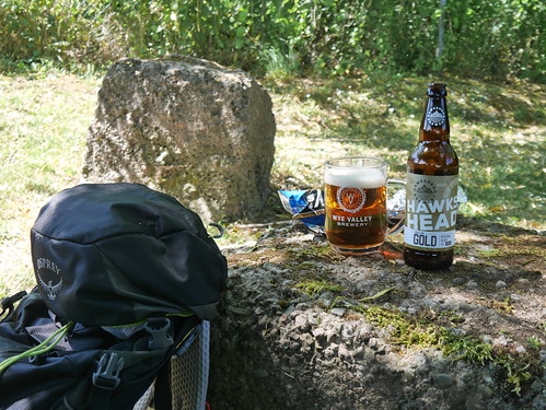
Picnic at Oakhanger
Dining in style


Saturday, 23 May 2020

23/05/20 - Chiltern Chain Walk - Stage 6 - Buckland Common

Distance - 12.1 Miles
Geocaches - 25
Walk Inspiration
Drink - Tring Brewery Ridgeway Bitter at Chartridge Pond
Previous Stages - Stage 1, Stage 2, Stage 3, Stage 4, Stage 5


I'd like to say that if Dominic Cummings can travel from London to Durham in the height of lock down - twice, with Covid Symptoms - I don't have to defend myself for resuming the Chiltern Chain Walk.  But that would be petty.

He is obviously an overlord and I am merely the sort of chav that would take his own bottle of beer to a bench by a pond.

Plus Boris's bumbling advice says that I can travel anywhere. In England. But National Parks and hills would still be frowned upon.  As long as hand sanitiser and 2m distancing from other ramblers are observed.

This is a walk that is high on loveliness during completion but devoid of anything too interesting. The dry valleys, woodland and farmland make for pretty walking.  There is an abundance of Geocaches - as I pick up (and repeatedly wash my hands) of more of the Chiltern 100 round.  Photo wise, I seemingly have lots of photos of trees and the GoPro was untroubled.

I start in Buckland Common - a place that tested a BMWs navigation system to the limit - as it tried to take me down dead ends and then up lanes that had grass growing in the middle.  Safely parked up, I head north through the woodlands of Drayton, Shrubbs and High Scrubs.

Buckland Common Start
Buckland Common Start - Dinosaur Wood is Closed.

Drayton Wood
Many Photos like this

Geocaching
With the odd Geocache to provide variety
Other things of interest - a well preserved Iron Age Fort at Cholesbury and a number of those dry valleys floors that provide plenty of ups and downs.

Cholesbury Fort
Earthworks of Cholesbury Camp
Hawridge
Glorious Chiltern Dry Valley Walking 

Lets move on to Lockdown refreshment items.

The first opportunity dispels the myth that farmer's don't have a sense of humour.

Refreshments
What delights remain within?
The Bell at Chartridge holds the honour of having been walked past twice without entering.  Last time - almost exactly a year ago - I was on the London Countryway and too early for lunch time opening.  Today, pubs no longer exist in any functional sense.

The Bell - Chartridge
One Day, the Bell at Chartridge will be picked
A little further down the high street is a geocache, a pond and a bench.  It's 8 miles into a 12 mile walk, so seems to be the perfect place to burst out the provisions.

Fitting with the location, I've bought a Tring Brewery Ridgeway Bitter to stuff into a Wye Valley Brewery chalice.  In a further nod to great preparation, the bottle was nestling nicely against a frozen ice pack in my rucksack.

My boy scout training was not in vain.

Chartridge Lunch
Decent walks require decent lunches

Sunday, 17 May 2020

17/05/20 - Searching for Arlescott

Distance - 6.5 Miles
Walk Inspiration - AA 1001 Walk - Walk 472
Geocaches - 1


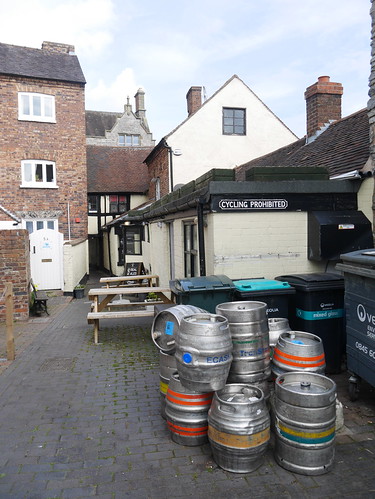
Lock down week 8 and the exact use of these metal containers has become lost in time.

Beer Barrels in a Much Wenlock Shut
Relics from a bygone era
Not that Much Wenlock troubles the Good Beer Guide.  A cursory check of the bible reveals there are no entries.  But how interesting is Market Drayton with its half dozen. Once the blog is written, I will be checking if they have a Premier Inn.

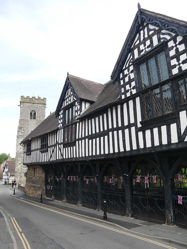
What Much Wenlock lacks in Good Beer, it gains in history. An Abbey, a mention in the Domesday Book and the birth place of the Modern Olympics.

Market Hall
Not forgetting the Market Hall
Instead of a pint, I'm going to track down the Medieval Village of Arlescott. Its a nice walk around Ash Coppice, on very good paths that show that the winter floods are leading to summer droughts.  Bone dry, despite the guide booking telling me of several swampy conditions.

Ash Coppice
A bimble around Ash Coppice
Arlescott has an eponymous farm and cottage but signs of the Medieval village are thin of the ground.  The OS Map uses the special ancient font to signify the "cultivation terraces". The map is probably more interesting than the photos at GZ.

Arlescott Medieval Village
Exciting medieval terracing
Arlescott
As displayed on the map


The remainder of the walk is a joy. Two long distance paths are used - the Jack Mytton Way taking me through fields of yellow rapeseed and the Shropshire Way running through sunbathing sheep and their newborns.

Rape Seed
Unusually for a rapeseed field, a decent gap to walk.

Shropshire Way back to Town
Crisis?  What Crisis?

Signs of normality back in the village. The Coffee Shop, doing takeaways, reminds me that as well as Cask Ale, its been 8 weeks since I have a had a coffee.  The locals sit on benches, eyeing me with suspicion as I collect the information for the Clock Tower Earthcache.


Sunday, 10 May 2020

10/05/20 - Trimpley, Eymore Woods and the River Severn

Distance - 6.75 Miles
Walk Inspiration
Geocaches -5

This might win "most varied walk of lockdown". A 6.75 mile walk that starts in dense woodland on the North Worcestershire Way, take in hidden green dingles, agricultural fields before a drop down to the River Severn at Upper Arley. Here, the river Severn is followed back to the Trimpley Reservoirs.

In happier times - refreshment could be found over the footbridge at Upper Arley. The Harbour Inn is a wonderful country pub, where you could start this walk, provided you make use of their facilities after. Hobsons, if I remember correctly. Why wouldn't you?

And if you are really lucky, you'll see a Severn Valley Steam Locomotive crossing the Victoria Bridge. At the time of its creation, the largest single span cast iron bridge in Britain.

These, alas, were not normal times. However, I am encouraged that remote and wild footpaths remain in good condition after seeing very limited footfall.

I write this blog two hours before the next of Boris's statements.   Who knows, I may be able to travel even further for exercise from next weekend. Although many friends insist I am not going to get a pub pint in 2020.

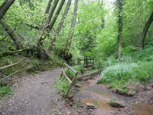
North Worcestershire Path through Eymore Woods
North Worcestershire Way - through Eymore Woods
Remote Dingle
A remote dingle
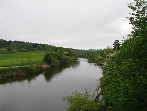
River Severn at Upper Arley
River Severn at Upper Arley - Harbour Inn close to hand
The record breaking Victoria Bridge
Record Breaking Victoria Bridge