Sunday, 29 December 2013

29/12/13 - History Today

Distance - 6 Miles
Geocaches - 10
Walk Inspiration - Adding together CW Mag Aug 2002 and a GPS My City Walk

Leicester City


We wake to the first real morning of Winter.  The car is white over, the roads need gritting and there is a wonderful clear blue sky.  Really, I should have been walking in the Cotswolds or the Shropshire Hills - somewhere to do justice to the conditions.  Instead, our walk was plotted yesterday. 

And we are going to Leicester.

Not prime walking country, I grant you, but I have been brushing up on my Tudor History and have planned to go ever since I found out that Cardinal Wolsey died there 1530.  Throw in the discovery of Richard III's remains and we have a historical jaunt to take on.

What surprised me is that Sonia wanted to come along as well.  What probably surprises you is that I have a wife in the first place. 

So a review of potential walks mean that I can combine a walk to Abbey Park, with a tour of the Cities most historical locations.

We follow the instructions and park to the North of the City.  A woman in a bus stop starts barking at us.  As unlikely a start to a walk as you could hope for.  We leave her to her yelping and pick up the River Soar, which has the distinction of splitting in half and turning into a canal.

There is a trail of caches to lead us down the path.  Cache 1 is found by Sonia under the watchful eyes of two special policemen.  The sight of a man and woman rummaging in the undergrowth has not piqued their interest.  That's how special they are.

There are a number down here that add a bit of variety to the walk.  One has a full log book, so I take photo evidence.  Sonia questions the logic of this, but I am nothing if not faithful to the rules of the game.

Holding a Cache Aloft
Sonia holds the cache aloft
The paths brings us to the Space Centre.  A transparent building with a least one rocket inside.

Space Centre
See through building made of Bubble Wrap
We have been successful with all caches today, including some brazen hunting by Sonia, who insists nobody is interested in what we are up to. 

All we need is some refreshment and I have high hopes for Abbey Park.

Abbey Foundations
The Building in the Distance looks promising
After a look around the foundations of the Abbey Infirmary, and a quick cache, we head down to investigate the building.

Too Big
And a bit of messing around in the Corner Portals.
Joy of joys, the building is not only a cafe, its also has a memorial to Wolsey.  Double whammy - the promise of sausages and our first historical reference point.

Wolsey and Me
Mappiman and Wolsey
Sonia took some convincing to enter the cafe.  She was put off by the rather gaudy Walls Signs, insisting that just a small one to advertise ice creams is all that is needed.  However, inside, she is well impressed.  I have some sat nav problems to overcome, so leave her with the money and my order.  Our food soon comes and in true lady style, she is disappointed that she only went for a Bacon Sarnie when I had a rather spiffing Full English Breakfast.  I am only surprised that she didn't jsut order nothing and suggest she "just shared mine".

With Sat Nav half fixed, we head off to cross the bridge and find a couple more caches, getting our only TB of the day.

Abbey Park Bridge
Pretty Bridge
With the park done, we head off into the City to see what it has to offer.  We walk through some industrial ruins, which soon bring us to the City.

Haymarket Memorial Clock Tower
Haymarket Memorial - Traditional Centre
The council are obviously doing a lot to promote their historical past. 

Proud of their Heritage
Our Next Quest - Richard III
The king without a horse has been getting a lot of media coverage recently.  They found his remains in the city.  Underneath a council car park.

In my opinion, the only thing that says more about Britain than finding a former Monarch entombed under a councilor's parking space is a man taking his wife out for a day trip to look at the aforementioned parking space.

Richard the III
Peaking through the gates is as close as we got
Having ticked off Greyfriars, we need to find our way to the Cathedral.

Which way is the Cathedral
Fortunately, there is a sign to help
Two places left to tick off.  First, the castle.  All that is left is the mound that it stood on and some nice gardens to walk through.  Finally, we need to check out the Jewry Wall.  These are the remains of a Roman Bathhouse.

1960s Town Planners meet the Romans
Roman architecture can only be improved by building a 1960s office block next to it.
Everything ticked off, we just need to pick up the canal to return to the car.  The town is filling up with football fans getting ready for the 3pm game against Bolton.

The canal provides a bleak industrial landscape to walk along.  It is the chosen location for groups of Asian youths to hang around drinking industrial strength lager. 

Leaving Sonia Behind
Our route back to the car.
Next historical walk is to see one of the finest examples of Victorian engineering in Britain.  On the drive home, Sonia says that she cannot wait.
 

Saturday, 28 December 2013

28/12/13 - Into the Woods

Distance - 7.09 Miles
Geocaches - 4 Found, 2 Not Found
Walk Inspiration - Country Walking Magazine, March 2011

Chaddesley Corbett at EveryTrail


There was no way I was traveling too far today.  Yesterday's 1 hour drive back from Cirencester took 3 hours.  M5 blocked through two separate accidents.  Enough to put you off venturing out of the house.

But the sun is shining.  Initially, I think of a riverside walk in Bewdley but that's just going to be a floody mess.  So I consult my local walks and notice a local one from Chaddesley Corbett from Country Walking Magazine.  Gaiter up for the inevitable mud bath.

I have completed many walks from here.  Plot the route on the map and I can see that most of the caches have been previously found but I must be taking on new paths, as there is hope of a few new smileys.

Park up, as usual, in front of the Talbot.  How can a village of this size have exactly two more decent pubs than the town that I come from?

Start at the Talbot
Is there a better place to start a walk?
Early stage of the walk is very familiar.  All routes from Chaddesley seem to go North East on the good footpath to Swancote Farm.  At the crossroads of paths, I head East on new paths to me, following the signs for the Royal Hunters Path.

Royal Hunters/Forrester's Way
Also called the Forester' Walk
Cache number one comes at an intersection of paths at Coalpit Coppice.  Its from the Bailey Rangers and of their usual standards.  Not going to say too much about it, but I am glad that I am in an isolated area, as I spend a good 15 minutes working out where the log is.

Cache 2 is off a similar standard, but I do strike lucky and the log is in hand.  Cache 3 is more amusing than complex. 

I have worked my way to Dordale and must be back on previously walked paths, as there are caches here that have been found.  If it wasn't for all the mud, it would have been superb walking.

This takes me to the outskirts of Dodford but I am soon back into the woodland of High Wood.  There are two new caches to have a look for but I did not expect much.  The clues are a touch vague (Holly - at Xmastime), off the main paths and under tree cover mean that I have a look but fail.  Still, others have found them, so my fail is purely down to my own ineptitude.

That leaves a micro for the remainder of the walk.

Back into the Woods
Still, I am on good paths under blue skies.
Soon arrive at the micro.  There is a reason it is here - some stunning views over to Malvern.  And I at least finish with success.

Worcestershire Views
All Views and Sunshine
Great walking on the way back.  I am through Chaddesley Woods and then into fields, where the Church Steeple is my beacon to get back to the car.

My Type of Path
My Sort of Walking

Chaddesley Below
Aim for the Steeple
Get through the mud back to the car.  A quick look around the Church.  Pub is not visited for two reasons.  My lower half looks like I came second in a mud wrestle and its 12:15pm and the Albion are on the TV in half an hour.

The questions for tomorrow are a) do I travel and b) do I dare go near a river?


Friday, 27 December 2013

27/12/13 - Best Completed after Heavy Rainfall

Distance - 7.5 Miles
Geocaches - 10 found.  3 TBs Dropped.
Walk Inspiration - Walks along the Thames Path


On plotting my planned walk in the Cotswolds last night, it became apparent that it was very close to a three section caching trail that I had completed in monthly stages since August this year.  As delightful as this part of the world is, I did not want to be traipsing along the same paths.

So a re-think.  I remembered that the Thames starts in the Cotswolds.  I consulted by book of 25 Thames Paths walk.  The opening comments for the first walk said "best completed after heavy rainfall".

This was a sign from the walking gods that could not be ignored.

Sonia and Ellie think they can stretch out Cirencester for three hours of shopping.  In the car down, Sonia asks where I am walking today.  I know that the source of the Thames does not have the same drama as the source of the Nile, but I didn't expect so much laughter.

They are dropped off in front of the beautiful church and I head off for the designated parking area.

Which is now designated as "Private".  The nearby Thames Inn Pub has a sign saying "unauthorised cars will be clamped".  In the end, I find a layby on the way to Ewen.

Gaiters on.  Raincoat on.  A bit of lane walking.  The weather does need to be commented upon.  We have gales and ominous black clouds but the BBC weather site has got it spot on.  I get a soaking twice from above.

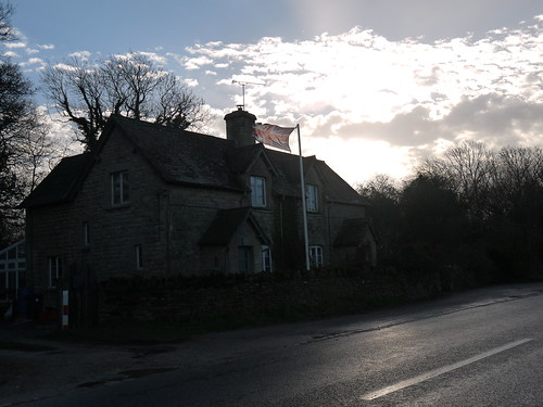
Good day to own a Flag
Great day to own flags.  And kites.
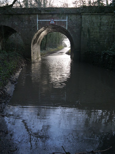
My first obstacle is soon met.  The soaking is going to come from below as well.

Obstacle Number 1
Just need an idiot in a 4x4 to come along
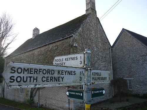
Soon arrive at Ewen.  This is where I see the first indication of the Thames Path.  And there is a nice trail of caches to allow me to drop off some TBs.

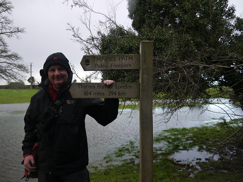
First Sign of the Thames Path
I have followed these signs all the way to Erith in Kent
Cache number 2 brings me to my first crossing of the Thames.  I wonder if this is the first bridge over the Thames, but it is in fact, number 3.

At the Thames
Crystal Clear Waters
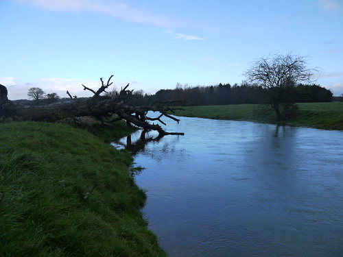
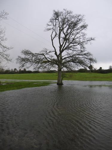
I am now walking through fields.  Normally, I would be watching the Thames reduce in size to a trickle.  Not today.

The Thames
Down at the Bank
The shape of the river is soon lost and its just a quagmire of flooded fields.  Hard to know which way to walk but in the end, its just a splish splosh through it.  At least I know my walking boots are still watertight.

Thames Head - Normally Dry
It all starts here
How Far to London?
London - That Way
The source is marked by a marker stone (camera is perched on it for the above photo) and a cache that unbelievably is nice and dry in its little hidey hole.  My walk is now meant to leave the water behind and pick up the disused Severn and Thames Canal.  Eventually, the puddle reduces in size and depth and I am back on terra firma.

The route is a walk up and back diversion of around 2 miles to go and see Sapperton Tunnel Entrance.  As there are a couple of caches, I go for it.

Do find a couple of unexpected oddities.

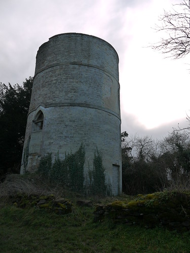
1)  The Coates Round House - looks like a Church Tower.

Unusual Round House
Nearly missed it - checking out the next Cache
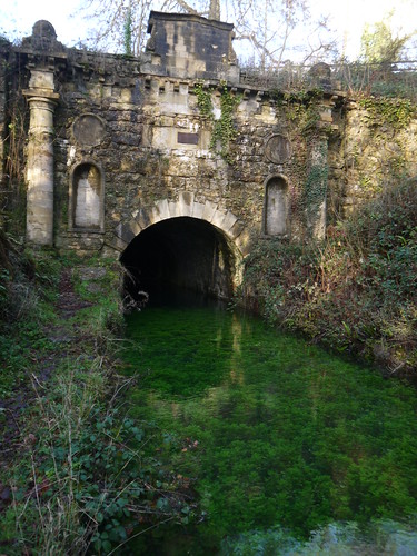
2) Of Course, the Sapperton Tunnel Entrance

Sapperton Tunnel Portal
More Crystal Clear Waters
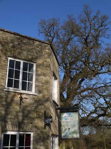
3) A Pub!

Unexpected Pub
Not even a road marked on the OS Map
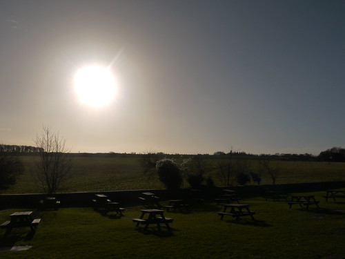
View from their Beer Garden
The View in the beer garden
Alas, I have no time for refreshments, as I am due to pick up the happy shoppers at 1:15pm.  Back retracing my steps before picking up the lane that returns me to the car.

And how was the shopping in Cirencester?  Even Ellie, Queen of Shops, couldn't drag it out.  They had independent stops for breakfast, a pub drink and a lunch.

And she bought something from Boots.  The shop where she works.

Tuesday, 24 December 2013

24/12/13 - Undistracted Walking

Distance - 7.4 Miles
Geocaches - 1 (and that was on the way to the pub, rather than the walk)
Walk Inspiration - Country Walking Magazine Sep 2013 - Walk 8

Knightwick at EveryTrail


Christmas Eve sounds like a perfect day to complete a walk from one of the Top 10 county pubs in Worcestershire.  In at number 5 in the list is the Talbot at Knightwick.  I've walked from here loads of times but never been in the pub before.  Find a new walk in Country Walking magazine that looks perfect.

But what to make of the weather?  Yesterday was an expected wash out, so I hung around the sofa watching Anglo/French remakes of Danish/Swedish crime thrillers.  Today was predicted to be good, but on the way down town to collect the Turkey, it starts raining.  There's nothing else for it, so I dig out the raincoat and hat and complete the short drive.

On parking arrival, the rain has stopped and I am rewarded with blue skies.  Fortune favours the brave.

The effect of yesterday's storms is plain to see on the River Teme.  I am meant to walk back along the banks.  Unfortunately, they have burst.

Teme has burst banks, plan needs revising
Quick replan in order
Walk uphill and pick up a previously undiscovered stretch of the Worcester Way.  All uphill but superb walking and I am rewarded with views in all directions.  I will have to complete the full length of this LDP one day.

Lovely
I can see for Miles
No caches on this route today, so there is nothing to distract from the simple pleasure of walking outdoors in the sunshine.  Apart from the very squelchy conditions underfoot.

At Crews Hill, I say goodbye to the Worcestershire Way and head down on lanes to Alfrick.

Unusual Angle to view the Malverns
Unusual Angle to view the Malverns From
A couple of fields to cross to get to the Church.  Recently ploughed, so a bit grim to make your way across.

Alfrick Church
Church makes the crossing worth it.
Not a lot to do in Alfrick.  Apart from say hello to the Birthday Boy.

Cross at Alfrick
Alfrick Memorial
Head up Folley Road, which starts as a lane but soon turns into a footpath.  Very old farmhouses dot the lane.  There is a disused railway line with a huge viaduct hidden in the trees.  This is where I meet my first ramblers of the day.  They warn me that a tree has fallen which has blocked their route but they think a young sprightly fella like myself will be fine.

Small Log
Ha - That's no obstacle

Big Log
But this is the one they mean!
Up the bank and around for Mappiman.  Pick up a lane that is totally flooded and have a squelch through the puddles to get back.  Use the road, rather than the river bank to get back to the pub.

Lulsley Church
Find an unexpected Church
Even in the two hours that I have been out, the Teme has risen further.

Not sure that pump is helping
Not sure that pumping Water in is going to help
There is a micro on the bridge, but the heavens open.  I decide to postpone my hunt to post-pub.

The Talbot
Fifth Best Pub in Worcestershire

This, That. T'Other
Took advice and went for a "That"
The landlord was correctly getting nervous about the rising water.  He was more worried for the next storm that is coming on Friday.

The Road Home
I'd be concerned now.  This is the road home outside the pub.
Get back on the footbridge.  Find the pesky little micro by the power of touch.