Wednesday, 29 June 2011

29/06/11 - One Walk, Two Counties

Distance - 4 Miles Walking, 4 Miles on a train
Caches - 12
Train Fayre - £0
Interesting World War 2 Artifact - A Pill Box
Walk Inspiration

Goring to Pangbourne - Home by train


Down in the Reading Area.  I can either stay at a soulless Holiday Inn or look for something with a bit of atmosphere and culture.  Having walked from Reading to Pangbourne previously, I decide to extend my river Thames knowledge and add Pangbourne to Goring into my experience bank. 

When I stayed in Pangbourne last time, my hotel was hotter than the sun and next to railway line.  I decide to reverse the walk and stay in a different place, walking from Goring to Pangbourne this time. My hotel is the Miller of Mansfield.  Its a tradional English Pub.  Nicely decorated room that I know is meant for two people, as there are two fluffy bathrobes on the bed.  However, the toilet is in the corner of the room with no door.  Now I don't know about you but going away for a romantic weekend is not going to go down to well when you see you other half parking the breakfast, is it?

Turn you back love, I need to drop the kids off at the pool.
Incredible.  I can see my fellow american travellers choking on their bagels at this lack of human decency.

This minor discomfort (and I'm on my own, so as long as I dont catch myself in the mirror) is soon forgotton by the quality of the walk.

Goring is the winner of Village of the Year (south) in 2011. It is easy to see why.  Its also in Oxfordshire - and as Pangbourne is in Berkshire, this walk will take me into two counties.  I head down to the river and its beautiful.  First stop is the old wooden bridge and cache number 1.

Goring Bridge
I am heading downstream.  There is no end of great architecture and Paul Daniels has a house down here somewhere.  You'll like that, but not a lot.

This fella is so posh he has a detached dining room - in the sky.

But this fella cannot afford a Lawn Mower
From a navigational perspective, this walk could not be easier.  The vista opens up a bit and I can see where I could have walked, the Chiltern Hills.  When I come back here again (alone, as there are some things a wife shouldn't see), I will head out onto these hills.

Next time I'm in Goring, I'm up there.
There are caches every 500 yards.... Including one at the railway bridge which will bring me home tonight.

Taxi for Mappiman

The walk continues and I hadn't paid too much attention to the route but it does eventually go inland (althought still on the Thames Path) up a decent climb with woods between me and the water.  Its here that I discover another WW2 artifact.  Its funny how there is continuity on these walks..... on the weekend it was a false airfield, today its a pill box.  I do think however, if the Hun had made it this far up the Thames, taking London, the war would have been over.  British fortitude at its best.

Who do you think you are kidding Mr Hitler?

After another stiff climb, its a tarmac road all the way down to Whitchurch on Thames.  I am instantly greeted by the Greyhound.  I was tempted to eat here, but as I was the only punter, I went for a packet of bacon fries in their garden.  The starter of the gods.

I bloody love walking

I didn't have to wait long for my tea.  Out the door of here, and down the road and there is the Ferryman.  This is positively heaving with people and I pop in, peruse the menu and convince mein host to replace the pepper sauce on the steak with a couple of fried eggs. Which he does at no extra cost.

Now, all that remains is to get the train back to Goring.  This involves crossing the river and into Berkshire - over a bono fido toll bridge but free to foot passengers and then dealing with British Rail.

Pangbourne Toll Bridge

This sign could save a brummies life on Stourport's Bridge in the Summer.  Then again, its probaly better where it is.
Follow the road back to the Station.  Next Challenge.  The ticket office is closed.  The automated ticket machines are all broken.  The platform indicators aren't working.  I use the information machine on the platform - thankfully, the station is empty - and I swear I am routed to India.  "Which Station are you calling from?" - I reply "Pangbourne".  Explain my position and she says "Oh just get on the train from platform 2 - if the ticket man comes, just pay him". 

He didn't come, so I hit the pubs of Goring smug in the knowledge that I got something for nothing.  This is extended to free wireless in the hotel so I can blog my walk. 

Life is all good - free eggs, free train travel, free wireless broadband, free access to the throne - unencumbered by such social niceties as privacy.

Saturday, 25 June 2011

25/6/11 - Caching in the Nether Regions

Distance - 4.7 miles
Caches - 13, 1 DNF
First Cache
Interesting World War 2 Building - A false airfield

Netherton, Worcs


I have the house to myself this morning.  Alex is at a sleep over.  Ellie is still going to work.  And today, so is Sonia.

So how will I entertain myself.  I could make a full english breakfast and watch the rest of Spiral.  I could dress up in Sonia's lingerie and dance to Madonna in the living room.  As there are no sausages and its too much of a squeeze, I decide to stick with geocaching.  Although I do throw a few shapes whilst convincing the dog this is a good idea before leaving.

Pershore is a goldmine for caching - there always seems to be new trails popping up and this one, around Netherton, is by the same person that put together the Peopleton one completed last week.

It really is a straightforward route - taking in green lanes in an almost complete rectangle.  There isn't a great deal to look at - apart from the magnificant Bredon Hill on the soutbound stretch.  I prefer this hill to the Malverns, as you get a great view across to the Malverns from here.

This is all on the flat.  The dog looks typically bored, as I keep looing for the boxes.  Today, I attempt as many as possible without the clues for a bit of variety.

Not enough for a swim at "Bridge the Gap" cache

First views of Bredon Hill.... Molly can't take her eyes of them

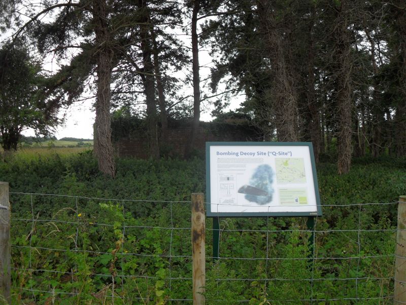
On reaching Netherton farm, we head along a bit to find the route back.  The one cache that I could not find (and there is always one) is on a building.  This has an info board and it was a WWII decoy bunker to confuse the Germans into thinking it was Pershore Airfield nearby.  Pershore was bombed twice and this once, so it added some value.   Had a good look around, but no joy.  You can enter the bunker and I did, for that authentic Blair Witch feeling.  I think the horse in the field was laughing at my fruitless search.

Confusing Jerry
Back up Smokey Lane to the car.  Thanks again to jayvon for helping me achieve my 100 caches in a calendar month.  I am about three off and have a trip to Goring, Berkshire in the week which looks like cache heaven.

On the way back, I go through Pershore town and there are a group of Morris Dancers performing.... now there is an idea for a hobby and my Madonna moves may not have been in vain.

Wednesday, 22 June 2011

22/6/11 - Manchester, so much to answer for

Distance - 7 Miles
Walk from - Walkingworld
Geocaches - 5
Famous person without socks - Rio Ferdinand
Breweries - 1

Manchester Architecture


Ellie has an open day in Manchester University today - so a day off work, a 7:30am start and a drive up the M6 with her mother and Ellie's friend so that they can go and learn all about student life (paying for chips by cheque) and I can get re-acquainted with a city that I used to know well.

Park up close to the Uni and walk with them up Oxford Road to drop then off.  I now have 4 hours and an excellent guide from walking world to take in most of the architectural highlights of the city.

First stop is the Sackville Gardens for a cache next to Alan Turing.

Caching doesn't have to be lonely

Sackville Gardens brings me out into Canal Street.  This is the gay area of Manchester and the road sign frequently lost its C.  Before 24 hour drinking, it used to be the only place you could get a late drink, so all roads used to lead here.  The last time I was in the new union, one of my team goosed an older homophobic team member who turned around and offered him a fight in a victorian boxer style.  It remains one of the funiest things i have ever seen.

Walk leads onto Portland Street.  There is a collection of three oldy worldy pubs that I am pleased are still here and haven't been taken away through progress.  In 2002, I was a frequent guest at the Thistle Hotel.  As I was uncultured in those days, we mainly went to city bars (and drops head in shame, Jumping Jacks).  However, I have fond memories of the landlady at the Grey Horse Inn who used to abuse us on every visit.  We took it as Northern Hospitality.

Head on up and then cut through Picadilly Gardens for a muggle central cache, which I soon find.  Avoid doing an Alan Bradley and head down Mosley Street.  In 2008, I met a manchunian native who tried to take me to Mr Thomas Chop House.  He got lost and this meant lots of walking around this area and all its alleys.

Get a bonus on the walk - a new greggs is opening and they are giving out free coffee...  This lasts me past the central library, midland hotel (where I stayed once) and onto the G-Mex.

Let me take you back to 21.07.90.  To get over the GazzaGate, Sonia, Danny, Jane and myself went here to see the mighty Inspiral Carpets at the peak of their organ based, strange haired fame.  Sonia and Jane were left in the seats whilst Danny and myself went down into the mosh pit.  The subsequent shuffly dancing that I performed kept Danny amused for the next 20 years.

Home of shuffly dancing
From the GMex, I pick up the canal.  Used to drink at Dukes 92 in the summer and at last, almost 25 years after I should have gone there, I have managed to find the Hacienda.  Its now been demolished and is a car park, but if you look carefully, you can see the quotes about the place in the building.

I merely read about it... 

Brought back the memories of New Order, Happy Mondays, God's Cop, the exotic sounding gun battles.... my own clubbing experiences revolved around talking Malcolm into letting me into the Severns Club, when I wasn't a member.

The canal is a hidden world within the City.  Soon comes out at Deansgate Locks.  Most of the clubs have now changed names, but there was a night in 2002, when I was in far end bar and Kylie was in the Sugar Lounge at the opposite end.  My chance to talk her into coming geocaching with me and I blew it.

The bar where I met an Antipodean Sex Midget (Almost)

Follow the canal down, under the railway and tram lines and then back up to Castlefield.  In 1998, I presented at Granada Studios and in 2003, I used to eat at the Ox - which at the time was Manchester's top gastropub - if such things existed then.  Today, its 11:45am and the chipper is open.  Go in and after a taxi driver orders a "Chip Barm Cake", I consider copying his order, but err on the side of caution.  £1.50 for a chip bap.... should have gone for it.

Liverpool street bring me back to Deansgate and I see exactly where the tallest building in Manchester (Beetham Tower) is loacted.  This is new to me.

One Day, I will stop at the Hilton
Used to install the world's most complicated printers for Abbey National along here in 1997.  Its the main shopping area, so I take detours up the side streets to see the posh shops, eventually winding up by the cathedral for another cache.  This is where I bump into Rio Ferdinand.  Its quite interesting really, he is sat outside the shops with his partner and presumably child.  Soon, people spot who he is and once the first person asks for an autograrph, a queue of peope all start waiting for photos etc.  He must like the fame, otherwise he would have been more inconspicous and wore socks.  I was more interested in successfully getting my cache.

Stop for a drink at the Old Wellington.  This is Manchesters oldest building and has quite a history - moved 300 yards, damaged by the IRA bomb etc.  Its also a great place to sit and read in the sunshine.

I am actually a lot happier than I look
Up past the Print Works.  2003, we take Alex to his first horror film here.  He didn't like it much and screamed most of the way through.  Then again, Scooby doo was particulary terrifying.
I now go off piste and look for the Marble Arch up on the Rochdale Road.  This a pub that comes with a reputation, with its own micro brewery on the back.  Lovely place in the middle of nowhere - the beer was great and tasted a lot like boddingtons to me.

Getting near the end of the scheduled walk now - and after picking up the canal again, I am back to Picadilly and pass the Place for Living.  This remains my favourite hotel in the land and I used to love coming here on a Monday night during 2002.  I notice that my chinese takeway - which was a run down, free standing building has been replaced with a shiny new glass and chrome place.

All that remains now is to return to the University.  I need to work on Ellie so that she makes this place her choice, so that I have the excuse to come here more often.

A fantastic trip down memory lane for me.

Sunday, 19 June 2011

19/6/11 - Not one place pronounceable in the West Brecons

Distance - 12 miles
From - Spring 2011 Trail Magazine
Confusion - Where to Park
Geocaches - 2

Picws Du


Reading through Spring Edition of Trail magazine and I realised that the Western side of the Brecons has been neglected.  This has more to do with the distance involved, rather than whether the mountains are any good or not.  Set the alarm for 6am and was out for 6:40am, with everything important apart from a mobile phone.  The journey at this time of day is a pleasure - Brecon in 75 mins and then another 40 down the most bizarre roads known to man - even going through a farmyard at one point.  There is no way this would be possible in Winter.

Sat Nav - are you sure its this way?

Arrive at Llanddeusant.  The magazine article provides the grid ref for the start of walk and a picture of a nice area for parking.  The two things are unrelated.  I drive around for a while looking for somewhere reasonable to park and end up popping into the the YHA (co-ords for walk start) and the nice man allows me to park there.  Why you would show a picture of a nice car park 1.5 miles away from the walk start is beyond me - unless they want to hoodwink inexperienced midlanders into making the journey.

Worried about the start of the walk for two reasons.  1)  I am going downhill, which means the last leg will be uphill and 2) The weather doesn't look the best.

My head will soon be in those clouds.

At the end of the road, turn right onto what has to be the most poorly signposted long distance path in the world.  The brecons way.  The way back takes in a decent stretch of this and not only is it not on the OS map, there isnt a single waymarker on the ground either.  The way is clear enough when you are there though.

Start the stiff climb up grassy banks to the starts of the unpronounceables - Bannau Sir Gaer to Waun-Lefrith.  You know what, I am sick of this.  Lets just call them hill one, hill two and look at the pictures.

We are on a ridge path that circumvents Llyn y Fan Fach (can't help myself, lake 1).  Impressive views, as once up, its a clear drop down and we just skirt the edges for some great photo opps.

What views.
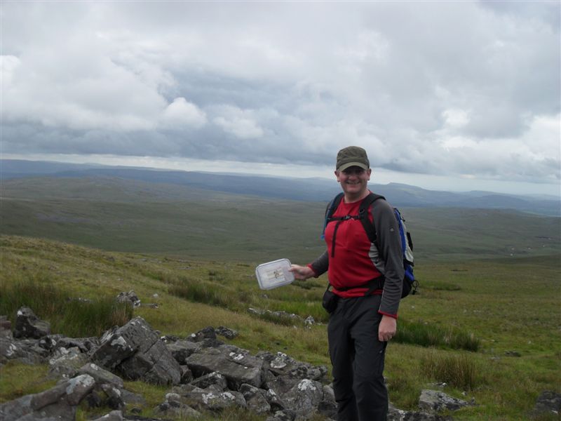
no sarnies - just a cache at Hill 1

I love it once you have gained the height.  I have good views, but the light isn't great for the photos.  Still, you cannot have everything in life can you.  Work my way around the edge, meeting the first groups of walkers of the day, both pairs coming from the opposite direction.  What do they know that I don't?  Work my way around to Fan Foel, my favourite, as I can spell it and it has a shelted and a Trig Point.  I can eat my malt loaf in comfort.

Trigger

Then have a bit of ticklisting to go up and straight back down Fan Hir.  This isn't required for the walk, as we retrace our steps to drop down a staircase to Lake 2. 

This makes the walk - we see the lakes from the high ground and then drop down and see the high ground from the lakes.  A unique experience for me.

Simple walking now, although I do see 2 elderly gentlemen, who either still love mountain walking or have been on this route for a considerable time.  Walk with them a while, overtaking as they stop for sandwiches and then them catching me up as I finish off whatever else I can find in my sandwich box.

Mappiman at Lake 1
Then its a simple case of taking the access road down running parallel to the run off from the damned lake.  Not sure how it all works, but its pretty and I am sure there are fish leaping out of the pools at the bottom.

Lake 1 Spill Off
Past the car park (!) and then the mile uphill on the access road back to the hamlet that begins with two ls.  I have noticed on the map that there is an intriguing entry called the "Red Lion".  Could this be a pub to offer refreshment to a weary walker?

No, its the Youth Hostel.
Summary of things I have learned...

1) YHA people are lovely, even if they don't sell beer.
2) Trust your sat nav
3) Cause asking for direction is futile.
4) All walks should take you to a mountain ridge and then bring you back along the bottom.