Walk Inspiration
Geocaches - 18
Drink - Hawkshead Gold on a rock at Oakhunger
The back end of May and the Severn Estuary is a close to the seaside as I have managed to achieve in this oddest of years.
What the the Lammastide Inn lacks in being open to the public, it makes up for with a Geocache in the car park. Once again, I've had to come prepared for post walk refreshment - and with the thermometer nudging 25 degrees - an ice cold beer was needed.
 |
| One for another day - Lammastide Inn |
 |
| Views under blue skies |
Purton probably owes is existence to the Sharpness - Gloucester Canal - built to provide straighter sailing than the winding Severn can offer. An eclectic collection of buildings and the wide canal is picked up to take me to the ghost boats.
Its a narrow strip of land between the estuary and the canal and to protect the earth, a collection of boats - some wooden, some concrete, were rammed into the mud for protection. They are all labelled up and some more obvious than others. How effective this approach to fighting erosion remains unknown.
 |
| Banks are still here - so it must be doing some good |
 |
| Wooden ones not fairing quite so well |
Amazingly, the hulk of the tankers can still be seen at low tide - and I'd timed it perfectly. Even if I was without the correct lens to take a decent photo.
 |
| Geocache and disaster story ahead |
 |
| End of the (canal) line |
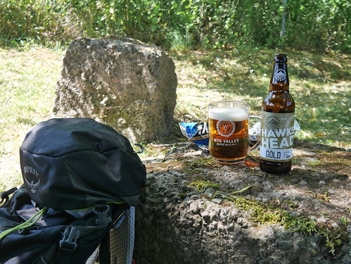
All I needed was a shady spot for lunch - and a huge rock under a willow tree provided a perfect location. The freezer pack did its job of keeping a Hawkshead Gold at perfect temperature. The two pairs of dog walkers either admired my preparation or took me for a posher than average tramp.
Either way, I couldn't have been happier.
 |
| Dining in style |
No comments:
Post a Comment